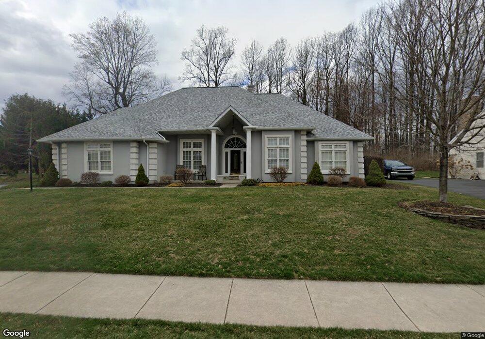
10 Ridge Ct Mohnton, PA 19540
Estimated Value: $352,000 - $492,000
3
Beds
2
Baths
2,103
Sq Ft
$202/Sq Ft
Est. Value
About This Home
This home is located at 10 Ridge Ct, Mohnton, PA 19540 and is currently estimated at $424,882, approximately $202 per square foot. 10 Ridge Ct is a home located in Berks County with nearby schools including Governor Mifflin Intermediate School, Brecknock Elementary School, and Governor Mifflin Middle School.
Ownership History
Date
Name
Owned For
Owner Type
Purchase Details
Closed on
Nov 3, 1997
Bought by
White White W and White Carrol J
Current Estimated Value
Create a Home Valuation Report for This Property
The Home Valuation Report is an in-depth analysis detailing your home's value as well as a comparison with similar homes in the area
Home Values in the Area
Average Home Value in this Area
Purchase History
| Date | Buyer | Sale Price | Title Company |
|---|---|---|---|
| White White W | $192,500 | -- |
Source: Public Records
Tax History
| Year | Tax Paid | Tax Assessment Tax Assessment Total Assessment is a certain percentage of the fair market value that is determined by local assessors to be the total taxable value of land and additions on the property. | Land | Improvement |
|---|---|---|---|---|
| 2025 | $3,122 | $186,800 | $35,100 | $151,700 |
| 2024 | $8,498 | $186,800 | $35,100 | $151,700 |
| 2023 | $8,277 | $186,800 | $35,100 | $151,700 |
| 2022 | $7,931 | $186,800 | $35,100 | $151,700 |
| 2021 | $7,838 | $186,800 | $35,100 | $151,700 |
| 2020 | $7,838 | $186,800 | $35,100 | $151,700 |
| 2019 | $7,707 | $186,800 | $35,100 | $151,700 |
| 2018 | $7,543 | $186,800 | $35,100 | $151,700 |
| 2017 | $7,392 | $186,800 | $35,100 | $151,700 |
| 2016 | $2,182 | $186,800 | $35,100 | $151,700 |
| 2015 | $2,182 | $186,800 | $35,100 | $151,700 |
| 2014 | $2,137 | $186,800 | $35,100 | $151,700 |
Source: Public Records
Map
Nearby Homes
- 665 Fairmont Ave
- 7 Buck Run
- 42 Chestnut St
- 17 E Summit St
- 902 Bedford Ave
- 26 E Mohn St
- 62 S Church St
- 153 E Wyomissing Ave
- 18 Front St
- 28 Charlemont Ct
- 30 Front St
- 3 Monroe St
- 148 Main St
- 17 Charlemont Ct
- 10 Chesterwood Cir
- 27 Rosemont Ave
- 352 Ashley Dr
- 2400 John Henry Dr
- 124 Mesa Dr
- 514 Arrowhead Trail
Your Personal Tour Guide
Ask me questions while you tour the home.