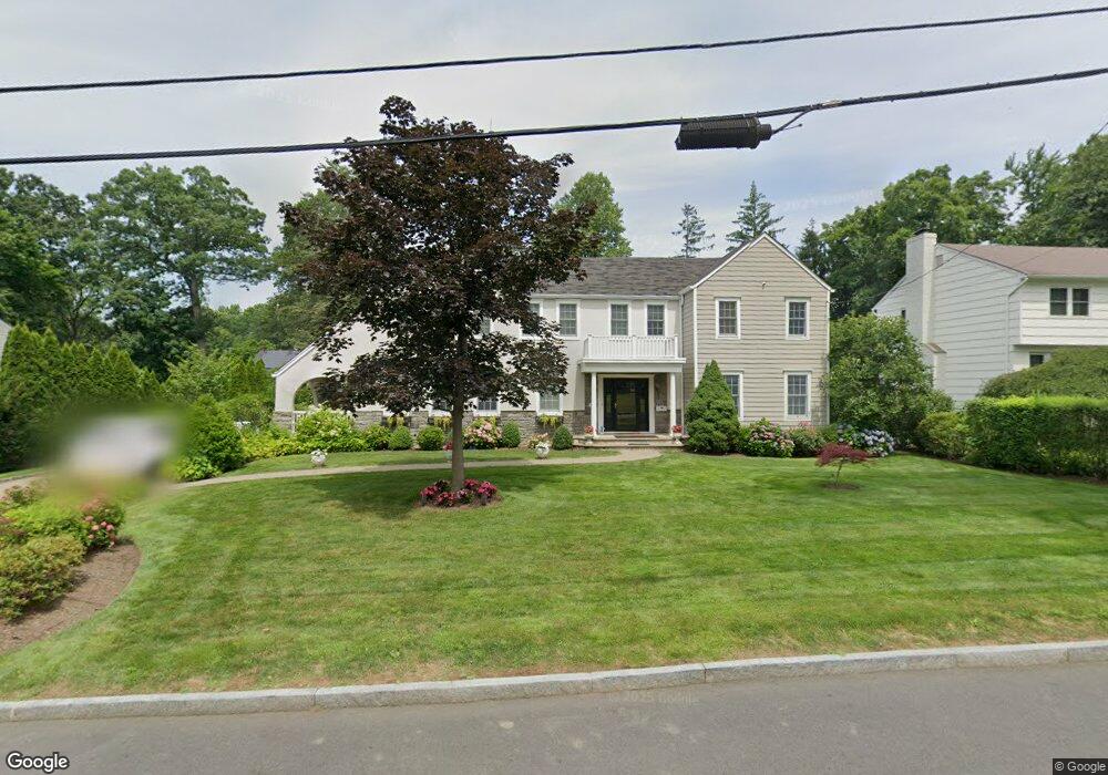
10 Robinhood Rd White Plains, NY 10605
Gedney Farms NeighborhoodEstimated Value: $1,664,859 - $2,122,000
6
Beds
4
Baths
4,350
Sq Ft
$421/Sq Ft
Est. Value
About This Home
This home is located at 10 Robinhood Rd, White Plains, NY 10605 and is currently estimated at $1,829,715, approximately $420 per square foot. 10 Robinhood Rd is a home located in Westchester County with nearby schools including White Plains Middle School, White Plains Senior High School, and German International School New York.
Ownership History
Date
Name
Owned For
Owner Type
Purchase Details
Closed on
Jan 3, 2017
Sold by
Gordon Elaine Taylor
Bought by
Gross Michael and Gross Alexander
Current Estimated Value
Home Financials for this Owner
Home Financials are based on the most recent Mortgage that was taken out on this home.
Original Mortgage
$1,000,000
Outstanding Balance
$824,326
Interest Rate
4.13%
Mortgage Type
New Conventional
Estimated Equity
$1,005,389
Purchase Details
Closed on
Dec 10, 2004
Sold by
Healy Kevin Burke and Healy Mary Ellen
Bought by
Taylor Gordon Elaine
Create a Home Valuation Report for This Property
The Home Valuation Report is an in-depth analysis detailing your home's value as well as a comparison with similar homes in the area
Home Values in the Area
Average Home Value in this Area
Purchase History
| Date | Buyer | Sale Price | Title Company |
|---|---|---|---|
| Gross Michael | $1,525,000 | None Available | |
| Taylor Gordon Elaine | $985,000 | -- |
Source: Public Records
Mortgage History
| Date | Status | Borrower | Loan Amount |
|---|---|---|---|
| Open | Gross Michael | $1,000,000 |
Source: Public Records
Tax History Compared to Growth
Tax History
| Year | Tax Paid | Tax Assessment Tax Assessment Total Assessment is a certain percentage of the fair market value that is determined by local assessors to be the total taxable value of land and additions on the property. | Land | Improvement |
|---|---|---|---|---|
| 2024 | $3,981 | $28,200 | $7,150 | $21,050 |
| 2023 | $3,997 | $28,200 | $7,150 | $21,050 |
| 2022 | $26,020 | $28,200 | $7,150 | $21,050 |
| 2021 | $26,013 | $28,200 | $7,150 | $21,050 |
| 2020 | $25,597 | $28,200 | $7,150 | $21,050 |
| 2019 | $29,127 | $28,200 | $7,150 | $21,050 |
| 2018 | $24,140 | $28,200 | $7,150 | $21,050 |
| 2017 | $0 | $25,200 | $7,150 | $18,050 |
| 2016 | $23,848 | $25,200 | $7,150 | $18,050 |
| 2015 | -- | $25,200 | $7,150 | $18,050 |
| 2014 | -- | $25,200 | $7,150 | $18,050 |
| 2013 | -- | $25,200 | $7,150 | $18,050 |
Source: Public Records
Map
Nearby Homes
- 11 Robinhood Rd
- 11 Oxford Rd
- 9 Oxford Rd
- 10 Bryant Crescent Unit 2A
- 11 Bryant Crescent Unit 2K
- 11 Bryant Crescent Unit 2I
- 175 Bryant Ave Unit 2A
- 11 Bryant Crescent Unit 1
- 8 Bryant Crescent Unit 1B
- 10 Bryant Crescent Unit 2L
- 24 Gedney Terrace
- 34 Gedney Park Dr
- 7 Gedney Terrace
- 1 Bryant Crescent Unit 2L
- 5 Bryant Crescent Unit 1N
- 5 Bryant Crescent Unit 2F
- 3 Bryant Crescent Unit 2G
- 3 Bryant Crescent Unit 1J
- 3 Bryant Crescent Unit 1B
- 4 Bryant Crescent Unit 2N
- 8 Robinhood Rd
- 25 Heatherbloom Rd
- 27 Heatherbloom Rd
- 14 Robinhood Rd
- 6 Robinhood Rd
- 1 Little John Place
- 2 Little John Place
- 29 Heatherbloom Rd
- 21 Heatherbloom Rd
- 3 Robinhood Rd
- 16 Robinhood Rd
- 2 Robinhood Rd
- 1 Macy Ave
- 2 Sherman Ave
- 6 Little John Place
- 8 Sherman Ave
- 5 Little John Place
- 7 Macy Ave
- 9 Macy Ave
- 10 Sherman Ave