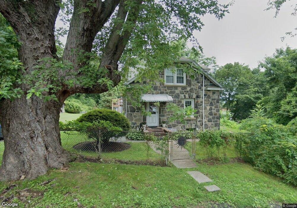
10 Robins Square S Norwalk, CT 06854
Brookside NeighborhoodEstimated Value: $632,000 - $686,424
4
Beds
3
Baths
1,638
Sq Ft
$402/Sq Ft
Est. Value
About This Home
This home is located at 10 Robins Square S, Norwalk, CT 06854 and is currently estimated at $658,356, approximately $401 per square foot. 10 Robins Square S is a home located in Fairfield County with nearby schools including Brookside Elementary School, Roton Middle School, and Brien Mcmahon High School.
Ownership History
Date
Name
Owned For
Owner Type
Purchase Details
Closed on
Jan 14, 2015
Sold by
Valiante Joseph
Bought by
Blake Patronella and Blake Matthew
Current Estimated Value
Purchase Details
Closed on
Dec 22, 2014
Sold by
Valiante Joseph
Bought by
Blake Patronella and Blake Matthew
Purchase Details
Closed on
Aug 1, 1978
Bought by
Blake Patronella and Blake Matthew
Create a Home Valuation Report for This Property
The Home Valuation Report is an in-depth analysis detailing your home's value as well as a comparison with similar homes in the area
Home Values in the Area
Average Home Value in this Area
Purchase History
| Date | Buyer | Sale Price | Title Company |
|---|---|---|---|
| Blake Patronella | -- | -- | |
| Blake Patronella | -- | -- | |
| Blake Patronella | -- | -- | |
| Blake Patronella | -- | -- | |
| Blake Patronella | -- | -- |
Source: Public Records
Mortgage History
| Date | Status | Borrower | Loan Amount |
|---|---|---|---|
| Previous Owner | Blake Patronella | $60,000 |
Source: Public Records
Tax History Compared to Growth
Tax History
| Year | Tax Paid | Tax Assessment Tax Assessment Total Assessment is a certain percentage of the fair market value that is determined by local assessors to be the total taxable value of land and additions on the property. | Land | Improvement |
|---|---|---|---|---|
| 2025 | $9,669 | $403,790 | $149,120 | $254,670 |
| 2024 | $9,526 | $403,790 | $149,120 | $254,670 |
| 2023 | $7,792 | $309,670 | $129,100 | $180,570 |
| 2022 | $7,646 | $309,670 | $129,100 | $180,570 |
| 2021 | $7,448 | $309,670 | $129,100 | $180,570 |
| 2020 | $7,444 | $309,670 | $129,100 | $180,570 |
| 2019 | $7,235 | $309,670 | $129,100 | $180,570 |
| 2018 | $5,629 | $211,130 | $110,240 | $100,890 |
| 2017 | $5,435 | $211,120 | $110,240 | $100,880 |
| 2016 | $5,384 | $211,130 | $110,240 | $100,890 |
| 2015 | $5,369 | $211,130 | $110,240 | $100,890 |
| 2014 | $5,299 | $211,130 | $110,240 | $100,890 |
Source: Public Records
Map
Nearby Homes
- 47 Glasser St
- 9 Observatory Place Unit A
- 7 Moscariello Place
- 7 Hadik Pkwy
- 5 Rockland Rd Unit A8
- 19 Woodchuck Ct
- 309 Ely Ave Unit A2
- 113 Rowayton Woods Dr
- 18 Soundview Ave
- 52 Lexington Ave
- 171 Rowayton Woods Dr Unit 171
- 73 Devils Garden Rd
- 40 Arnold Ln
- 7 Hamilton Ave Unit 32
- 181 Highland Ave
- 25 Chestnut St Unit 1-I
- 28 Chestnut St
- 9 Lawrence St
- 187 Flax Hill Rd Unit A4
- 187 Flax Hill Rd Unit D5
- 28 Robins Square E
- 13 Robins Square S
- 22 Robins Square E
- 11 Robins Square S
- 15 Robins Square E
- 8 Robins Square S
- 9 Robins Square S
- 11 Robins Square E
- 30 Lenox Ave
- 20 Robins Square E
- 7 Robins Square S
- 6 Robins Square S
- 18 Robins Square E
- 9 Robins Square E
- 1 Robins Square E
- 16 Robins Square E
- 28 Lenox Ave
- 26 Lenox Ave
- 26 Lenox Ave Unit 2ND F
- 26 Lenox Ave Unit 1