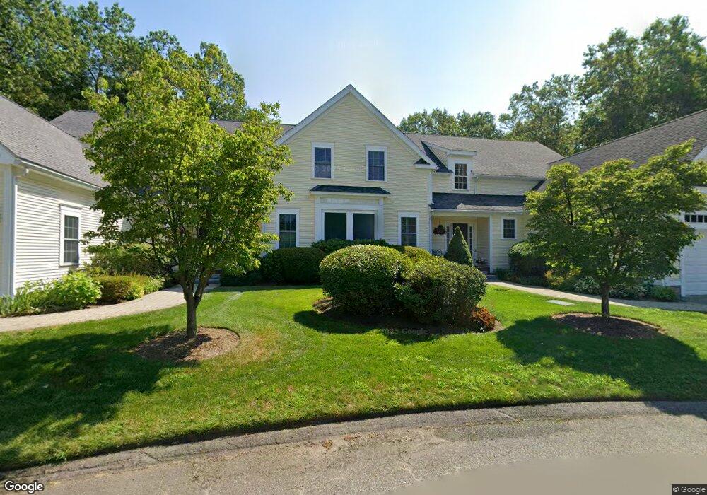
10 Rocky Point Carlisle, MA 01741
Estimated Value: $1,014,000 - $1,272,000
2
Beds
3
Baths
2,951
Sq Ft
$371/Sq Ft
Est. Value
About This Home
This home is located at 10 Rocky Point, Carlisle, MA 01741 and is currently estimated at $1,096,135, approximately $371 per square foot. 10 Rocky Point is a home located in Middlesex County with nearby schools including Carlisle School and Middlesex School.
Ownership History
Date
Name
Owned For
Owner Type
Purchase Details
Closed on
Aug 2, 2017
Sold by
Dowcett Peggy
Bought by
Felsdale Rt
Current Estimated Value
Purchase Details
Closed on
Aug 4, 2009
Sold by
Us Bk
Bought by
Dowcett Peggy
Purchase Details
Closed on
Aug 25, 2008
Sold by
Connelly Thomas P
Bought by
Suntrust Mortgage Inc
Purchase Details
Closed on
Oct 7, 2005
Sold by
Mkckmk Llc
Bought by
Connelly Thomas P
Home Financials for this Owner
Home Financials are based on the most recent Mortgage that was taken out on this home.
Original Mortgage
$560,050
Interest Rate
5.81%
Mortgage Type
Purchase Money Mortgage
Create a Home Valuation Report for This Property
The Home Valuation Report is an in-depth analysis detailing your home's value as well as a comparison with similar homes in the area
Home Values in the Area
Average Home Value in this Area
Purchase History
| Date | Buyer | Sale Price | Title Company |
|---|---|---|---|
| Felsdale Rt | $758,000 | -- | |
| Dowcett Peggy | $520,000 | -- | |
| Us Bk | -- | -- | |
| Suntrust Mortgage Inc | $620,743 | -- | |
| Connelly Thomas P | $712,500 | -- |
Source: Public Records
Mortgage History
| Date | Status | Borrower | Loan Amount |
|---|---|---|---|
| Previous Owner | Connelly Thomas P | $560,050 |
Source: Public Records
Tax History Compared to Growth
Tax History
| Year | Tax Paid | Tax Assessment Tax Assessment Total Assessment is a certain percentage of the fair market value that is determined by local assessors to be the total taxable value of land and additions on the property. | Land | Improvement |
|---|---|---|---|---|
| 2025 | $10,358 | $785,900 | $0 | $785,900 |
| 2024 | $10,917 | $819,000 | $0 | $819,000 |
| 2023 | $12,022 | $849,600 | $0 | $849,600 |
| 2022 | $12,329 | $747,200 | $0 | $747,200 |
| 2021 | $12,164 | $747,200 | $0 | $747,200 |
| 2020 | $12,870 | $701,000 | $0 | $701,000 |
| 2019 | $12,821 | $701,000 | $0 | $701,000 |
| 2018 | $12,737 | $701,000 | $0 | $701,000 |
| 2017 | $11,767 | $667,800 | $0 | $667,800 |
| 2016 | $11,486 | $667,800 | $0 | $667,800 |
| 2015 | $11,360 | $597,900 | $0 | $597,900 |
| 2014 | $11,145 | $597,900 | $0 | $597,900 |
Source: Public Records
Map
Nearby Homes
- 225 Lowell St
- 8 Kay's Walk Unit 13
- 14 Kay's Walk
- 6 Kay's Walk Unit 6
- 6 Kay's Walk
- 2 Kay's Walk Unit 18
- 4 Kay's Walk Unit 15
- 3 Kay's Walk
- 15 Kay's Walk
- 1 Kay's Walk Unit 1
- 1 Kay's Walk
- 13 Kay's Walk
- 15 Kay's Walk Unit 4
- 3 Kay's Walk Unit 3
- 383 E Riding Dr
- 373 E Riding Dr
- 282 Brook St
- 12 Martin St
- 1056 Curve St
- 232 Baldwin Rd
- 5 Rocky Point
- 10 Rocky Point Unit 10
- 398 Lowell St
- 8 Rocky Point
- 6 Rocky Point
- 8 Rocky Point Unit F
- 3 Rocky Point
- 1 Rocky Point
- 288 Lowell St
- 2 Rocky Point
- 4 Rocky Point Unit II
- 2 Rocky Point Unit A-1
- 107 Woodbine Rd
- 280 Lowell St
- 82 Hillside Rd
- 67 Hillside Rd
- 40 Hillside Rd
- 236 Lowell St
- 100 Litchfield Dr
- 210 Litchfield Dr