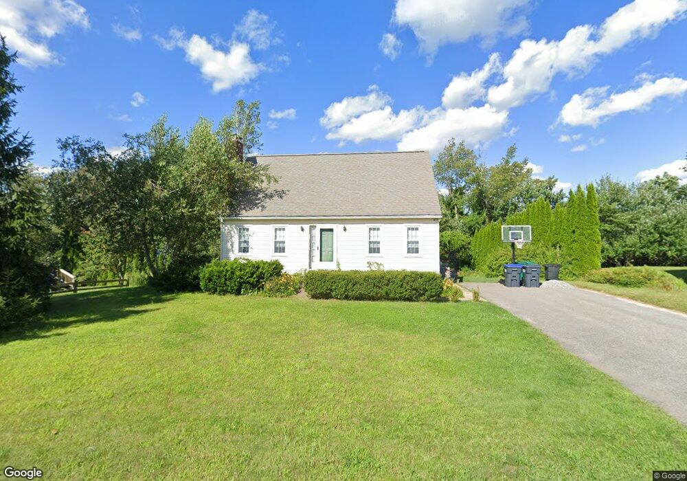
10 Rolling Ridge Rd Rutland, MA 01543
Estimated Value: $443,000 - $494,000
3
Beds
2
Baths
1,428
Sq Ft
$336/Sq Ft
Est. Value
About This Home
This home is located at 10 Rolling Ridge Rd, Rutland, MA 01543 and is currently estimated at $479,230, approximately $335 per square foot. 10 Rolling Ridge Rd is a home located in Worcester County with nearby schools including Wachusett Regional High School.
Ownership History
Date
Name
Owned For
Owner Type
Purchase Details
Closed on
Jun 21, 1993
Sold by
C B Blair Dev Corp
Bought by
Miller Sean C and Miller Lynn
Current Estimated Value
Home Financials for this Owner
Home Financials are based on the most recent Mortgage that was taken out on this home.
Original Mortgage
$111,600
Interest Rate
7.38%
Mortgage Type
Purchase Money Mortgage
Create a Home Valuation Report for This Property
The Home Valuation Report is an in-depth analysis detailing your home's value as well as a comparison with similar homes in the area
Home Values in the Area
Average Home Value in this Area
Purchase History
| Date | Buyer | Sale Price | Title Company |
|---|---|---|---|
| Miller Sean C | $117,755 | -- |
Source: Public Records
Mortgage History
| Date | Status | Borrower | Loan Amount |
|---|---|---|---|
| Open | Miller Sean C | $29,700 | |
| Open | Miller Sean C | $105,400 | |
| Closed | Miller Sean C | $111,600 |
Source: Public Records
Tax History Compared to Growth
Tax History
| Year | Tax Paid | Tax Assessment Tax Assessment Total Assessment is a certain percentage of the fair market value that is determined by local assessors to be the total taxable value of land and additions on the property. | Land | Improvement |
|---|---|---|---|---|
| 2025 | $5,494 | $385,800 | $95,800 | $290,000 |
| 2024 | $4,906 | $330,800 | $85,900 | $244,900 |
| 2023 | $4,458 | $324,900 | $81,100 | $243,800 |
| 2022 | $4,443 | $281,400 | $68,600 | $212,800 |
| 2021 | $4,290 | $256,900 | $68,600 | $188,300 |
| 2020 | $4,459 | $253,200 | $64,600 | $188,600 |
| 2019 | $4,503 | $251,700 | $59,200 | $192,500 |
| 2018 | $4,313 | $237,900 | $59,200 | $178,700 |
| 2017 | $3,986 | $217,600 | $59,200 | $158,400 |
| 2016 | $3,566 | $205,300 | $59,100 | $146,200 |
| 2015 | $3,322 | $188,200 | $59,100 | $129,100 |
| 2014 | $3,220 | $188,200 | $59,100 | $129,100 |
Source: Public Records
Map
Nearby Homes
- 10 Beechwood Dr
- 7 Prescott St
- 21 Highland Park Rd
- 85 Maple Ave Unit A
- 176 Maple Ave Unit 1-38
- 176 Maple Ave Unit 3-25
- 176 Maple Ave Unit 2-26
- 189 Maple Ave
- 27 Lewis St
- 11 Lewis St
- 21 Lewis St
- 12 Lewis St
- 2 Forest Hill Dr
- 6 Lewis St
- 132 Fidelity Dr Unit 61
- 10 Fidelity Dr Unit 5
- 2226 Main St
- 28 Forest Hill Dr
- 25 Watson Ln
- 32 Pommogussett Rd Unit 1
- 8 Rolling Ridge Rd
- 12 Rolling Ridge Rd
- 22 Orchard Hill Dr
- 24 Orchard Hill Dr
- 26 Orchard Hill Dr
- 20 Orchard Hill Dr
- 9 Rolling Ridge Rd
- 14 Rolling Ridge Rd
- 6 Rolling Ridge Rd
- 7 Rolling Ridge Rd
- 28 Orchard Hill Dr
- 18 Orchard Hill Dr
- 11 Rolling Ridge Rd
- 5 Rolling Ridge Rd
- 8 Orchard Hill Dr
- 10 Orchard Hill Dr
- 4 Rolling Ridge Rd
- 30 Orchard Hill Dr
- 4 Orchard Hill Dr
- 14 Orchard Hill Dr