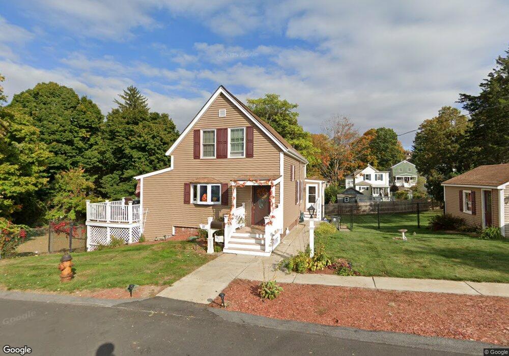
10 S Merrill St Haverhill, MA 01835
Central Bradford NeighborhoodEstimated Value: $481,000 - $574,000
3
Beds
1
Bath
1,350
Sq Ft
$394/Sq Ft
Est. Value
About This Home
This home is located at 10 S Merrill St, Haverhill, MA 01835 and is currently estimated at $532,148, approximately $394 per square foot. 10 S Merrill St is a home located in Essex County with nearby schools including Greenleaf Academy, Bradford Elementary School, and Haverhill High School.
Ownership History
Date
Name
Owned For
Owner Type
Purchase Details
Closed on
Apr 25, 2003
Sold by
Trelfa Jon G and Trelfa Rebecca
Bought by
Vacca Brian M
Current Estimated Value
Purchase Details
Closed on
Oct 31, 2000
Sold by
Lewis Scott J and Lewis Cinty L
Bought by
Trelfa Jon G and Trelfa Rebecca E
Purchase Details
Closed on
Apr 29, 1994
Sold by
Murphy Garrett L and Murphy Barbara
Bought by
Lewis Scott J
Create a Home Valuation Report for This Property
The Home Valuation Report is an in-depth analysis detailing your home's value as well as a comparison with similar homes in the area
Home Values in the Area
Average Home Value in this Area
Purchase History
| Date | Buyer | Sale Price | Title Company |
|---|---|---|---|
| Vacca Brian M | $235,000 | -- | |
| Trelfa Jon G | $169,900 | -- | |
| Lewis Scott J | $117,000 | -- |
Source: Public Records
Mortgage History
| Date | Status | Borrower | Loan Amount |
|---|---|---|---|
| Open | Lewis Scott J | $260,738 | |
| Closed | Lewis Scott J | $264,655 |
Source: Public Records
Tax History Compared to Growth
Tax History
| Year | Tax Paid | Tax Assessment Tax Assessment Total Assessment is a certain percentage of the fair market value that is determined by local assessors to be the total taxable value of land and additions on the property. | Land | Improvement |
|---|---|---|---|---|
| 2025 | $5,346 | $499,200 | $175,300 | $323,900 |
| 2024 | $4,954 | $465,600 | $175,300 | $290,300 |
| 2023 | $4,910 | $440,400 | $175,300 | $265,100 |
| 2022 | $4,713 | $370,500 | $159,200 | $211,300 |
| 2021 | $4,431 | $329,700 | $144,700 | $185,000 |
| 2020 | $4,371 | $321,400 | $139,900 | $181,500 |
| 2019 | $4,327 | $310,200 | $128,700 | $181,500 |
| 2018 | $4,153 | $291,200 | $122,200 | $169,000 |
| 2017 | $3,824 | $255,100 | $102,900 | $152,200 |
| 2016 | $3,866 | $251,700 | $102,900 | $148,800 |
| 2015 | $3,814 | $248,500 | $99,700 | $148,800 |
Source: Public Records
Map
Nearby Homes
- 496 S Main St
- 21 Twin Brooks Cir Unit U21
- 552 S Main St Unit 2
- 374 River St
- 11 Villa St Unit 106
- 219 River St
- 39 Ayer St
- 15 Blossom St
- 455 Washington St
- 2 Marion St
- 80/88 River St
- 1 Marion St
- 204 Wilson St Unit 204
- 78 Lamoille Ave
- 552 Washington St
- 72 River St Unit 4
- 72 River St Unit 7
- 72 River St Unit 2
- 72 River St Unit 6
- 72 River St Unit 3
- 17 Verndale St
- 19 Verndale St
- 12 S Merrill St
- 21 Verndale St
- 11 S Merrill St
- 15 Verndale St
- 13 Verndale St
- 23 Verndale St
- 17 S Merrill St
- 16 S Merrill St
- 11 Verndale St
- 25 Verndale St
- 4 S Merrill St
- 23 S Merrill St
- 9 Verndale St
- 27 Verndale St
- 14 Verndale St
- 20 S Merrill St
- 24 Verndale St
- 18 Verndale St