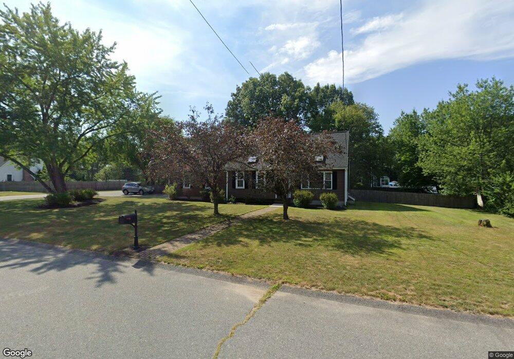
10 Samuel Way Attleboro, MA 02703
Estimated Value: $550,035 - $632,000
3
Beds
1
Bath
1,147
Sq Ft
$506/Sq Ft
Est. Value
About This Home
This home is located at 10 Samuel Way, Attleboro, MA 02703 and is currently estimated at $580,759, approximately $506 per square foot. 10 Samuel Way is a home located in Bristol County with nearby schools including Hill-Roberts Elementary School, Robert J. Coelho Middle School, and Attleboro High School.
Ownership History
Date
Name
Owned For
Owner Type
Purchase Details
Closed on
Apr 25, 2003
Sold by
Mcdonald Daniel J and Mcdonald Taylar L
Bought by
Rossignol Richard P and Rossignol Jennifer L
Current Estimated Value
Home Financials for this Owner
Home Financials are based on the most recent Mortgage that was taken out on this home.
Original Mortgage
$259,900
Outstanding Balance
$108,788
Interest Rate
5.64%
Mortgage Type
Purchase Money Mortgage
Estimated Equity
$471,971
Purchase Details
Closed on
Apr 27, 2000
Sold by
Botsch Erik K and Dube-Botsch Suzanne M
Bought by
Mcdonald Daniel J and Mcdonald Taylar L
Home Financials for this Owner
Home Financials are based on the most recent Mortgage that was taken out on this home.
Original Mortgage
$179,450
Interest Rate
8.23%
Mortgage Type
Purchase Money Mortgage
Purchase Details
Closed on
Dec 31, 1992
Sold by
Cedar Ridge Dev Inc
Bought by
Botsch Erik K and Botsch Suzanne
Home Financials for this Owner
Home Financials are based on the most recent Mortgage that was taken out on this home.
Original Mortgage
$107,120
Interest Rate
8.32%
Mortgage Type
Purchase Money Mortgage
Create a Home Valuation Report for This Property
The Home Valuation Report is an in-depth analysis detailing your home's value as well as a comparison with similar homes in the area
Home Values in the Area
Average Home Value in this Area
Purchase History
| Date | Buyer | Sale Price | Title Company |
|---|---|---|---|
| Rossignol Richard P | $289,900 | -- | |
| Mcdonald Daniel J | $185,000 | -- | |
| Botsch Erik K | $109,810 | -- |
Source: Public Records
Mortgage History
| Date | Status | Borrower | Loan Amount |
|---|---|---|---|
| Open | Rossignol Richard P | $259,900 | |
| Previous Owner | Botsch Erik K | $185,000 | |
| Previous Owner | Botsch Erik K | $179,450 | |
| Previous Owner | Botsch Erik K | $23,000 | |
| Previous Owner | Botsch Erik K | $107,120 |
Source: Public Records
Tax History Compared to Growth
Tax History
| Year | Tax Paid | Tax Assessment Tax Assessment Total Assessment is a certain percentage of the fair market value that is determined by local assessors to be the total taxable value of land and additions on the property. | Land | Improvement |
|---|---|---|---|---|
| 2025 | $6,208 | $494,700 | $168,300 | $326,400 |
| 2024 | $5,821 | $457,300 | $151,500 | $305,800 |
| 2023 | $5,833 | $426,100 | $153,100 | $273,000 |
| 2022 | $5,560 | $384,800 | $145,600 | $239,200 |
| 2021 | $4,834 | $326,600 | $140,300 | $186,300 |
| 2020 | $4,741 | $325,600 | $133,900 | $191,700 |
| 2019 | $4,173 | $294,700 | $131,600 | $163,100 |
| 2018 | $4,244 | $286,400 | $127,600 | $158,800 |
| 2017 | $4,381 | $301,100 | $124,400 | $176,700 |
| 2016 | $4,280 | $288,800 | $116,400 | $172,400 |
| 2015 | $3,944 | $268,100 | $116,400 | $151,700 |
| 2014 | $3,613 | $243,300 | $111,300 | $132,000 |
Source: Public Records
Map
Nearby Homes
- 59 Samuel Way
- 101 Middle St
- 15 Arline Dr
- 130 Zoar Ave
- 0 Middle St
- 176 Read St
- 517 Newport Ave
- 39 Slade Ave
- 64 Highland Ave Unit A
- 64 Highland Ave Unit B
- 56 Liberty Dr
- 295 Newport Ave
- 980 Newport Ave
- 31 Kevin Dr
- 53 Liberty Dr
- 44 Buffington St
- 48 Liberty Dr
- 135 Cumberland Ave
- 13 Rita Dr
- 27 Killarney Way