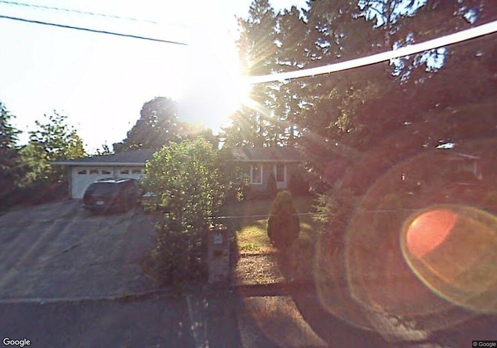
10 SE 131st Place Portland, OR 97233
Hazelwood NeighborhoodEstimated Value: $499,000 - $543,000
3
Beds
3
Baths
2,140
Sq Ft
$244/Sq Ft
Est. Value
About This Home
This home is located at 10 SE 131st Place, Portland, OR 97233 and is currently estimated at $522,685, approximately $244 per square foot. 10 SE 131st Place is a home located in Multnomah County with nearby schools including Menlo Park Elementary School, Floyd Light Middle School, and David Douglas High School.
Ownership History
Date
Name
Owned For
Owner Type
Purchase Details
Closed on
Jan 30, 2006
Sold by
Graham William E
Bought by
Khliu Kim H
Current Estimated Value
Home Financials for this Owner
Home Financials are based on the most recent Mortgage that was taken out on this home.
Original Mortgage
$192,650
Outstanding Balance
$110,372
Interest Rate
6.5%
Mortgage Type
Fannie Mae Freddie Mac
Estimated Equity
$412,313
Purchase Details
Closed on
May 16, 2000
Sold by
Klinepier Richard L
Bought by
Graham William E and Graham Beth Ann
Home Financials for this Owner
Home Financials are based on the most recent Mortgage that was taken out on this home.
Original Mortgage
$148,773
Interest Rate
8.22%
Mortgage Type
FHA
Create a Home Valuation Report for This Property
The Home Valuation Report is an in-depth analysis detailing your home's value as well as a comparison with similar homes in the area
Home Values in the Area
Average Home Value in this Area
Purchase History
| Date | Buyer | Sale Price | Title Company |
|---|---|---|---|
| Khliu Kim H | $256,900 | Transnation Title Agency Or | |
| Graham William E | $150,000 | First American Title Co |
Source: Public Records
Mortgage History
| Date | Status | Borrower | Loan Amount |
|---|---|---|---|
| Open | Khliu Kim H | $192,650 | |
| Previous Owner | Graham William E | $148,773 |
Source: Public Records
Tax History Compared to Growth
Tax History
| Year | Tax Paid | Tax Assessment Tax Assessment Total Assessment is a certain percentage of the fair market value that is determined by local assessors to be the total taxable value of land and additions on the property. | Land | Improvement |
|---|---|---|---|---|
| 2024 | $5,810 | $243,530 | -- | -- |
| 2023 | $5,557 | $236,440 | $0 | $0 |
| 2022 | $5,268 | $229,560 | $0 | $0 |
| 2021 | $5,181 | $222,880 | $0 | $0 |
| 2020 | $4,694 | $216,390 | $0 | $0 |
| 2019 | $4,544 | $210,090 | $0 | $0 |
| 2018 | $4,405 | $203,980 | $0 | $0 |
| 2017 | $4,242 | $198,040 | $0 | $0 |
| 2016 | $4,130 | $192,280 | $0 | $0 |
| 2015 | $4,032 | $186,680 | $0 | $0 |
| 2014 | $3,955 | $181,250 | $0 | $0 |
Source: Public Records
Map
Nearby Homes
- 59 NE 134th Place
- 13035 SE Stark St
- 13045 SE Stark St Unit 124
- 13045 SE Stark St
- 13045 SE Stark St Unit 6
- 301 SE 129th Ave
- 142 NE 128th Ave
- 335 SE 129th Ave
- 12827 SE Stark St Unit B4
- 12841 SE Stark St Unit A19
- 15 NE 127th Ave
- 12871 SE Stark St Unit A16
- 12950 NE Glisan St
- 13241 SE Washington St
- 307 SE 127th Ave
- 601 SE 135th Ave
- 13730 SE Stark St Unit 13752
- 706 SE 135th Ave
- 750 SE 135th Ave
- 13050 SE Morrison St
- 8 SE 131st Place
- 30 SE 131st Place
- 13210 E Burnside St Unit 13224
- 17 SE 131st Place
- 13226 E Burnside St(not Busy
- 13226 E Burnside St
- 40 SE 131st Place
- 13145 E Burnside St
- 13209 SE Ankeny Ct
- 13125 E Burnside St
- 13217 SE Ankeny Ct
- 13124 SE Ankeny St
- 13045 SE Ankeny St
- 13240 E Burnside St
- 13110 SE Ankeny St
- 13211 E Burnside St
- 13105 E Burnside St
- 16 NE 131st Place
- 13206 SE Ankeny Ct
- 13235 SE Ankeny Ct