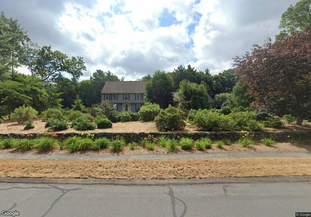
10 Shepherd St Foxboro, MA 02035
Estimated Value: $954,000 - $1,280,000
4
Beds
3
Baths
3,538
Sq Ft
$306/Sq Ft
Est. Value
About This Home
This home is located at 10 Shepherd St, Foxboro, MA 02035 and is currently estimated at $1,082,575, approximately $305 per square foot. 10 Shepherd St is a home located in Norfolk County with nearby schools including Foxborough High School, Foxborough Regional Charter School, and Cadence Academy Preschool - North Attleborough.
Ownership History
Date
Name
Owned For
Owner Type
Purchase Details
Closed on
Jan 22, 2016
Sold by
Stanton Nancy
Bought by
Stanton Nancy Z and Stanton Michael P
Current Estimated Value
Purchase Details
Closed on
Dec 30, 1986
Bought by
Stanton Nancy
Create a Home Valuation Report for This Property
The Home Valuation Report is an in-depth analysis detailing your home's value as well as a comparison with similar homes in the area
Home Values in the Area
Average Home Value in this Area
Purchase History
| Date | Buyer | Sale Price | Title Company |
|---|---|---|---|
| Stanton Nancy Z | -- | -- | |
| Stanton Nancy | -- | -- |
Source: Public Records
Mortgage History
| Date | Status | Borrower | Loan Amount |
|---|---|---|---|
| Previous Owner | Stanton Nancy | $100,000 | |
| Previous Owner | Stanton Nancy | $50,000 |
Source: Public Records
Tax History Compared to Growth
Tax History
| Year | Tax Paid | Tax Assessment Tax Assessment Total Assessment is a certain percentage of the fair market value that is determined by local assessors to be the total taxable value of land and additions on the property. | Land | Improvement |
|---|---|---|---|---|
| 2025 | $12,207 | $923,400 | $315,300 | $608,100 |
| 2024 | $11,567 | $856,200 | $289,000 | $567,200 |
| 2023 | $10,621 | $747,400 | $275,400 | $472,000 |
| 2022 | $10,216 | $703,600 | $257,100 | $446,500 |
| 2021 | $10,146 | $688,300 | $250,600 | $437,700 |
| 2020 | $9,816 | $673,700 | $250,600 | $423,100 |
| 2019 | $9,821 | $668,100 | $269,600 | $398,500 |
| 2018 | $9,725 | $667,500 | $280,000 | $387,500 |
| 2017 | $9,520 | $633,000 | $271,300 | $361,700 |
| 2016 | $9,431 | $636,400 | $266,600 | $369,800 |
| 2015 | $9,143 | $601,900 | $213,300 | $388,600 |
| 2014 | $8,910 | $594,400 | $213,300 | $381,100 |
Source: Public Records
Map
Nearby Homes
- 24 Maverick Dr
- 16 Treasure Island Rd
- 406 South St
- 9 Oak Dr
- 116 George St
- 28 Messenger St
- 10 Sleepy Hollow Cir
- 11 Landry Ave
- 47 Old Farm Rd
- 126 Washington St
- 130 Washington St
- 124 Washington St
- 5 Old Wood Rd
- 158 Washington St
- 15 Old Wood Rd
- 4 Buckskin Dr
- 196 Donald Tennant Cir
- 150 Gilbert St
- 9 Sunnyside Dr Unit 9
- 80 Mill St