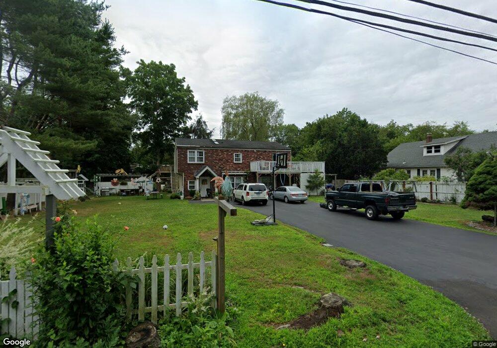
10 Short Rocks Rd Branford, CT 06405
Estimated Value: $361,000 - $484,404
3
Beds
3
Baths
2,132
Sq Ft
$203/Sq Ft
Est. Value
About This Home
This home is located at 10 Short Rocks Rd, Branford, CT 06405 and is currently estimated at $432,851, approximately $203 per square foot. 10 Short Rocks Rd is a home located in New Haven County with nearby schools including Francis Walsh Intermediate School, Branford High School, and St Mary School.
Ownership History
Date
Name
Owned For
Owner Type
Purchase Details
Closed on
Sep 4, 2020
Sold by
Derenzo Annette
Bought by
Super Deal Roofing & Home
Current Estimated Value
Purchase Details
Closed on
Feb 11, 2005
Sold by
Grammattei Gerald A and Grammattei Linda A
Bought by
Castillo Victor H
Home Financials for this Owner
Home Financials are based on the most recent Mortgage that was taken out on this home.
Original Mortgage
$184,500
Interest Rate
5.83%
Create a Home Valuation Report for This Property
The Home Valuation Report is an in-depth analysis detailing your home's value as well as a comparison with similar homes in the area
Home Values in the Area
Average Home Value in this Area
Purchase History
| Date | Buyer | Sale Price | Title Company |
|---|---|---|---|
| Super Deal Roofing & Home | $128,000 | None Available | |
| Castillo Victor H | $205,000 | -- |
Source: Public Records
Mortgage History
| Date | Status | Borrower | Loan Amount |
|---|---|---|---|
| Previous Owner | Castillo Victor H | $264,000 | |
| Previous Owner | Castillo Victor H | $52,800 | |
| Previous Owner | Castillo Victor H | $184,500 |
Source: Public Records
Tax History
| Year | Tax Paid | Tax Assessment Tax Assessment Total Assessment is a certain percentage of the fair market value that is determined by local assessors to be the total taxable value of land and additions on the property. | Land | Improvement |
|---|---|---|---|---|
| 2025 | $5,564 | $260,000 | $82,600 | $177,400 |
| 2024 | $5,148 | $168,900 | $73,400 | $95,500 |
| 2023 | $5,048 | $168,900 | $73,400 | $95,500 |
| 2022 | $4,974 | $168,900 | $73,400 | $95,500 |
| 2021 | $4,974 | $168,900 | $73,400 | $95,500 |
| 2020 | $4,885 | $168,900 | $73,400 | $95,500 |
| 2019 | $5,407 | $186,000 | $76,700 | $109,300 |
| 2018 | $5,327 | $186,000 | $76,700 | $109,300 |
| 2017 | $5,295 | $186,000 | $76,700 | $109,300 |
| 2016 | $5,098 | $186,000 | $76,700 | $109,300 |
| 2015 | $5,009 | $186,000 | $76,700 | $109,300 |
| 2014 | $4,663 | $177,700 | $73,400 | $104,300 |
Source: Public Records
Map
Nearby Homes
- 39 Manorwood Dr
- 211 E Main St Unit 50
- 251 N Main St
- 173 Mill Plain Rd
- 8 Meadow Circle Rd
- 7 Hamre Ln Unit A
- 226 Austin Ryer Ln Unit 226
- 121 Damascus Rd
- 49 Rose St Unit 204
- 7 Dogwood Ct
- 9 Patrick Ln
- 200 Damascus Rd
- 16 Pine Orchard Rd Unit 27
- 7 Bay Path Way Unit 7
- 53 Brushy Plain Rd Unit 3F
- 86 Pine Orchard Rd
- 53 Montowese St
- 15 Griffing Pond Rd
- 180 Cherry Hill Rd Unit Lot 5
- 184 Cherry Hill Rd Unit Lot 4
- 12 Short Rocks Rd
- 6 Short Rocks Rd
- 15 Short Rocks Rd
- 11 Short Rocks Rd
- 26 Short Rocks Rd
- 21 Short Rocks Rd
- 50 Mill Plain Rd
- 56 Mill Plain Rd
- 28 Short Rocks Rd
- 23 Short Rocks Rd
- 60 Mill Plain Rd
- 18 Stonegate Dr
- 30 Short Rocks Rd
- 16 Stonegate Dr
- 27 Short Rocks Rd
- 24 Mill Plain Rd
- 39 Mill Plain Rd
- 62 Manorwood Dr
- 62 Manorwood Dr
- 62 Manorwood Dr Unit 62
Your Personal Tour Guide
Ask me questions while you tour the home.