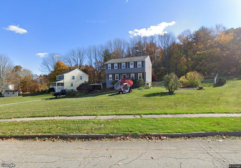
10 Stacey Ln Amesbury, MA 01913
Estimated Value: $672,000 - $722,000
3
Beds
2
Baths
1,700
Sq Ft
$408/Sq Ft
Est. Value
About This Home
This home is located at 10 Stacey Ln, Amesbury, MA 01913 and is currently estimated at $693,770, approximately $408 per square foot. 10 Stacey Ln is a home located in Essex County with nearby schools including Amesbury High School and Amesbury Seventh-Day Adventist School.
Ownership History
Date
Name
Owned For
Owner Type
Purchase Details
Closed on
Dec 3, 1993
Sold by
Stanichuk Ricky C
Bought by
Mccarthy Timothy D and Mcwhinnie Brenda J
Current Estimated Value
Create a Home Valuation Report for This Property
The Home Valuation Report is an in-depth analysis detailing your home's value as well as a comparison with similar homes in the area
Home Values in the Area
Average Home Value in this Area
Purchase History
| Date | Buyer | Sale Price | Title Company |
|---|---|---|---|
| Mccarthy Timothy D | $145,000 | -- |
Source: Public Records
Mortgage History
| Date | Status | Borrower | Loan Amount |
|---|---|---|---|
| Open | Mccarthy Timothy D | $280,000 | |
| Closed | Mccarthy Timothy D | $40,000 | |
| Closed | Mccarthy Timothy D | $213,000 | |
| Closed | Mccarthy Timothy D | $188,500 |
Source: Public Records
Tax History
| Year | Tax Paid | Tax Assessment Tax Assessment Total Assessment is a certain percentage of the fair market value that is determined by local assessors to be the total taxable value of land and additions on the property. | Land | Improvement |
|---|---|---|---|---|
| 2025 | $9,536 | $623,300 | $293,200 | $330,100 |
| 2024 | $9,106 | $582,200 | $276,600 | $305,600 |
| 2023 | $8,477 | $518,800 | $240,600 | $278,200 |
| 2022 | $8,084 | $457,000 | $209,300 | $247,700 |
| 2021 | $7,373 | $404,000 | $168,600 | $235,400 |
| 2020 | $6,554 | $381,500 | $162,100 | $219,400 |
| 2019 | $6,698 | $364,600 | $162,100 | $202,500 |
| 2018 | $6,586 | $346,800 | $154,400 | $192,400 |
| 2017 | $6,779 | $339,800 | $154,400 | $185,400 |
| 2016 | $6,644 | $327,600 | $154,400 | $173,200 |
| 2015 | $6,548 | $318,800 | $154,400 | $164,400 |
| 2014 | $6,427 | $306,500 | $154,400 | $152,100 |
Source: Public Records
Map
Nearby Homes
- 1 Brown Ave Unit 1-25
- 149 Market St
- 105 Market St Unit B
- 101 Market St Unit B
- 25 Whittier Meadows Dr
- 25 Cedar St Unit 4
- 21 Congress St
- 9 Elmwood St
- 97 Elm St
- 3 Tremont Ave Unit A
- 4 Clark St
- 48 Orchard St
- 82 Monroe St
- 51 Locust St
- 84 Blacksnake Rd Unit B
- 24 Adder Ln
- 2 Adder Ln
- 21 River St
- 4 Greenwood St
- 1 Hillside Ave Unit 3
Your Personal Tour Guide
Ask me questions while you tour the home.