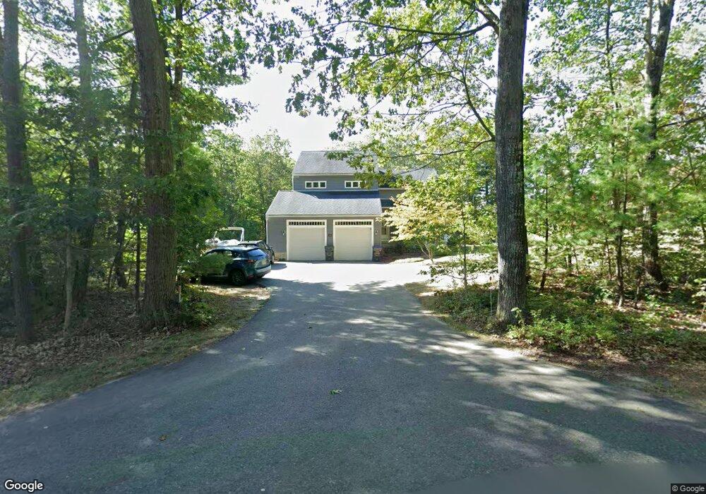
10 Stagecoach Rd Lancaster, MA 01523
Estimated Value: $657,000 - $707,000
3
Beds
2
Baths
1,728
Sq Ft
$390/Sq Ft
Est. Value
About This Home
This home is located at 10 Stagecoach Rd, Lancaster, MA 01523 and is currently estimated at $674,272, approximately $390 per square foot. 10 Stagecoach Rd is a home located in Worcester County with nearby schools including Mary Rowlandson Elementary School, Luther Burbank Middle School, and Nashoba Regional High School.
Ownership History
Date
Name
Owned For
Owner Type
Purchase Details
Closed on
Jun 1, 1990
Sold by
Stagecoach Rt
Bought by
Revell Paul E
Current Estimated Value
Home Financials for this Owner
Home Financials are based on the most recent Mortgage that was taken out on this home.
Original Mortgage
$90,000
Interest Rate
10.25%
Mortgage Type
Purchase Money Mortgage
Create a Home Valuation Report for This Property
The Home Valuation Report is an in-depth analysis detailing your home's value as well as a comparison with similar homes in the area
Home Values in the Area
Average Home Value in this Area
Purchase History
| Date | Buyer | Sale Price | Title Company |
|---|---|---|---|
| Revell Paul E | $181,440 | -- |
Source: Public Records
Mortgage History
| Date | Status | Borrower | Loan Amount |
|---|---|---|---|
| Closed | Revell Paul E | $90,000 |
Source: Public Records
Tax History Compared to Growth
Tax History
| Year | Tax Paid | Tax Assessment Tax Assessment Total Assessment is a certain percentage of the fair market value that is determined by local assessors to be the total taxable value of land and additions on the property. | Land | Improvement |
|---|---|---|---|---|
| 2025 | $10,035 | $621,000 | $174,900 | $446,100 |
| 2024 | $10,174 | $582,700 | $174,900 | $407,800 |
| 2023 | $9,353 | $544,100 | $154,900 | $389,200 |
| 2022 | $9,283 | $477,300 | $151,900 | $325,400 |
| 2021 | $9,023 | $451,600 | $151,900 | $299,700 |
| 2020 | $8,391 | $422,700 | $151,900 | $270,800 |
| 2019 | $8,054 | $407,800 | $151,900 | $255,900 |
| 2018 | $7,760 | $388,400 | $151,900 | $236,500 |
| 2016 | $7,691 | $393,400 | $150,500 | $242,900 |
| 2015 | $7,318 | $390,100 | $150,500 | $239,600 |
| 2014 | $7,110 | $376,000 | $150,500 | $225,500 |
Source: Public Records
Map
Nearby Homes
- 95 Old Union Turnpike
- 7 Lawson Ave
- 0 Windsor Rd
- 1497 Lunenburg Rd
- 35 Mcgovern Blvd
- 27 Lancaster Rd
- 2038-1 Laurel Hill Ln
- 2038 Laurel Hill Ln Unit LOT 18
- 3 Mill St
- 25 Front St
- 30 Ayer Rd
- 40 Ayer Rd
- 303 Ponakin Rd
- 50 Sky Ln
- 2237 Main St
- 3 Ambrose Way Unit 3
- 6 Ambrose Way Unit 3
- 19 Ambrose Way Unit 19
- 9 Ambrose Way Unit 9
- 1 Ambrose Way Unit 1
- 26 Stagecoach Rd
- 15 Stagecoach Rd
- 50 Stagecoach Rd
- 94 Old Union Turnpike
- 45 Stagecoach Rd
- 141 Old Union Turnpike
- 76 Stagecoach Rd
- 87 Stagecoach Rd
- 2 Massachusetts 2
- 100 Stagecoach Rd
- 101 Stagecoach Rd
- 116 Stagecoach Rd
- 61 Old Union Turnpike
- 123 Stagecoach Rd
- 131 Stagecoach Rd
- 27 Old Union Turnpike
- 20 Evelyn Place
- 56 Vincent Ave
- 60 Grant Way
- 50 Vincent Ave