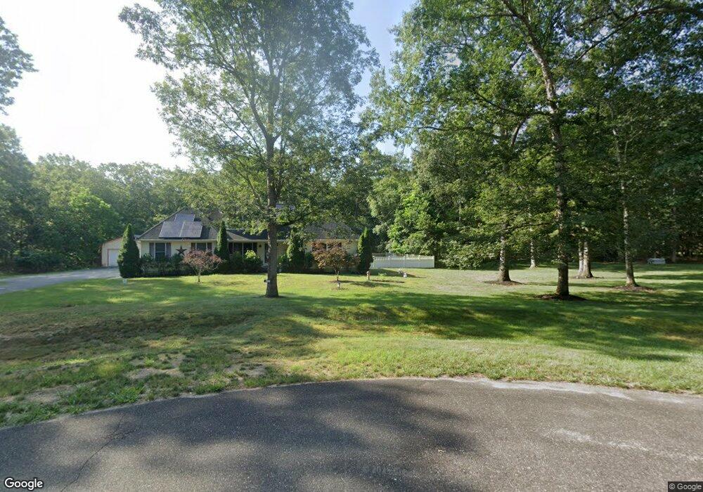
10 Stone Walk Mays Landing, NJ 08330
Estimated Value: $442,000 - $711,000
--
Bed
--
Bath
1,888
Sq Ft
$287/Sq Ft
Est. Value
About This Home
This home is located at 10 Stone Walk, Mays Landing, NJ 08330 and is currently estimated at $541,588, approximately $286 per square foot. 10 Stone Walk is a home located in Atlantic County with nearby schools including Joseph Shaner School, George L. Hess Educational Complex, and William Davies Middle School.
Ownership History
Date
Name
Owned For
Owner Type
Purchase Details
Closed on
Oct 20, 2004
Sold by
Glenn Construction Llc
Bought by
Joyner William and Joyner Margaret
Current Estimated Value
Purchase Details
Closed on
Aug 25, 2003
Sold by
Stone Lawrence
Bought by
Glenn Construction Llc
Create a Home Valuation Report for This Property
The Home Valuation Report is an in-depth analysis detailing your home's value as well as a comparison with similar homes in the area
Home Values in the Area
Average Home Value in this Area
Purchase History
| Date | Buyer | Sale Price | Title Company |
|---|---|---|---|
| Joyner William | $129,900 | -- | |
| Joyner William | $129,900 | -- | |
| Glenn Construction Llc | $45,000 | -- | |
| Glenn Construction Llc | $45,000 | Liberty Title Agency |
Source: Public Records
Tax History Compared to Growth
Tax History
| Year | Tax Paid | Tax Assessment Tax Assessment Total Assessment is a certain percentage of the fair market value that is determined by local assessors to be the total taxable value of land and additions on the property. | Land | Improvement |
|---|---|---|---|---|
| 2025 | $10,475 | $305,300 | $60,400 | $244,900 |
| 2024 | $10,475 | $305,300 | $60,400 | $244,900 |
| 2023 | $9,849 | $305,300 | $60,400 | $244,900 |
| 2022 | $9,849 | $305,300 | $60,400 | $244,900 |
| 2021 | $9,828 | $305,300 | $60,400 | $244,900 |
| 2020 | $9,828 | $305,300 | $60,400 | $244,900 |
| 2019 | $9,852 | $305,300 | $60,400 | $244,900 |
| 2018 | $9,507 | $305,300 | $60,400 | $244,900 |
| 2017 | $9,357 | $305,300 | $60,400 | $244,900 |
| 2016 | $9,095 | $305,300 | $60,400 | $244,900 |
| 2015 | $8,787 | $305,300 | $60,400 | $244,900 |
| 2014 | $8,617 | $328,000 | $70,500 | $257,500 |
Source: Public Records
Map
Nearby Homes