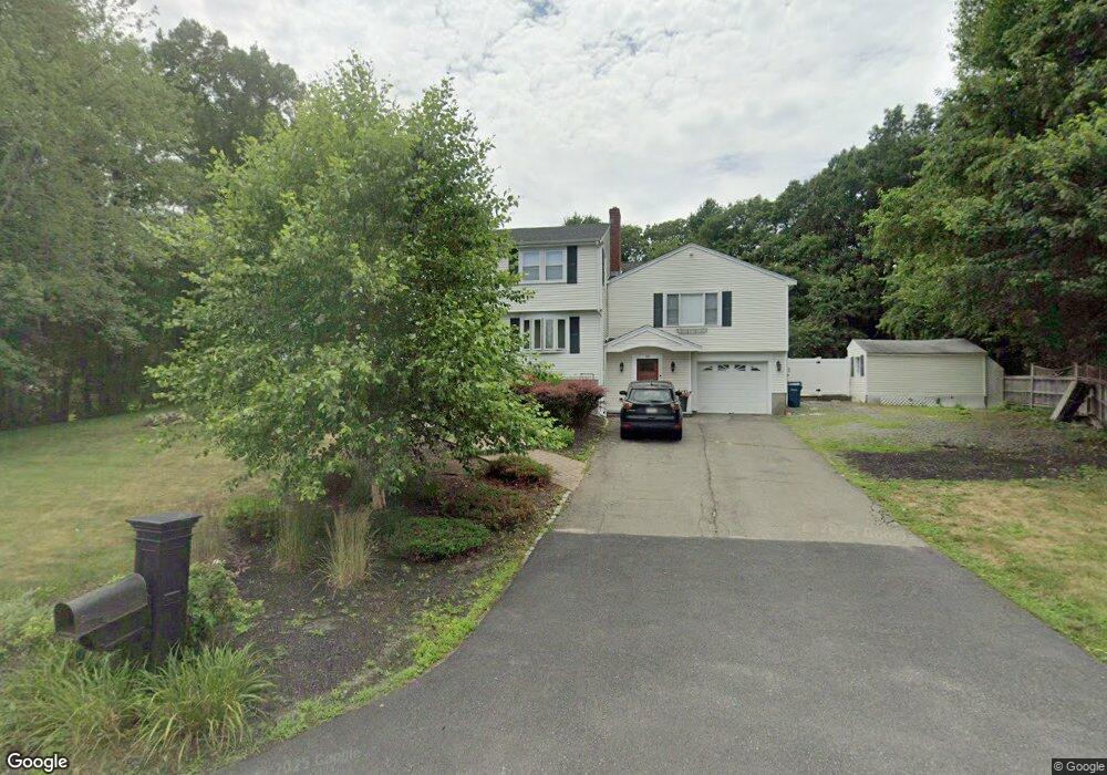
10 Stonewood Dr Canton, MA 02021
Estimated Value: $919,913 - $1,165,000
5
Beds
3
Baths
3,100
Sq Ft
$344/Sq Ft
Est. Value
About This Home
This home is located at 10 Stonewood Dr, Canton, MA 02021 and is currently estimated at $1,066,478, approximately $344 per square foot. 10 Stonewood Dr is a home located in Norfolk County.
Ownership History
Date
Name
Owned For
Owner Type
Purchase Details
Closed on
Nov 15, 2005
Sold by
Friece Marianne and Friece William D
Bought by
Duserick Peter and Duserick Juanita C
Current Estimated Value
Home Financials for this Owner
Home Financials are based on the most recent Mortgage that was taken out on this home.
Original Mortgage
$510,000
Outstanding Balance
$277,556
Interest Rate
5.93%
Mortgage Type
Purchase Money Mortgage
Estimated Equity
$788,922
Purchase Details
Closed on
Jun 30, 1997
Sold by
Butts Mark C and Butts Barbara A
Bought by
Friece William D
Create a Home Valuation Report for This Property
The Home Valuation Report is an in-depth analysis detailing your home's value as well as a comparison with similar homes in the area
Home Values in the Area
Average Home Value in this Area
Purchase History
| Date | Buyer | Sale Price | Title Company |
|---|---|---|---|
| Duserick Peter | $680,000 | -- | |
| Friece William D | $252,000 | -- |
Source: Public Records
Mortgage History
| Date | Status | Borrower | Loan Amount |
|---|---|---|---|
| Open | Duserick Peter | $510,000 | |
| Previous Owner | Friece William D | $100,000 | |
| Previous Owner | Friece William D | $340,000 |
Source: Public Records
Tax History Compared to Growth
Tax History
| Year | Tax Paid | Tax Assessment Tax Assessment Total Assessment is a certain percentage of the fair market value that is determined by local assessors to be the total taxable value of land and additions on the property. | Land | Improvement |
|---|---|---|---|---|
| 2025 | $8,250 | $834,200 | $339,100 | $495,100 |
| 2024 | $8,069 | $809,300 | $326,100 | $483,200 |
| 2023 | $7,939 | $751,100 | $326,100 | $425,000 |
| 2022 | $7,913 | $697,200 | $310,600 | $386,600 |
| 2021 | $7,729 | $633,500 | $282,300 | $351,200 |
| 2020 | $7,449 | $609,100 | $268,900 | $340,200 |
| 2019 | $7,095 | $572,200 | $222,200 | $350,000 |
| 2018 | $6,898 | $555,400 | $213,600 | $341,800 |
| 2017 | $7,028 | $549,500 | $209,500 | $340,000 |
| 2016 | $6,914 | $540,600 | $204,300 | $336,300 |
| 2015 | $6,746 | $526,200 | $198,400 | $327,800 |
Source: Public Records
Map
Nearby Homes
- 11 Ledgewood Dr
- 43 Ledgebrook Ave
- 68 High St
- 50 Indian Ln
- 106 Indian Ln
- 79 Gold St
- 545 Page St Unit 208
- 30 Manitou Rd
- 3 Spotted Turtle Path Unit 24-2
- 43 Emily Jeffers Rd
- Lot 2 Pondview Ln
- Lot 1 Pondview Ln
- 17 Mazzeo Dr
- 280 Deady Ave
- 2 Smith Rd
- 229 Chestnut St
- 33 Michael Rd
- 888 Turnpike St
- 98 Glen Echo Blvd
- 902 Irving Rd Unit 902
- 16 Stonewood Dr
- 8 Stonewood Dr
- 3 Overlook Rd
- 11 Stonewood Dr
- 20 Ledgewood Dr
- 9 Stonewood Dr
- 5 Overlook Rd
- lot # 2 Overlook Rd
- 7 Stonewood Dr
- 17 Stonewood Dr
- 12 Stonewood Dr
- 23 Ledgewood Dr
- 4 Overlook Rd
- 21 Ledgewood Dr
- 5 Stonewood Dr
- 19 Ledgewood Dr
- 9 Overlook Rd
- 22 Woodcliff Rd
- 4 Stonewood Dr
- 4 Stonewood Dr Unit 103