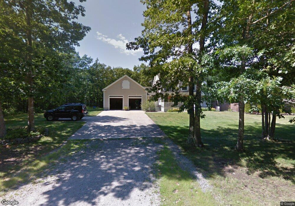
10 Summit Dr Kennebunk, ME 04043
Estimated Value: $693,000 - $867,000
3
Beds
4
Baths
2,116
Sq Ft
$373/Sq Ft
Est. Value
About This Home
This home is located at 10 Summit Dr, Kennebunk, ME 04043 and is currently estimated at $789,516, approximately $373 per square foot. 10 Summit Dr is a home located in York County with nearby schools including Kennebunk High School and The New School.
Ownership History
Date
Name
Owned For
Owner Type
Purchase Details
Closed on
Mar 4, 2022
Sold by
Parent Charles A
Bought by
Bergeron Gail and Bergeron Ronald
Current Estimated Value
Home Financials for this Owner
Home Financials are based on the most recent Mortgage that was taken out on this home.
Original Mortgage
$472,000
Outstanding Balance
$438,205
Interest Rate
3.69%
Mortgage Type
Purchase Money Mortgage
Estimated Equity
$351,311
Purchase Details
Closed on
Apr 18, 2012
Sold by
Porell Tracy A
Bought by
Parent Charles A
Home Financials for this Owner
Home Financials are based on the most recent Mortgage that was taken out on this home.
Original Mortgage
$269,910
Interest Rate
3.89%
Mortgage Type
Purchase Money Mortgage
Create a Home Valuation Report for This Property
The Home Valuation Report is an in-depth analysis detailing your home's value as well as a comparison with similar homes in the area
Home Values in the Area
Average Home Value in this Area
Purchase History
| Date | Buyer | Sale Price | Title Company |
|---|---|---|---|
| Bergeron Gail | $632,000 | None Available | |
| Parent Charles A | -- | -- | |
| Parent Charles A | -- | -- |
Source: Public Records
Mortgage History
| Date | Status | Borrower | Loan Amount |
|---|---|---|---|
| Open | Bergeron Gail | $472,000 | |
| Previous Owner | Parent Charles A | $269,910 | |
| Previous Owner | Parent Charles A | $119,000 |
Source: Public Records
Tax History Compared to Growth
Tax History
| Year | Tax Paid | Tax Assessment Tax Assessment Total Assessment is a certain percentage of the fair market value that is determined by local assessors to be the total taxable value of land and additions on the property. | Land | Improvement |
|---|---|---|---|---|
| 2024 | $7,326 | $432,200 | $98,400 | $333,800 |
| 2023 | $6,937 | $432,200 | $98,400 | $333,800 |
| 2022 | $6,310 | $432,200 | $98,400 | $333,800 |
| 2021 | $6,159 | $432,200 | $98,400 | $333,800 |
| 2020 | $5,762 | $432,200 | $98,400 | $333,800 |
| 2019 | $5,943 | $432,200 | $98,400 | $333,800 |
| 2018 | $5,672 | $324,100 | $73,800 | $250,300 |
| 2017 | $5,364 | $324,100 | $73,800 | $250,300 |
| 2016 | $5,153 | $324,100 | $73,800 | $250,300 |
| 2015 | $4,959 | $324,100 | $73,800 | $250,300 |
| 2014 | $4,829 | $324,100 | $73,800 | $250,300 |
Source: Public Records
Map
Nearby Homes
- 29 Bentley Place Unit 50
- 17 Hampton Glen Dr Unit 5
- 9 Hampton Glen Dr Unit 3
- 23 Lilac Ln
- 23 Cascade Cir Unit 22
- 15 Dragonfly Ln
- 25 Cambridge Ct
- 6 Dunnhill Dr Unit 28
- 22 Winchester Ct
- 056 Cat Mousam Rd
- 108 Hampton Glen Dr Unit 108
- 3 Kensington Dr
- 3 Nichols Ln
- 9 Hammond Rd
- 2 Chestnut Ln Unit 2
- lot 12 Lydia's Cir
- lot 6 Lydias Cir
- lot 20 Lydias Cir
- 59 Plymouth Grove Unit 11
- lot 5 Lydia's Cir
- 10 Summit Dr
- 00 Summit Dr
- LOT#6 Summit Dr
- LOT#7 Summit Dr
- 11 Summit Dr
- 0 Summit Unit 714226
- 0 Summit Unit 877944
- 73 Whitten Rd
- 101 Whitten Rd
- Lot 98 Summit Dr
- 13 Summit Dr
- 90 Whitten Rd
- 3 Rusty Bucket Ln
- 117 Whitten Rd
- 15 Summit Dr
- 15 Summit Dr
- 78 Whitten Rd
- 704 Whitten Rd
- 55 Whitten Rd
- 1 Rusty Bucket Ln