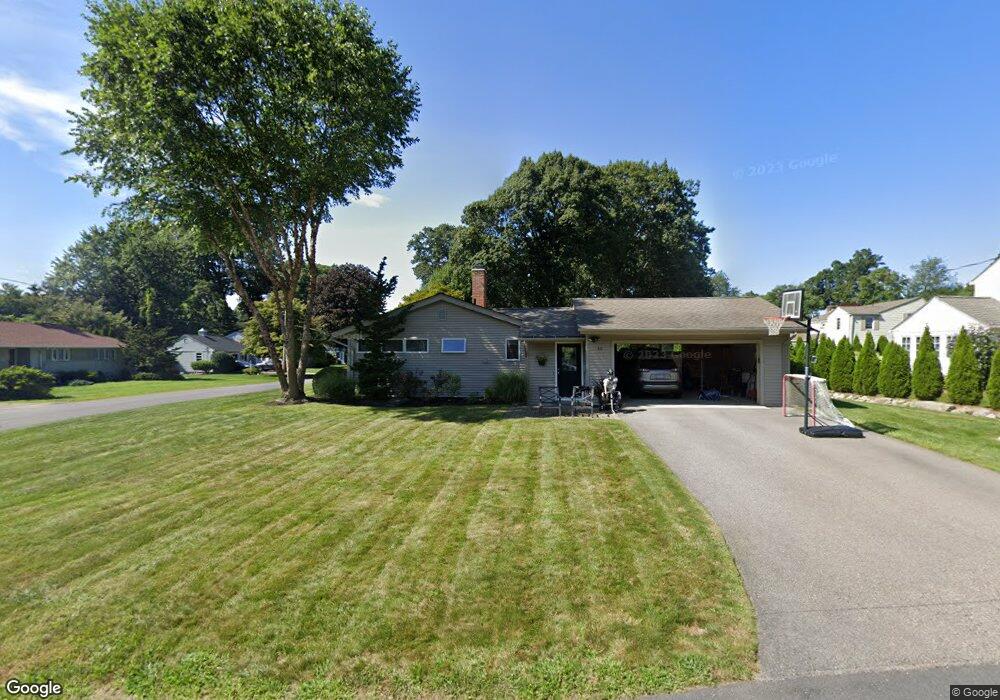
10 Surrey Ln Shrewsbury, MA 01545
Estimated Value: $805,525 - $862,000
4
Beds
3
Baths
2,150
Sq Ft
$386/Sq Ft
Est. Value
About This Home
This home is located at 10 Surrey Ln, Shrewsbury, MA 01545 and is currently estimated at $830,381, approximately $386 per square foot. 10 Surrey Ln is a home located in Worcester County with nearby schools including Walter J. Paton Elementary School, Sherwood Middle School, and Oak Middle School.
Ownership History
Date
Name
Owned For
Owner Type
Purchase Details
Closed on
Nov 7, 2008
Sold by
Durkin Elizabeth A and Losty Elizabeth A
Bought by
Ferguson Cindy B and Ferguson Eric T
Current Estimated Value
Purchase Details
Closed on
Sep 30, 1994
Sold by
Mcconnell Jessica M
Bought by
Durkin Jeffery C and Losty Elizabeth
Purchase Details
Closed on
Nov 18, 1991
Sold by
Detroit Sb
Bought by
Mcconnell Jessica M
Purchase Details
Closed on
Aug 27, 1991
Sold by
Grip Kenneth C
Bought by
Detroit Sb Fsb
Purchase Details
Closed on
Jun 20, 1991
Sold by
Grip Kenneth C
Bought by
Mackinac Realty Inc
Purchase Details
Closed on
Oct 13, 1989
Sold by
Kelso Florence
Bought by
Grip Kenneth
Create a Home Valuation Report for This Property
The Home Valuation Report is an in-depth analysis detailing your home's value as well as a comparison with similar homes in the area
Home Values in the Area
Average Home Value in this Area
Purchase History
| Date | Buyer | Sale Price | Title Company |
|---|---|---|---|
| Ferguson Cindy B | $487,000 | -- | |
| Ferguson Cindy B | $487,000 | -- | |
| Ferguson Cindy B | $487,000 | -- | |
| Durkin Jeffery C | $164,900 | -- | |
| Durkin Jeffery C | $164,900 | -- | |
| Mcconnell Jessica M | $143,500 | -- | |
| Mcconnell Jessica M | $143,500 | -- | |
| Detroit Sb Fsb | $183,250 | -- | |
| Detroit Sb Fsb | $183,250 | -- | |
| Mackinac Realty Inc | $160,284 | -- | |
| Mackinac Realty Inc | $160,284 | -- | |
| Grip Kenneth | $215,000 | -- |
Source: Public Records
Mortgage History
| Date | Status | Borrower | Loan Amount |
|---|---|---|---|
| Open | Grip Kenneth | $275,000 | |
| Closed | Grip Kenneth | $284,000 |
Source: Public Records
Tax History Compared to Growth
Tax History
| Year | Tax Paid | Tax Assessment Tax Assessment Total Assessment is a certain percentage of the fair market value that is determined by local assessors to be the total taxable value of land and additions on the property. | Land | Improvement |
|---|---|---|---|---|
| 2025 | $95 | $791,700 | $287,300 | $504,400 |
| 2024 | $8,642 | $698,100 | $273,600 | $424,500 |
| 2023 | $8,455 | $644,400 | $273,600 | $370,800 |
| 2022 | $7,732 | $548,000 | $215,000 | $333,000 |
| 2021 | $6,943 | $526,400 | $215,000 | $311,400 |
| 2020 | $6,363 | $510,300 | $215,000 | $295,300 |
| 2019 | $6,208 | $493,900 | $200,200 | $293,700 |
| 2018 | $5,724 | $452,100 | $187,400 | $264,700 |
| 2017 | $5,573 | $434,400 | $169,700 | $264,700 |
| 2016 | $5,504 | $423,400 | $158,700 | $264,700 |
| 2015 | $5,545 | $420,100 | $143,800 | $276,300 |
Source: Public Records
Map
Nearby Homes
- 515 Main St
- 46-50 Wesleyan St
- 7 Wesleyan St
- 19 Grafton St
- 3 Merriam Ave
- 29 Elma Cir
- 34 Gates Rd
- 647 Main St
- 7 Holman Heights Cir
- 114 Grafton St
- 18 Eastwood Rd
- 9 Arnold Rd
- 21 Fiske St
- 33 Shady Lane Ave
- 129 A-B Maple Ave
- 39 Old Brook Rd
- 11 Adin Dr
- 307 Main St
- 15 Conifer Cir Unit 31
- 5 Conifer Cir Unit 28