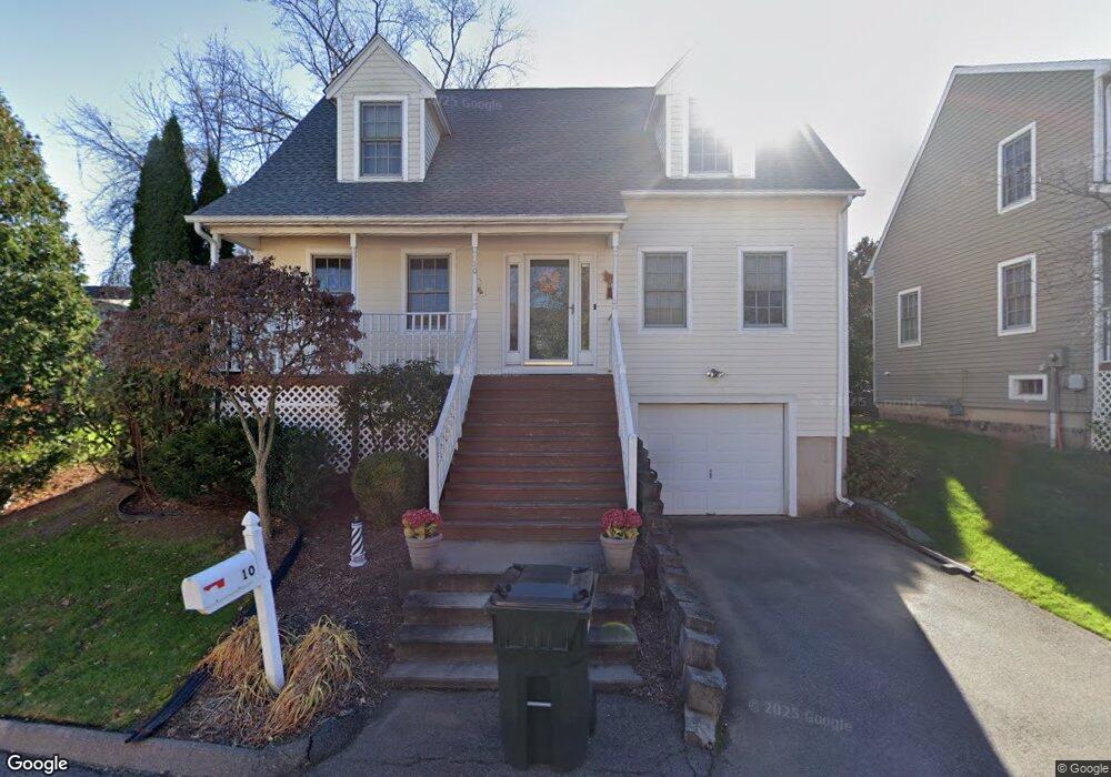
10 Taylor Ln Wethersfield, CT 06109
Estimated Value: $255,000 - $308,326
3
Beds
2
Baths
1,210
Sq Ft
$234/Sq Ft
Est. Value
About This Home
This home is located at 10 Taylor Ln, Wethersfield, CT 06109 and is currently estimated at $283,582, approximately $234 per square foot. 10 Taylor Ln is a home located in Hartford County with nearby schools including Alfred W. Hanmer School, Silas Deane Middle School, and Wethersfield High School.
Ownership History
Date
Name
Owned For
Owner Type
Purchase Details
Closed on
Jun 28, 2005
Sold by
Frame George and Frame Patricia
Bought by
Tavernier Michael J
Current Estimated Value
Home Financials for this Owner
Home Financials are based on the most recent Mortgage that was taken out on this home.
Original Mortgage
$192,850
Outstanding Balance
$101,709
Interest Rate
5.82%
Estimated Equity
$181,873
Purchase Details
Closed on
Sep 18, 2001
Sold by
Haiko May B
Bought by
Frame George and Frame Patricia
Home Financials for this Owner
Home Financials are based on the most recent Mortgage that was taken out on this home.
Original Mortgage
$119,920
Interest Rate
6.99%
Purchase Details
Closed on
Sep 29, 1997
Sold by
Premier Building & Dev
Bought by
Haiko May B
Home Financials for this Owner
Home Financials are based on the most recent Mortgage that was taken out on this home.
Original Mortgage
$65,000
Interest Rate
7.47%
Mortgage Type
Unknown
Create a Home Valuation Report for This Property
The Home Valuation Report is an in-depth analysis detailing your home's value as well as a comparison with similar homes in the area
Home Values in the Area
Average Home Value in this Area
Purchase History
| Date | Buyer | Sale Price | Title Company |
|---|---|---|---|
| Tavernier Michael J | $203,000 | -- | |
| Frame George | $149,900 | -- | |
| Haiko May B | $131,000 | -- |
Source: Public Records
Mortgage History
| Date | Status | Borrower | Loan Amount |
|---|---|---|---|
| Open | Haiko May B | $192,850 | |
| Previous Owner | Haiko May B | $119,920 | |
| Previous Owner | Haiko May B | $65,000 |
Source: Public Records
Tax History
| Year | Tax Paid | Tax Assessment Tax Assessment Total Assessment is a certain percentage of the fair market value that is determined by local assessors to be the total taxable value of land and additions on the property. | Land | Improvement |
|---|---|---|---|---|
| 2025 | $7,327 | $177,760 | $0 | $177,760 |
| 2024 | $5,229 | $120,980 | $0 | $120,980 |
| 2023 | $5,055 | $120,980 | $0 | $120,980 |
| 2022 | $4,970 | $120,980 | $0 | $120,980 |
| 2021 | $4,920 | $120,980 | $0 | $120,980 |
| 2020 | $4,923 | $120,980 | $0 | $120,980 |
| 2019 | $4,929 | $120,980 | $0 | $120,980 |
| 2018 | $4,869 | $119,400 | $0 | $119,400 |
| 2017 | $4,749 | $119,400 | $0 | $119,400 |
| 2016 | $4,602 | $119,400 | $0 | $119,400 |
| 2015 | $4,560 | $119,400 | $0 | $119,400 |
| 2014 | $4,387 | $119,400 | $0 | $119,400 |
Source: Public Records
Map
Nearby Homes
- 35 Stillwold Dr
- 108 Chamberlain Rd
- 119 Coleman Rd
- 91 Somerset St
- 87 Somerset St
- 195 Middletown Ave
- 38 Wheeler Rd
- 137 Dale Rd
- 89 Merriman Rd
- 18 Avalon Place
- 116 Wells Farm Dr
- 455 Brimfield Rd
- 493 Main St
- 219 Jordan Ln Unit 221
- 104 Willow St
- 97 Brussels Ave
- 25 Sutton Rd
- 20 Forest Dr
- 19 Albert Ave
- 90 Goodwin Park Rd
- 47 Spring St
- 14 Taylor Ln Unit 16
- 14 Taylor Ln
- 24 Taylor Ln
- 20 Taylor Ln
- 41 Town House Ln
- 41 Spring St
- 40 Spring St
- 39 Spring St
- 38 Spring St
- 37 Spring St
- 36 Spring St
- 35 Spring St
- 39 Spring St Unit 39
- 36 Spring St Unit 36
- 35 Spring St Unit 35
- 40 Spring St Unit 40
- 55 Spring St Unit 57
- 45 Town House Ln
- 49 Town House Ln
Your Personal Tour Guide
Ask me questions while you tour the home.