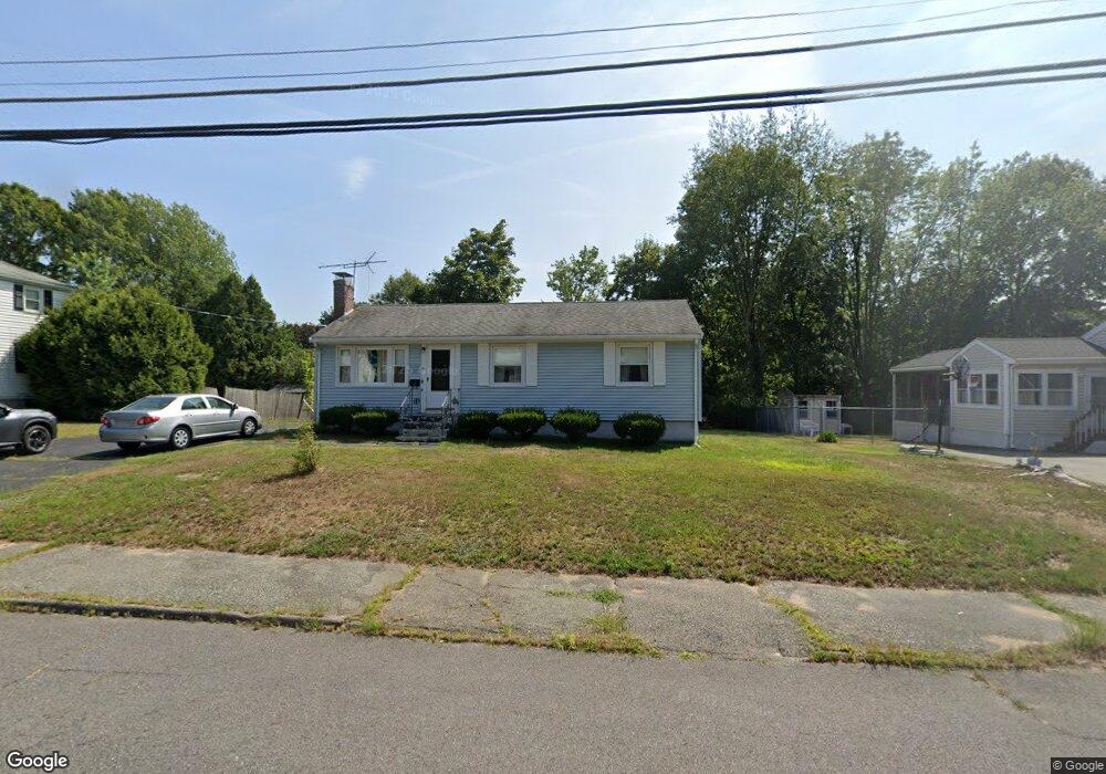
10 Thornton Rd Holbrook, MA 02343
Estimated Value: $487,000 - $524,000
3
Beds
1
Bath
880
Sq Ft
$570/Sq Ft
Est. Value
About This Home
This home is located at 10 Thornton Rd, Holbrook, MA 02343 and is currently estimated at $502,024, approximately $570 per square foot. 10 Thornton Rd is a home located in Norfolk County with nearby schools including John F. Kennedy Elementary School, Holbrook Middle High School, and Boston Higashi School.
Create a Home Valuation Report for This Property
The Home Valuation Report is an in-depth analysis detailing your home's value as well as a comparison with similar homes in the area
Home Values in the Area
Average Home Value in this Area
Tax History Compared to Growth
Tax History
| Year | Tax Paid | Tax Assessment Tax Assessment Total Assessment is a certain percentage of the fair market value that is determined by local assessors to be the total taxable value of land and additions on the property. | Land | Improvement |
|---|---|---|---|---|
| 2025 | $53 | $400,700 | $226,700 | $174,000 |
| 2024 | $4,996 | $371,700 | $206,000 | $165,700 |
| 2023 | $5,285 | $343,600 | $187,300 | $156,300 |
| 2022 | $4,883 | $296,100 | $162,900 | $133,200 |
| 2021 | $4,787 | $278,000 | $152,200 | $125,800 |
| 2020 | $4,991 | $271,700 | $152,200 | $119,500 |
| 2019 | $5,025 | $258,200 | $144,900 | $113,300 |
| 2018 | $5,031 | $243,400 | $134,200 | $109,200 |
| 2017 | $4,748 | $227,200 | $122,200 | $105,000 |
| 2016 | $4,283 | $218,100 | $115,200 | $102,900 |
| 2015 | $3,965 | $207,800 | $110,200 | $97,600 |
| 2014 | $3,803 | $202,600 | $110,200 | $92,400 |
Source: Public Records
Map
Nearby Homes
- 45 King Rd
- 14 Fern Rd
- 375 S Franklin St Unit 1
- 27 Ell Rd
- 35 Rindone St
- 40 Overlook Rd
- 13 Mayflower Rd
- 55 Border Rd
- 14 Dale Rd
- 181 S Franklin St Unit 102
- 181 S Franklin St Unit 207
- 19 Bradford St
- 75 Hilltop Rd
- 28 Border Rd
- 610 S Franklin St Unit D304
- 152 S Franklin St
- 28 Hilltop Rd
- 12 Hawthorne Rd
- 27 Arnold St
- 34 Reeds Ln