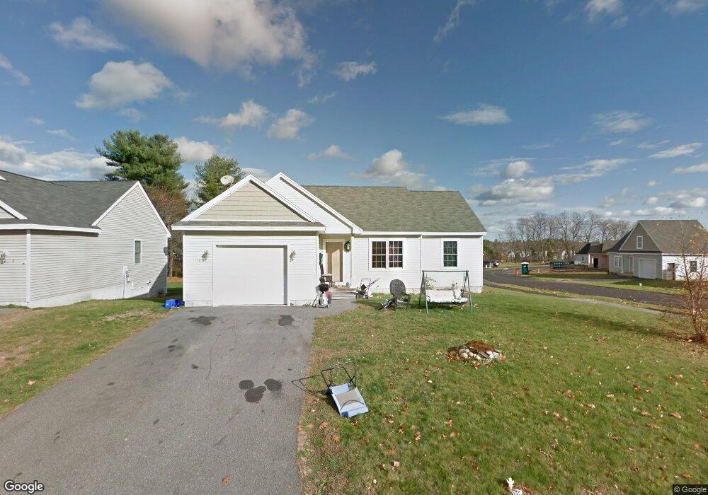
10 Tink Dr Unit 10 Gorham, ME 04038
Estimated Value: $438,000 - $458,000
3
Beds
2
Baths
1,176
Sq Ft
$377/Sq Ft
Est. Value
About This Home
This home is located at 10 Tink Dr Unit 10, Gorham, ME 04038 and is currently estimated at $443,264, approximately $376 per square foot. 10 Tink Dr Unit 10 is a home located in Cumberland County with nearby schools including Narragansett Elementary School, Gorham Middle School, and Gorham High School.
Ownership History
Date
Name
Owned For
Owner Type
Purchase Details
Closed on
Oct 21, 2021
Sold by
Gervais Homes Llc
Bought by
Doyle Erica S
Current Estimated Value
Home Financials for this Owner
Home Financials are based on the most recent Mortgage that was taken out on this home.
Original Mortgage
$300,000
Outstanding Balance
$271,186
Interest Rate
2.8%
Mortgage Type
FHA
Estimated Equity
$172,078
Purchase Details
Closed on
Jul 12, 2021
Sold by
Usa
Bought by
Gervais Hm Llc
Create a Home Valuation Report for This Property
The Home Valuation Report is an in-depth analysis detailing your home's value as well as a comparison with similar homes in the area
Home Values in the Area
Average Home Value in this Area
Purchase History
We collect this data history from publicly available records. To have your information removed, we recommend requesting removal directly through your county’s website.
| Date | Buyer | Sale Price | Title Company |
|---|---|---|---|
| Doyle Erica S | -- | None Available | |
| Gervais Hm Llc | -- | None Available |
Source: Public Records
Mortgage History
We collect this data history from publicly available records. To have your information removed, we recommend requesting removal directly through your county’s website.
| Date | Status | Borrower | Loan Amount |
|---|---|---|---|
| Open | Doyle Erica S | $300,000 |
Source: Public Records
Tax History
| Year | Tax Paid | Tax Assessment Tax Assessment Total Assessment is a certain percentage of the fair market value that is determined by local assessors to be the total taxable value of land and additions on the property. | Land | Improvement |
|---|---|---|---|---|
| 2025 | $4,856 | $328,100 | $32,700 | $295,400 |
| 2024 | $4,823 | $328,100 | $32,700 | $295,400 |
| 2023 | $4,511 | $328,100 | $32,700 | $295,400 |
| 2022 | $4,216 | $328,100 | $32,700 | $295,400 |
| 2021 | $3,678 | $189,600 | $113,600 | $76,000 |
| 2020 | $3,602 | $189,600 | $113,600 | $76,000 |
| 2019 | $3,593 | $189,600 | $113,600 | $76,000 |
| 2018 | $3,451 | $189,600 | $113,600 | $76,000 |
| 2017 | $3,242 | $189,600 | $113,600 | $76,000 |
| 2016 | $3,225 | $189,700 | $113,700 | $76,000 |
| 2015 | $3,092 | $189,700 | $113,700 | $76,000 |
| 2014 | $3,238 | $186,100 | $107,800 | $78,300 |
| 2013 | $3,220 | $186,100 | $107,800 | $78,300 |
Source: Public Records
Map
Nearby Homes
- 36 Meadowbrook Dr Unit 2
- 296 Main St
- 84 Johnson Rd
- 11 Carnation Dr
- 14 Hillview Rd
- 49 Lochwood Dr
- 45 Lochwood Dr
- 25 Lochwood Dr
- 21 Lochwood Dr
- 10 Elm St
- 41 Lochwood Dr
- 27 Town Common
- 32 Lawn Ave
- 12 Natalee Dr Unit 16
- 22 Woods Edge Dr Unit 14
- 91 South St
- 29 Baxter Ln Unit 8
- 20 Willowdale Dr
- 18 Wintergreen Dr
- 146 Falcon Crest Dr Unit 44
- 10 Tink Dr Unit 10
- 6 Stephanie Dr
- 6 Stephanie Dr Unit 3
- 8 Tink Dr Unit 8
- 8 Stephanie Dr Unit 4
- 8 Stephanie Dr
- 9 Tink Dr Unit 35
- 16 Tink Dr Unit 36
- 16 Tink Dr Unit 38
- 5 Stephanie Dr
- 5 Stephanie Dr Unit 44
- 241 Main St
- 237 Main St
- 15 Tink Dr
- 10 Stephanie Dr Unit 5
- 249 Main St
- 9 Stephanie Dr Unit 43
- 9 Stephanie Dr
- 17 Tink Dr Unit 32
- 17 Tink Dr
Your Personal Tour Guide
Ask me questions while you tour the home.