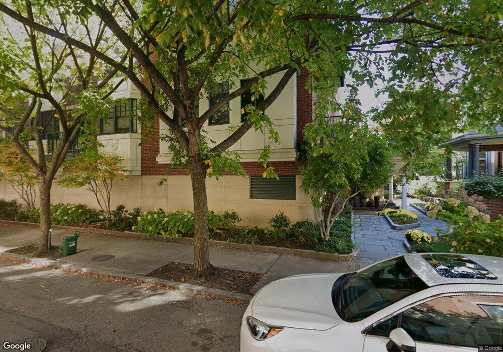
10 Vernon St Unit 12 Brookline, MA 02446
Coolidge Corner NeighborhoodEstimated Value: $1,343,000 - $1,885,000
2
Beds
2
Baths
1,406
Sq Ft
$1,148/Sq Ft
Est. Value
About This Home
This home is located at 10 Vernon St Unit 12, Brookline, MA 02446 and is currently estimated at $1,613,979, approximately $1,147 per square foot. 10 Vernon St Unit 12 is a home located in Norfolk County with nearby schools including Pierce School, Brookline High School, and St. Mary of the Assumption Elementary School.
Ownership History
Date
Name
Owned For
Owner Type
Purchase Details
Closed on
May 28, 2024
Sold by
Strauss Andrew F
Bought by
10 Vernon Street Rt and Odonoghue
Current Estimated Value
Purchase Details
Closed on
Feb 16, 2011
Sold by
Bowden Stephen and Bowden Kristin
Bought by
Strauss Andrew F
Create a Home Valuation Report for This Property
The Home Valuation Report is an in-depth analysis detailing your home's value as well as a comparison with similar homes in the area
Home Values in the Area
Average Home Value in this Area
Purchase History
| Date | Buyer | Sale Price | Title Company |
|---|---|---|---|
| 10 Vernon Street Rt | $1,725,000 | None Available | |
| Strauss Andrew F | $750,000 | -- | |
| Strauss Andrew F | $750,000 | -- |
Source: Public Records
Mortgage History
| Date | Status | Borrower | Loan Amount |
|---|---|---|---|
| Previous Owner | Strauss Andrew F | $575,368 |
Source: Public Records
Tax History Compared to Growth
Tax History
| Year | Tax Paid | Tax Assessment Tax Assessment Total Assessment is a certain percentage of the fair market value that is determined by local assessors to be the total taxable value of land and additions on the property. | Land | Improvement |
|---|---|---|---|---|
| 2025 | $11,853 | $1,200,900 | $0 | $1,200,900 |
| 2024 | $11,502 | $1,177,300 | $0 | $1,177,300 |
| 2023 | $11,270 | $1,130,400 | $0 | $1,130,400 |
| 2022 | $11,293 | $1,108,200 | $0 | $1,108,200 |
| 2021 | $10,754 | $1,097,300 | $0 | $1,097,300 |
| 2020 | $10,267 | $1,086,500 | $0 | $1,086,500 |
| 2019 | $9,696 | $1,034,800 | $0 | $1,034,800 |
| 2018 | $9,360 | $989,400 | $0 | $989,400 |
| 2017 | $9,051 | $916,100 | $0 | $916,100 |
| 2016 | $8,678 | $832,800 | $0 | $832,800 |
| 2015 | $8,086 | $757,100 | $0 | $757,100 |
| 2014 | $7,791 | $684,000 | $0 | $684,000 |
Source: Public Records
Map
Nearby Homes
- 19 Harris St Unit 2
- 181 Harvard St
- 24 Auburn St Unit 1
- 24 Auburn St Unit 3
- 24 Auburn St Unit 2
- 5 Auburn Ct Unit 1
- 80 Park St Unit 55
- 80 Park St Unit 23
- 64 Aspinwall Ave Unit 1
- 125 Park St Unit 6
- 80 Vernon St Unit 1-A
- 80 Vernon St Unit 2A
- 80 Vernon St Unit PHA
- 37 Saint Paul St Unit 3
- 17 Park Vale Unit 3
- 89 Marion St
- 57 Saint Paul St Unit 19
- 56-58 Perry St Unit 4
- 98 Saint Paul St Unit A1
- 45 Longwood Ave Unit 812
- 10 Vernon St Unit 303
- 10 Vernon St Unit 12
- 10 Vernon St Unit 12
- 10 Vernon St Unit 12
- 10 Vernon St Unit 12
- 10 Vernon St Unit 201
- 10 Vernon St Unit PH - 3
- 10 Vernon St Unit 301
- 10 Vernon St Unit 305
- 10 Vernon St Unit PH - 2
- 10 Vernon St Unit 205
- 10 Vernon St Unit 203
- 10 Vernon St Unit 304
- 10 Vernon St Unit 302
- 10 Vernon St Unit 206
- 10 Vernon St Unit PH1
- 10 Vernon St Unit 204
- 10-12 Vernon St Unit 205
- 10-12 Vernon St Unit 304
- 10-12 Vernon St Unit 203