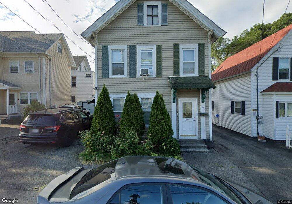
10 W Adams St Lowell, MA 01851
Highlands NeighborhoodEstimated Value: $498,000 - $558,000
4
Beds
2
Baths
2,060
Sq Ft
$258/Sq Ft
Est. Value
About This Home
This home is located at 10 W Adams St, Lowell, MA 01851 and is currently estimated at $530,743, approximately $257 per square foot. 10 W Adams St is a home located in Middlesex County with nearby schools including Charles W. Morey Elementary School, Abraham Lincoln Elementary School, and Joseph McAvinnue Elementary School.
Ownership History
Date
Name
Owned For
Owner Type
Purchase Details
Closed on
Aug 3, 1998
Sold by
Diamantopoulos Paul and Diamantopoulos Michael
Bought by
Senechiame Somnuk
Current Estimated Value
Purchase Details
Closed on
Aug 3, 1987
Sold by
Phi Gamma Psi Corp
Bought by
Diamantopoulos P
Create a Home Valuation Report for This Property
The Home Valuation Report is an in-depth analysis detailing your home's value as well as a comparison with similar homes in the area
Home Values in the Area
Average Home Value in this Area
Purchase History
| Date | Buyer | Sale Price | Title Company |
|---|---|---|---|
| Senechiame Somnuk | $76,000 | -- | |
| Senechiame Somnuk | $76,000 | -- | |
| Diamantopoulos P | $115,000 | -- |
Source: Public Records
Mortgage History
| Date | Status | Borrower | Loan Amount |
|---|---|---|---|
| Open | Diamantopoulos P | $30,000 | |
| Open | Diamantopoulos P | $118,000 | |
| Closed | Diamantopoulos P | $23,800 |
Source: Public Records
Tax History Compared to Growth
Tax History
| Year | Tax Paid | Tax Assessment Tax Assessment Total Assessment is a certain percentage of the fair market value that is determined by local assessors to be the total taxable value of land and additions on the property. | Land | Improvement |
|---|---|---|---|---|
| 2025 | $5,244 | $456,800 | $122,100 | $334,700 |
| 2024 | $5,067 | $425,400 | $109,900 | $315,500 |
| 2023 | $4,793 | $385,900 | $95,600 | $290,300 |
| 2022 | $4,554 | $358,900 | $86,900 | $272,000 |
| 2021 | $4,253 | $316,000 | $75,500 | $240,500 |
| 2020 | $3,936 | $294,600 | $66,000 | $228,600 |
| 2019 | $3,757 | $267,600 | $61,100 | $206,500 |
| 2018 | $3,636 | $252,700 | $55,600 | $197,100 |
| 2017 | $3,481 | $233,300 | $50,600 | $182,700 |
| 2016 | $3,241 | $213,800 | $48,100 | $165,700 |
| 2015 | $3,138 | $202,700 | $49,300 | $153,400 |
| 2013 | $2,880 | $191,900 | $58,900 | $133,000 |
Source: Public Records
Map
Nearby Homes
- 11 Columbus Ave
- 19 Lawton St
- 1149 Middlesex St
- 997 Middlesex St Unit 2
- 312 Wilder St
- 987 Middlesex St
- 41 Coral St
- 32 Sargent St
- 1280 Middlesex St
- 1311 Middlesex St
- 21 Kimball Ave
- 18 Edson St
- 42 Branch St
- 440 Pawtucket St
- 613 School St
- 173 Westford St
- 113 School St Unit 12
- 41 Butterfield St
- 15 Sayles St
- 390 Pawtucket St Unit 1
- 12 W Adams St
- 227 Walker St
- 207 Walker St
- 225 Walker St
- 16 W Adams St
- 20 W Adams St
- 233 Walker St
- 22 W Adams St
- 9 W Adams St Unit 1
- 9 W Adams St Unit 7
- 9 W Adams St Unit 2
- 9 W Adams St Unit 3
- 9 W Adams St Unit 2 & 3
- 9 W Adams St Unit 7&8
- 9 W Adams St
- 26 W Adams St
- 15 Columbus Ave
- 15 Columbus Ave Unit 15
- 19 Columbus Ave
- 23 Columbus Ave