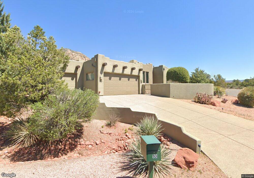
10 W Gunsmoke Rd Sedona, AZ 86336
Estimated Value: $1,343,089 - $1,636,000
3
Beds
--
Bath
2,894
Sq Ft
$523/Sq Ft
Est. Value
About This Home
This home is located at 10 W Gunsmoke Rd, Sedona, AZ 86336 and is currently estimated at $1,513,772, approximately $523 per square foot. 10 W Gunsmoke Rd is a home located in Yavapai County with nearby schools including West Sedona Elementary School, Sedona Red Rock Junior/Senior High School, and Sedona Charter School.
Ownership History
Date
Name
Owned For
Owner Type
Purchase Details
Closed on
May 30, 2017
Sold by
Lynn I and Terry Maudelle L
Bought by
Terry Lynn I and Living Maudelle L Terry
Current Estimated Value
Purchase Details
Closed on
May 2, 2005
Sold by
Soderberg Joseph L and Soderberg Eleanor L
Bought by
Terry Lynn I and Terry Maudelle L
Purchase Details
Closed on
Jan 4, 1999
Sold by
Thunder Mountain Ranch Ltd Liability Co
Bought by
Soderberg Joseph L and Soderberg Eleanor L
Home Financials for this Owner
Home Financials are based on the most recent Mortgage that was taken out on this home.
Original Mortgage
$100,000
Interest Rate
6.73%
Mortgage Type
Purchase Money Mortgage
Create a Home Valuation Report for This Property
The Home Valuation Report is an in-depth analysis detailing your home's value as well as a comparison with similar homes in the area
Home Values in the Area
Average Home Value in this Area
Purchase History
| Date | Buyer | Sale Price | Title Company |
|---|---|---|---|
| Terry Lynn I | -- | None Available | |
| Terry Lynn I | $760,000 | Arizona Title Agency Inc | |
| Soderberg Joseph L | $144,000 | Transnation Title Ins Co |
Source: Public Records
Mortgage History
| Date | Status | Borrower | Loan Amount |
|---|---|---|---|
| Previous Owner | Soderberg Joseph L | $100,000 |
Source: Public Records
Tax History Compared to Growth
Tax History
| Year | Tax Paid | Tax Assessment Tax Assessment Total Assessment is a certain percentage of the fair market value that is determined by local assessors to be the total taxable value of land and additions on the property. | Land | Improvement |
|---|---|---|---|---|
| 2026 | $5,118 | $113,880 | -- | -- |
| 2024 | $5,101 | $121,798 | -- | -- |
| 2023 | $5,101 | $88,368 | $12,772 | $75,596 |
| 2022 | $4,878 | $71,320 | $11,730 | $59,590 |
| 2021 | $5,007 | $69,727 | $11,081 | $58,646 |
| 2020 | $5,004 | $0 | $0 | $0 |
| 2019 | $4,966 | $0 | $0 | $0 |
| 2018 | $4,723 | $0 | $0 | $0 |
| 2017 | $4,616 | $0 | $0 | $0 |
| 2016 | $4,526 | $0 | $0 | $0 |
| 2015 | $4,328 | $0 | $0 | $0 |
| 2014 | $4,073 | $0 | $0 | $0 |
Source: Public Records
Map
Nearby Homes
- 50 Bronco Dr Unit 51
- 20 Bronco Dr
- 25 Spring House Dr Unit 71
- 3160 Thunder Mountain Rd Unit 119
- 20 N Roan Ct Unit 121
- 170 Stardust Ln
- 240 Stardust Ln
- 15 N Roan Ct
- 2820 Raven Rd
- 35 S Roan Ct
- 455 Rhapsody Rd
- 650 Rhapsody Rd Unit 20
- 640 Rhapsody Rd Unit 21
- 420 Windsong Dr
- 590 Rhapsody Rd
- 395 Dry Creek Rd
- 10 Stetson Ct
- 750 Dry Creek Rd
- 750 Rhapsody Rd
- 730 & 750 Rhapsody Rd