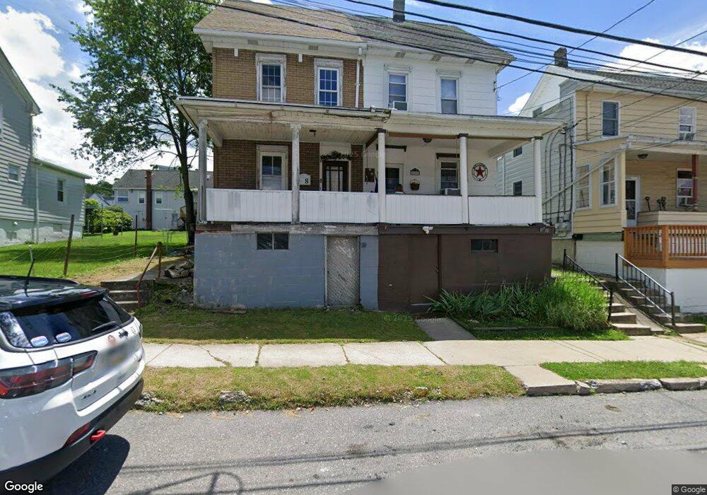
10 W High St Coaldale, PA 18218
Estimated Value: $81,000 - $120,000
3
Beds
2
Baths
1,272
Sq Ft
$79/Sq Ft
Est. Value
About This Home
This home is located at 10 W High St, Coaldale, PA 18218 and is currently estimated at $100,566, approximately $79 per square foot. 10 W High St is a home located in Schuylkill County with nearby schools including Panther Valley Intermediate School, Panther Valley Elementary School, and Panther Valley Junior/Senior High School.
Ownership History
Date
Name
Owned For
Owner Type
Purchase Details
Closed on
Nov 29, 2021
Sold by
Sabol Karen M and Obrien Sean K
Bought by
Souders Mathew S and Souders Kelly J
Current Estimated Value
Home Financials for this Owner
Home Financials are based on the most recent Mortgage that was taken out on this home.
Original Mortgage
$60,462
Outstanding Balance
$55,564
Interest Rate
3.05%
Mortgage Type
FHA
Estimated Equity
$45,002
Purchase Details
Closed on
Nov 23, 2021
Sold by
Sabol Karen M and Obrien Sean K
Bought by
Souders Mathew S and Souders Kelly J
Home Financials for this Owner
Home Financials are based on the most recent Mortgage that was taken out on this home.
Original Mortgage
$60,462
Outstanding Balance
$55,564
Interest Rate
3.05%
Mortgage Type
FHA
Estimated Equity
$45,002
Create a Home Valuation Report for This Property
The Home Valuation Report is an in-depth analysis detailing your home's value as well as a comparison with similar homes in the area
Home Values in the Area
Average Home Value in this Area
Purchase History
| Date | Buyer | Sale Price | Title Company |
|---|---|---|---|
| Souders Mathew S | $65,649 | None Listed On Document | |
| Souders Mathew S | -- | None Available |
Source: Public Records
Mortgage History
| Date | Status | Borrower | Loan Amount |
|---|---|---|---|
| Open | Souders Mathew S | $60,462 | |
| Closed | Souders Mathew S | $60,462 |
Source: Public Records
Tax History Compared to Growth
Tax History
| Year | Tax Paid | Tax Assessment Tax Assessment Total Assessment is a certain percentage of the fair market value that is determined by local assessors to be the total taxable value of land and additions on the property. | Land | Improvement |
|---|---|---|---|---|
| 2025 | $1,449 | $12,725 | $3,250 | $9,475 |
| 2024 | $1,379 | $12,725 | $3,250 | $9,475 |
| 2023 | $1,373 | $12,725 | $3,250 | $9,475 |
| 2022 | $1,357 | $12,725 | $3,250 | $9,475 |
| 2021 | $1,358 | $12,725 | $3,250 | $9,475 |
| 2020 | $1,302 | $12,725 | $3,250 | $9,475 |
| 2018 | $1,217 | $12,725 | $3,250 | $9,475 |
| 2017 | $1,190 | $12,725 | $3,250 | $9,475 |
| 2015 | -- | $12,725 | $3,250 | $9,475 |
| 2011 | -- | $12,725 | $0 | $0 |
Source: Public Records
Map
Nearby Homes
- 26 E High St
- 8 W High St
- 12 W High St
- 2 W High St
- 14 E High St
- 28 E High St
- 0 E High St Unit 1001241901
- 0 E High St
- 0 E High St Unit 23-851
- 0 E High St Unit PM-104323
- 0 E High St Unit 711853
- 0 E High St Unit PASK2009526
- 0 E High St Unit 1009991096
- 0 E High St Unit 594137
- 0 E High St Unit 544328
- 0 E High St Unit 1009834768
- 16 W High St
- 18 W High St
- 13 E High St
- 34 E High St