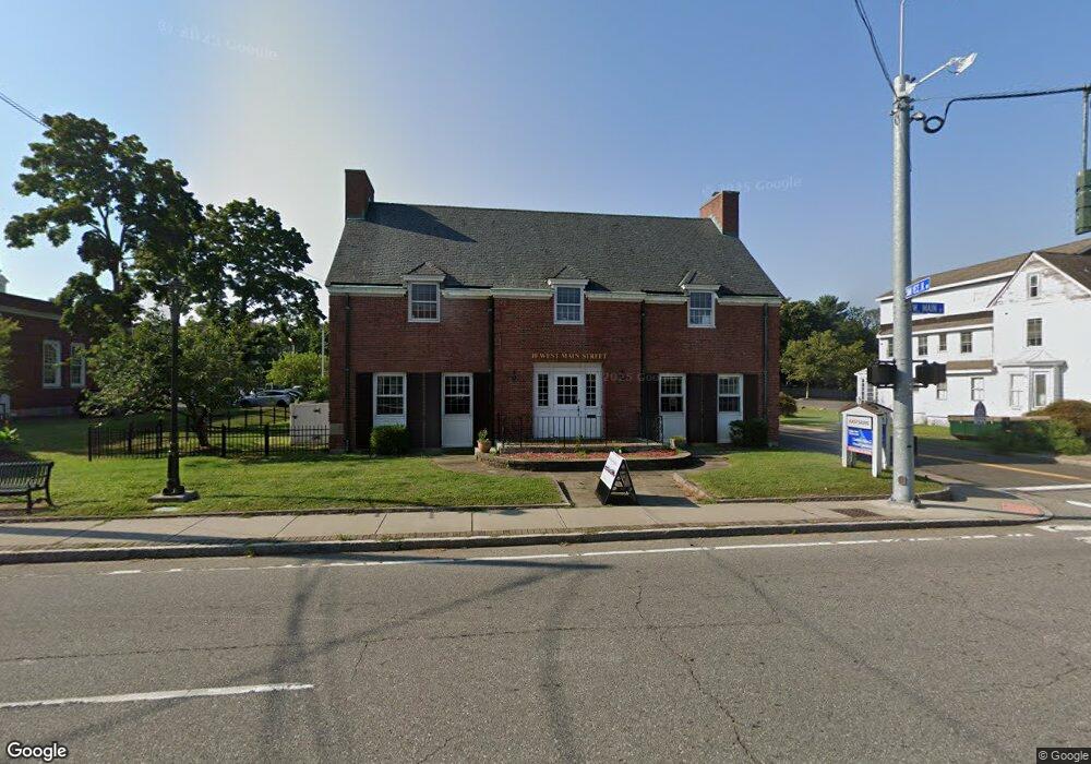
10 W Main St Clinton, CT 06413
Estimated Value: $632,015
Studio
--
Bath
5,244
Sq Ft
$121/Sq Ft
Est. Value
About This Home
This home is located at 10 W Main St, Clinton, CT 06413 and is currently estimated at $632,015, approximately $120 per square foot. 10 W Main St is a home located in Middlesex County with nearby schools including Lewin G. Joel Jr. School and The Morgan School.
Ownership History
Date
Name
Owned For
Owner Type
Purchase Details
Closed on
Apr 1, 2021
Sold by
Learning Courtyard Llc
Bought by
10 West Main Llc
Current Estimated Value
Home Financials for this Owner
Home Financials are based on the most recent Mortgage that was taken out on this home.
Original Mortgage
$418,500
Outstanding Balance
$377,245
Interest Rate
2.9%
Mortgage Type
Purchase Money Mortgage
Estimated Equity
$250,953
Purchase Details
Closed on
Apr 6, 2016
Sold by
Cornerstone Const Svcs
Bought by
Smith Thomas F
Create a Home Valuation Report for This Property
The Home Valuation Report is an in-depth analysis detailing your home's value as well as a comparison with similar homes in the area
Home Values in the Area
Average Home Value in this Area
Purchase History
| Date | Buyer | Sale Price | Title Company |
|---|---|---|---|
| 10 West Main Llc | $465,000 | None Available | |
| 10 West Main Llc | $465,000 | None Available | |
| Smith Thomas F | -- | -- | |
| Smith Renee C | -- | -- | |
| Smith Renee C | -- | -- |
Source: Public Records
Mortgage History
| Date | Status | Borrower | Loan Amount |
|---|---|---|---|
| Open | 10 West Main Llc | $418,500 | |
| Closed | 10 West Main Llc | $418,500 |
Source: Public Records
Tax History
| Year | Tax Paid | Tax Assessment Tax Assessment Total Assessment is a certain percentage of the fair market value that is determined by local assessors to be the total taxable value of land and additions on the property. | Land | Improvement |
|---|---|---|---|---|
| 2025 | $11,251 | $361,300 | $130,500 | $230,800 |
| 2024 | $10,933 | $361,300 | $130,500 | $230,800 |
| 2023 | $10,778 | $361,300 | $130,500 | $230,800 |
| 2022 | $10,778 | $361,300 | $130,500 | $230,800 |
| 2021 | $9,865 | $330,700 | $130,800 | $199,900 |
| 2020 | $10,334 | $330,700 | $130,800 | $199,900 |
| 2019 | $10,334 | $330,700 | $130,800 | $199,900 |
| 2018 | $10,100 | $330,700 | $130,800 | $199,900 |
| 2017 | $9,891 | $330,700 | $130,800 | $199,900 |
| 2016 | $8,975 | $330,700 | $130,800 | $199,900 |
| 2015 | $7,450 | $278,300 | $94,500 | $183,800 |
| 2014 | $7,311 | $278,300 | $94,500 | $183,800 |
Source: Public Records
Map
Nearby Homes
- 0 Cow Hill Rd
- 64 W Main St
- 16 Silverbrook Ln
- 13 Waterside Ln
- 116 Commerce St Unit F-9
- 110 E Main St
- 133 W Main St Unit MV1
- 133 W Main St Unit TRLR A9
- 144 E Main St Unit 5
- 151 E Main St Unit 12
- 153 E Main St Unit 10
- 153 E Main St Unit 13
- 153 E Main St Unit 31
- 153 E Main St Unit 8
- 153 E Main St Unit 9
- 153 E Main St Unit 6
- 153 E Main St Unit 7
- 153 E Main St Unit 11
- 153 E Main St Unit 32
- 153 E Main St Unit 5
- 10 W Main St
- 13 W Main St Unit 1
- 13 W Main St
- 7 W Main St Unit 13
- 14 W Main St
- 5 W Main St
- 1 W Main St
- 10 Post Office Square
- 12 Post Office Square
- 16 W Main St
- 11 Commerce St
- 11 -17 Commerce St
- 23 W Main St
- 6 John Street Extension
- 9 Post Office Square Unit 2
- 26 W Main St
- 1 E Main St
- 5 E Main St
- 5 E Main St
- 5 E Main St
Your Personal Tour Guide
Ask me questions while you tour the home.