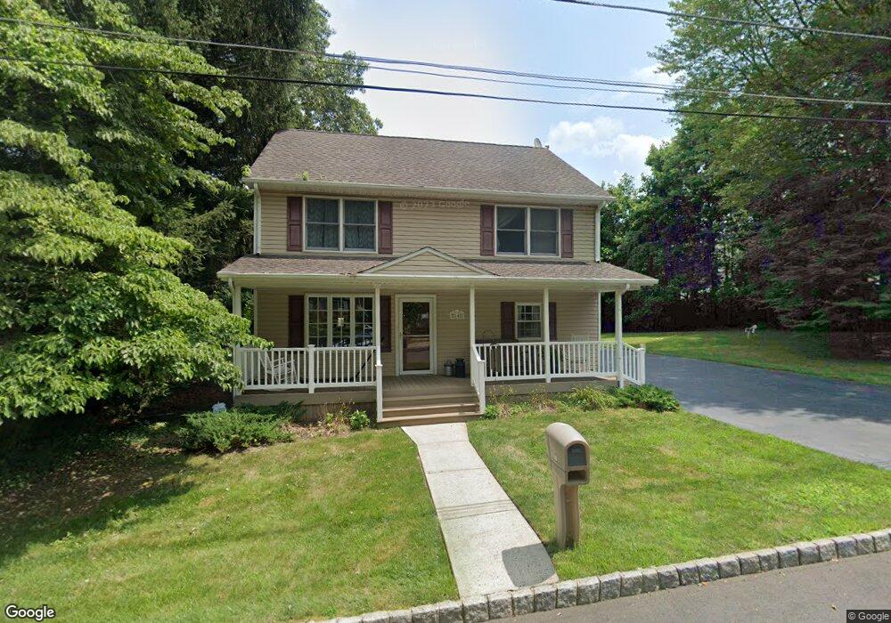
10 Walnut St Monroe Township, NJ 08831
Estimated Value: $496,000 - $600,000
--
Bed
--
Bath
1,728
Sq Ft
$320/Sq Ft
Est. Value
About This Home
This home is located at 10 Walnut St, Monroe Township, NJ 08831 and is currently estimated at $553,594, approximately $320 per square foot. 10 Walnut St is a home located in Middlesex County with nearby schools including Barclay Brook Elementary School, Brookside Elementary School, and Monroe Township Middle School.
Ownership History
Date
Name
Owned For
Owner Type
Purchase Details
Closed on
Nov 17, 1997
Sold by
Bason Raymond
Bought by
Pede Michael and Yourstone Alaina
Current Estimated Value
Home Financials for this Owner
Home Financials are based on the most recent Mortgage that was taken out on this home.
Original Mortgage
$139,000
Interest Rate
7.28%
Mortgage Type
FHA
Purchase Details
Closed on
Sep 19, 1997
Sold by
Buchan William
Bought by
Bason Raymond and Bason Karen
Home Financials for this Owner
Home Financials are based on the most recent Mortgage that was taken out on this home.
Original Mortgage
$139,000
Interest Rate
7.28%
Mortgage Type
FHA
Purchase Details
Closed on
Feb 23, 1994
Sold by
Dematteo Samuel
Bought by
Bason Raymond and Bason Karen
Home Financials for this Owner
Home Financials are based on the most recent Mortgage that was taken out on this home.
Original Mortgage
$88,000
Interest Rate
8.61%
Create a Home Valuation Report for This Property
The Home Valuation Report is an in-depth analysis detailing your home's value as well as a comparison with similar homes in the area
Home Values in the Area
Average Home Value in this Area
Purchase History
| Date | Buyer | Sale Price | Title Company |
|---|---|---|---|
| Pede Michael | $140,000 | -- | |
| Bason Raymond | $50,000 | -- | |
| Bason Raymond | $110,000 | -- |
Source: Public Records
Mortgage History
| Date | Status | Borrower | Loan Amount |
|---|---|---|---|
| Previous Owner | Pede Michael | $139,000 | |
| Previous Owner | Bason Raymond | $88,000 |
Source: Public Records
Tax History Compared to Growth
Tax History
| Year | Tax Paid | Tax Assessment Tax Assessment Total Assessment is a certain percentage of the fair market value that is determined by local assessors to be the total taxable value of land and additions on the property. | Land | Improvement |
|---|---|---|---|---|
| 2025 | $8,725 | $312,600 | $152,000 | $160,600 |
| 2024 | $8,421 | $312,600 | $152,000 | $160,600 |
| 2023 | $8,421 | $312,600 | $152,000 | $160,600 |
| 2022 | $8,290 | $312,600 | $152,000 | $160,600 |
| 2021 | $6,180 | $312,600 | $152,000 | $160,600 |
| 2020 | $8,246 | $312,600 | $152,000 | $160,600 |
| 2019 | $8,068 | $312,600 | $152,000 | $160,600 |
| 2018 | $8,006 | $312,600 | $152,000 | $160,600 |
| 2017 | $7,849 | $312,600 | $152,000 | $160,600 |
| 2016 | $7,734 | $312,600 | $152,000 | $160,600 |
| 2015 | $7,515 | $312,600 | $152,000 | $160,600 |
| 2014 | $7,209 | $312,600 | $152,000 | $160,600 |
Source: Public Records
Map
Nearby Homes
- 8 Walnut St
- 101 Pergola Ave
- 6 Diana Ln
- 38 New St
- 34 Spruce Meadows Dr
- 27 Marryott St
- 3 Worth St
- 112 Mendoker Dr
- 302 Buckelew Ave
- 14 W Dante Rd
- 135 Pergola Ave
- 323 Buckelew Ave
- 12000-600000 Rues Ln
- 11 Hampton Rd
- 3 Arlene Dr
- 28 Mitchell Dr
- 10 Villa Farms Cir
- 164 Old Forge Rd
- 10 Dante Rd
- 475 Grace Hill Rd
- 62 Spruce Meadows Dr
- 60 Spruce Meadows Dr
- 9 Walnut St
- 6 Walnut St
- 7 Walnut St
- 58 Spruce Meadows Dr
- 64 Spruce Meadows Dr
- 4 Walnut St
- 5 Walnut St
- 56 Spruce Meadows Dr
- 66 Spruce Meadows Dr
- 54 Spruce Meadows Dr
- 3 Walnut St
- 95 Pergola Ave
- 49 Spruce Meadows Dr
- 51 Spruce Meadows Dr
- 47 Spruce Meadows Dr
- 53 Spruce Meadows Dr
- 45 Spruce Meadows Dr
- 91 Pergola Ave