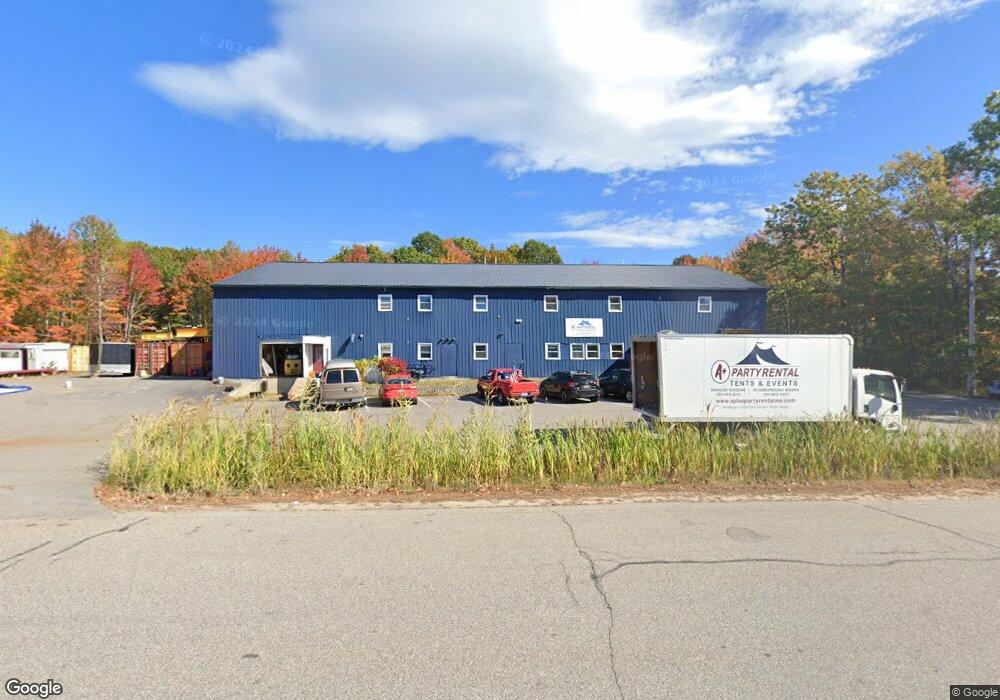
10 Washington Ave Scarborough, ME 04074
Estimated Value: $796,236
--
Bed
--
Bath
7,296
Sq Ft
$109/Sq Ft
Est. Value
About This Home
This home is located at 10 Washington Ave, Scarborough, ME 04074 and is currently estimated at $796,236, approximately $109 per square foot. 10 Washington Ave is a home located in Cumberland County with nearby schools including Scarborough High School and Cornerstone Baptist Academy.
Ownership History
Date
Name
Owned For
Owner Type
Purchase Details
Closed on
Jun 12, 2025
Sold by
Marks Factory Llc and Pams Factory Llc
Bought by
Jnl Holdings Llc
Current Estimated Value
Purchase Details
Closed on
Dec 28, 2016
Sold by
Philip E E and Philip F M
Bought by
Marks Factory Llc
Home Financials for this Owner
Home Financials are based on the most recent Mortgage that was taken out on this home.
Original Mortgage
$209,932
Interest Rate
3.94%
Mortgage Type
Commercial
Create a Home Valuation Report for This Property
The Home Valuation Report is an in-depth analysis detailing your home's value as well as a comparison with similar homes in the area
Home Values in the Area
Average Home Value in this Area
Purchase History
| Date | Buyer | Sale Price | Title Company |
|---|---|---|---|
| Jnl Holdings Llc | $800,000 | None Available | |
| Jnl Holdings Llc | $800,000 | None Available | |
| Marks Factory Llc | -- | -- | |
| Marks Factory Llc | -- | -- |
Source: Public Records
Mortgage History
| Date | Status | Borrower | Loan Amount |
|---|---|---|---|
| Previous Owner | Marks Factory Llc | $209,932 |
Source: Public Records
Tax History Compared to Growth
Tax History
| Year | Tax Paid | Tax Assessment Tax Assessment Total Assessment is a certain percentage of the fair market value that is determined by local assessors to be the total taxable value of land and additions on the property. | Land | Improvement |
|---|---|---|---|---|
| 2025 | $9,185 | $810,700 | $338,000 | $472,700 |
| 2024 | $8,861 | $810,700 | $338,000 | $472,700 |
| 2023 | $8,549 | $535,300 | $311,500 | $223,800 |
| 2022 | $8,238 | $535,300 | $311,500 | $223,800 |
| 2021 | $8,040 | $535,300 | $311,500 | $223,800 |
| 2020 | $7,955 | $535,300 | $311,500 | $223,800 |
| 2019 | $7,869 | $535,300 | $311,500 | $223,800 |
| 2017 | $5,867 | $355,800 | $117,300 | $238,500 |
| 2016 | $4,846 | $304,400 | $117,300 | $187,100 |
| 2015 | $4,715 | $304,400 | $117,300 | $187,100 |
| 2014 | $4,596 | $304,400 | $117,300 | $187,100 |
| 2013 | -- | $304,400 | $117,300 | $187,100 |
Source: Public Records
Map
Nearby Homes
- 9 Evergreen Farms Rd
- 24 Bayberry Ln
- 12 Inspiration Dr
- 26 Inspiration Dr
- 18 Millbrook Rd
- 5 Traditional St
- 19 Millbrook Rd
- 4 High Point Rd
- 29-31 Haigis Pkwy
- 6 Rose Hill Way
- Lot 5 Jean's Way
- 156 Scarborough Downs Rd Unit 330
- 46 Two Rod Rd
- 11 Phillip St
- 166 Pine Point Rd
- 4 Sylvan Rd
- 11 Hillside Ave
- 49 Seavey Landing Rd
- 1 Teal Point Dr Unit 1
- 1 Stratton Rd Unit 1
- 2 Washington Ave
- 29 Washington Ave
- 21 Washington Ave
- 2 Lincoln Ave Unit 12
- 2 Lincoln Ave Unit 11
- 2 Lincoln Ave Unit 10
- 2 Lincoln Ave Unit 9
- 2 Lincoln Ave Unit 8
- 2 Lincoln Ave Unit 7
- 2 Lincoln Ave Unit 6
- 2 Lincoln Ave Unit 5
- 2 Lincoln Ave Unit 4
- 2 Lincoln Ave Unit 3
- 2 Lincoln Ave
- 2 Lincoln Ave Unit 1
- 74 Manson Libby Rd
- 7 Lincoln Ave
- 65 Willowdale Rd
- 69 Willowdale Rd
- 39 Willowdale Rd