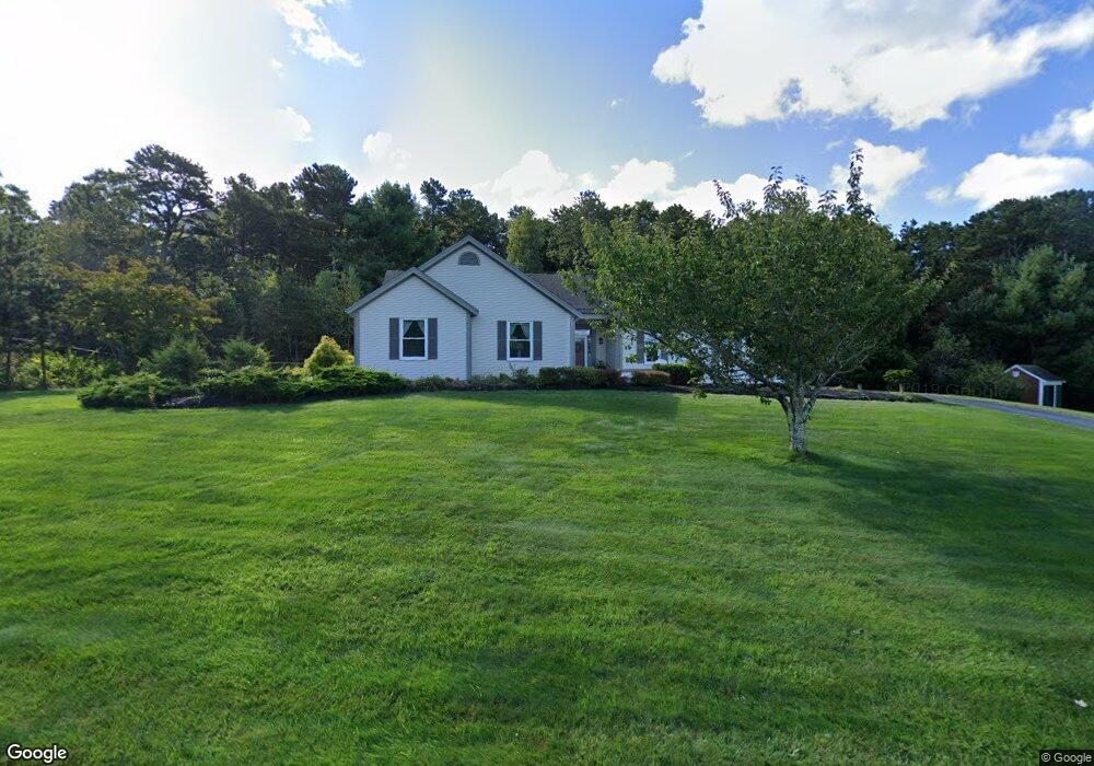
10 Weather Deck Rd Bourne, MA 02532
Estimated Value: $703,000 - $813,000
3
Beds
2
Baths
1,700
Sq Ft
$431/Sq Ft
Est. Value
About This Home
This home is located at 10 Weather Deck Rd, Bourne, MA 02532 and is currently estimated at $733,108, approximately $431 per square foot. 10 Weather Deck Rd is a home located in Barnstable County with nearby schools including Bourne High School, St Margaret Regional School, and Bridgeview Montessori School.
Ownership History
Date
Name
Owned For
Owner Type
Purchase Details
Closed on
Jun 25, 2020
Sold by
Baroncelli Albert J and Baroncelli Elizabeth J
Bought by
Lavallee Robert J and Lavallee Cheryl
Current Estimated Value
Home Financials for this Owner
Home Financials are based on the most recent Mortgage that was taken out on this home.
Original Mortgage
$374,900
Outstanding Balance
$331,585
Interest Rate
3.2%
Mortgage Type
New Conventional
Estimated Equity
$401,523
Purchase Details
Closed on
Nov 13, 2008
Sold by
Slowik Cynthia A
Bought by
Baroncelli Albert J and Baroncelli Elizabeth J
Purchase Details
Closed on
Mar 4, 2005
Sold by
Green Pamela A
Bought by
Slowik Cynthia A
Purchase Details
Closed on
Dec 11, 1996
Sold by
Port Of Call Rt and Sundman
Bought by
Green Pamela A
Home Financials for this Owner
Home Financials are based on the most recent Mortgage that was taken out on this home.
Original Mortgage
$125,000
Interest Rate
7.75%
Mortgage Type
Purchase Money Mortgage
Create a Home Valuation Report for This Property
The Home Valuation Report is an in-depth analysis detailing your home's value as well as a comparison with similar homes in the area
Purchase History
| Date | Buyer | Sale Price | Title Company |
|---|---|---|---|
| Lavallee Robert J | $484,900 | None Available | |
| Baroncelli Albert J | $315,000 | -- | |
| Baroncelli Albert J | $315,000 | -- | |
| Slowik Cynthia A | $430,000 | -- | |
| Slowik Cynthia A | $430,000 | -- | |
| Green Pamela A | $50,000 | -- | |
| Green Pamela A | $50,000 | -- | |
| Green Pamela A | $50,000 | -- |
Source: Public Records
Mortgage History
| Date | Status | Borrower | Loan Amount |
|---|---|---|---|
| Open | Lavallee Robert J | $374,900 | |
| Previous Owner | Green Pamela A | $125,000 |
Source: Public Records
Tax History
| Year | Tax Paid | Tax Assessment Tax Assessment Total Assessment is a certain percentage of the fair market value that is determined by local assessors to be the total taxable value of land and additions on the property. | Land | Improvement |
|---|---|---|---|---|
| 2025 | $5,145 | $658,800 | $204,600 | $454,200 |
| 2024 | $4,782 | $596,300 | $194,800 | $401,500 |
| 2023 | $4,858 | $551,400 | $191,600 | $359,800 |
| 2022 | $4,465 | $442,500 | $169,500 | $273,000 |
| 2021 | $4,375 | $406,200 | $154,300 | $251,900 |
| 2020 | $4,119 | $383,500 | $152,800 | $230,700 |
| 2019 | $3,923 | $373,300 | $152,800 | $220,500 |
| 2018 | $3,642 | $345,500 | $145,600 | $199,900 |
| 2017 | $3,520 | $341,700 | $137,000 | $204,700 |
| 2016 | $3,420 | $336,600 | $137,000 | $199,600 |
| 2015 | $3,245 | $322,200 | $122,600 | $199,600 |
Source: Public Records
Map
Nearby Homes
- 16 Weather Deck Rd
- 29 Weather Deck Rd
- 24 Ships View Terrace
- 3 Honora Ln Unit 3
- 6 Honora Ln
- 60 Sandwich Rd
- 38 Old Bridge Rd
- 44 Cotuit Rd
- 405 Village Dr Unit 405
- 58 Maple St
- 4 Hollyhock Knoll Ct Unit 4
- 4 Hollyhock Knoll Ct Unit 4
- 5 Zoli Ln
- 2 Applewood Ct
- 6 Wall St
- 46 Holt Rd Unit A
- 46 Holt Rd Unit B
- 46 Holt Rd
- 13 Laurel Hill Ct
- 12 Turnberry Rd Unit 12
- 10 Weather Deck Dr
- 10 Weather Deck Dr
- 8 Weather Deck Rd
- 8 Weather Deck Dr
- 8 Weather Deck Dr
- 16 Weather Deck Dr
- 16 Weather Deck Dr
- 4 Foretop Rd
- 9 Weather Deck Rd
- 9 Weather Deck Dr
- 6 Weather Deck Dr
- 6 Weather Deck Rd
- 4 Foretop Rd
- 18 Weather Deck Dr
- 7 Mainstay Ln
- 18 Weather Deck Dr
- 7 Mainstay Ln
- 8 Foretop Rd
- 15 Weather Deck Rd
- 8 Foretop Rd
Your Personal Tour Guide
Ask me questions while you tour the home.