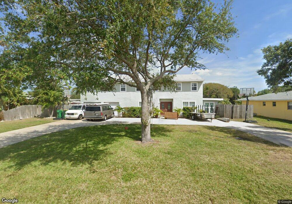
10 West Point Dr Cocoa Beach, FL 32931
Estimated Value: $1,200,934 - $1,642,000
5
Beds
4
Baths
3,070
Sq Ft
$457/Sq Ft
Est. Value
About This Home
This home is located at 10 West Point Dr, Cocoa Beach, FL 32931 and is currently estimated at $1,402,484, approximately $456 per square foot. 10 West Point Dr is a home located in Brevard County with nearby schools including Theodore Roosevelt Elementary School, Cocoa Beach Junior/Senior High School, and Cocoa Beach Christian School.
Ownership History
Date
Name
Owned For
Owner Type
Purchase Details
Closed on
Aug 5, 2013
Sold by
Walsh Sarah E
Bought by
Gash Jason D and Gash Sarah C
Current Estimated Value
Home Financials for this Owner
Home Financials are based on the most recent Mortgage that was taken out on this home.
Original Mortgage
$392,000
Outstanding Balance
$291,981
Interest Rate
4.43%
Estimated Equity
$1,110,503
Purchase Details
Closed on
Jun 16, 2000
Sold by
Walsh James P and Walsh Sarah E
Bought by
Walsh Sarah E
Create a Home Valuation Report for This Property
The Home Valuation Report is an in-depth analysis detailing your home's value as well as a comparison with similar homes in the area
Home Values in the Area
Average Home Value in this Area
Purchase History
| Date | Buyer | Sale Price | Title Company |
|---|---|---|---|
| Gash Jason D | $490,000 | Countywide Title & Escrow Co | |
| Walsh Sarah E | -- | -- | |
| Walsh Sarah E | -- | -- |
Source: Public Records
Mortgage History
| Date | Status | Borrower | Loan Amount |
|---|---|---|---|
| Open | Gash Jason D | $392,000 |
Source: Public Records
Tax History Compared to Growth
Tax History
| Year | Tax Paid | Tax Assessment Tax Assessment Total Assessment is a certain percentage of the fair market value that is determined by local assessors to be the total taxable value of land and additions on the property. | Land | Improvement |
|---|---|---|---|---|
| 2025 | $5,514 | $455,970 | -- | -- |
| 2024 | $5,454 | $443,120 | -- | -- |
| 2023 | $5,454 | $430,220 | $0 | $0 |
| 2022 | $5,087 | $417,690 | $0 | $0 |
| 2021 | $5,254 | $405,530 | $0 | $0 |
| 2020 | $5,194 | $399,940 | $0 | $0 |
| 2019 | $5,160 | $390,950 | $0 | $0 |
| 2018 | $5,194 | $383,670 | $0 | $0 |
| 2017 | $5,279 | $375,780 | $0 | $0 |
| 2016 | $5,401 | $368,060 | $230,000 | $138,060 |
| 2015 | $5,587 | $365,510 | $200,000 | $165,510 |
| 2014 | $5,638 | $362,610 | $200,000 | $162,610 |
Source: Public Records
Map
Nearby Homes
- 1790 Bayshore Dr
- 1441 Bayshore Dr
- 1529 Bayshore Dr
- 30 Indian Village Trail
- 2050 S Atlantic Ave
- 1630 S Atlantic Ave
- 1525 S Atlantic Ave Unit 401
- 1527 S Atlantic Ave Unit 201
- 1563 S Atlantic Ave Unit 13
- 1277 S Orlando Ave Unit 4B
- 1700 S Atlantic Ave Unit 104
- 1305 S Atlantic Ave Unit 350
- 1305 S Atlantic Ave Unit 450
- 1251 S Atlantic Ave Unit 403
- 2001 Julep Dr Unit 206- 3rd Floor
- 1181 S Atlantic Ave
- 2021 S Orlando Ave
- 2022 Julep Dr Unit 304
- 1155 S Atlantic Ave Unit 203
- 1145 S Atlantic Ave Unit B
- 9 W Point Dr
- 11 West Point Dr
- 9 West Point Dr
- 11 W Point Dr
- 8 W Point Dr
- 12 West Point Dr
- 8 West Point Dr
- 12 W Point Dr
- 25 W Point Dr
- 25 West Point Dr
- 26 West Point Dr
- 1754 Bayshore Dr
- 24 West Point Dr
- 27 West Point Dr
- 7 W Point Dr
- 13 West Point Dr
- 1746 Bayshore Dr
- 7 West Point Dr
- 13 W Point Dr
- 28 West Point Dr