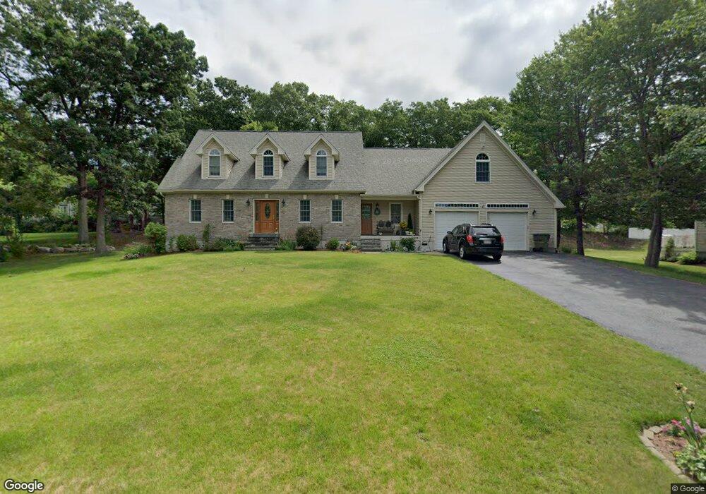
10 Westview Ave Millbury, MA 01527
Estimated Value: $626,000 - $754,405
3
Beds
4
Baths
2,440
Sq Ft
$294/Sq Ft
Est. Value
About This Home
This home is located at 10 Westview Ave, Millbury, MA 01527 and is currently estimated at $717,351, approximately $293 per square foot. 10 Westview Ave is a home located in Worcester County with nearby schools including Elmwood Street Elementary School, Raymond E. Shaw Elementary School, and Millbury Junior/Senior High School.
Ownership History
Date
Name
Owned For
Owner Type
Purchase Details
Closed on
Oct 29, 2008
Sold by
Boire Darlene and Bean Eric J
Bought by
Boire Darlene
Current Estimated Value
Home Financials for this Owner
Home Financials are based on the most recent Mortgage that was taken out on this home.
Original Mortgage
$100,800
Interest Rate
5.83%
Mortgage Type
Purchase Money Mortgage
Create a Home Valuation Report for This Property
The Home Valuation Report is an in-depth analysis detailing your home's value as well as a comparison with similar homes in the area
Home Values in the Area
Average Home Value in this Area
Purchase History
| Date | Buyer | Sale Price | Title Company |
|---|---|---|---|
| Boire Darlene | -- | -- | |
| Boire Darlene | -- | -- | |
| Boire Darlene | -- | -- |
Source: Public Records
Mortgage History
| Date | Status | Borrower | Loan Amount |
|---|---|---|---|
| Open | Boire Darlene | $99,500 | |
| Closed | Boire Darlene | $104,000 | |
| Closed | Boire Darlene | $100,800 |
Source: Public Records
Tax History Compared to Growth
Tax History
| Year | Tax Paid | Tax Assessment Tax Assessment Total Assessment is a certain percentage of the fair market value that is determined by local assessors to be the total taxable value of land and additions on the property. | Land | Improvement |
|---|---|---|---|---|
| 2025 | $9,238 | $689,900 | $116,200 | $573,700 |
| 2024 | $8,496 | $642,200 | $107,600 | $534,600 |
| 2023 | $7,498 | $518,900 | $75,400 | $443,500 |
| 2022 | $7,269 | $484,600 | $75,400 | $409,200 |
| 2021 | $3,913 | $458,700 | $75,400 | $383,300 |
| 2020 | $6,834 | $445,800 | $75,400 | $370,400 |
| 2019 | $7,034 | $443,800 | $68,500 | $375,300 |
| 2018 | $2,851 | $448,100 | $68,500 | $379,600 |
| 2017 | $6,306 | $383,800 | $68,500 | $315,300 |
| 2016 | $6,215 | $377,600 | $68,500 | $309,100 |
| 2015 | $6,163 | $374,400 | $72,900 | $301,500 |
| 2014 | $5,669 | $331,500 | $72,900 | $258,600 |
Source: Public Records
Map
Nearby Homes
- 11 Westview Ave
- 12 Irene Ct
- 2 Diane St
- 86 Wheelock Ave
- 1 Pineland Ave
- 3 May St
- 1 Broadmeadow Ave
- 330 Millbury Ave
- 497 Massasoit Rd
- 12 Alstead Path
- 27 A-B Grafton St
- 11 Maplewood Rd
- 90 Macarthur Dr
- 3 Stidsen Way
- 232 Weatherstone Dr
- 76 Weatherstone Dr
- 1203 Grafton St Unit 38
- 1201 Grafton St Unit 73
- 1195 Grafton St Unit 3
- 11 Margin St
- Lot 90 Westview Ave
- Lot 95 Westview Ave
- Lot 93 Westview Ave
- Lot 92 Westview Ave
- 8 Westview Ave
- 14 Westview Ave
- 7 Overlook Ave
- 6 Westview Ave
- 16 Westview Ave
- 9 Westview Ave
- 9A Overlook Ave
- 5 Overlook Ave
- 9 Overlook Ave
- 5 Westview Ave
- 15 Westview Ave
- Lot 68 Westview Ave
- Lot 65 Westview Ave
- Lot 96 Westview Ave
- Lot 98 Westview Ave
- Lot 97 Westview Ave