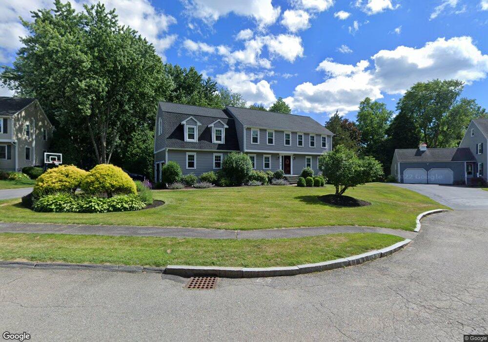
10 Wight Farm Rd Natick, MA 01760
Estimated Value: $1,304,000 - $1,536,000
4
Beds
3
Baths
2,752
Sq Ft
$518/Sq Ft
Est. Value
About This Home
This home is located at 10 Wight Farm Rd, Natick, MA 01760 and is currently estimated at $1,425,608, approximately $518 per square foot. 10 Wight Farm Rd is a home located in Middlesex County with nearby schools including Natick High School, Wilson Middle School, and Bennett-Hemenway (Ben-Hem) Elementary School.
Ownership History
Date
Name
Owned For
Owner Type
Purchase Details
Closed on
Mar 13, 2008
Sold by
Russell James M and Lynch Kelly A
Bought by
Russell James M and Russell Kelly A
Current Estimated Value
Purchase Details
Closed on
Jan 22, 2007
Sold by
Alexander Sandra M
Bought by
Russell James M and Lynch Kelly A
Home Financials for this Owner
Home Financials are based on the most recent Mortgage that was taken out on this home.
Original Mortgage
$508,000
Interest Rate
8%
Mortgage Type
Purchase Money Mortgage
Purchase Details
Closed on
Jun 20, 1988
Sold by
Construc Britton
Bought by
Alexander Robert R
Create a Home Valuation Report for This Property
The Home Valuation Report is an in-depth analysis detailing your home's value as well as a comparison with similar homes in the area
Home Values in the Area
Average Home Value in this Area
Purchase History
| Date | Buyer | Sale Price | Title Company |
|---|---|---|---|
| Russell James M | -- | -- | |
| Russell James M | $635,000 | -- | |
| Alexander Robert R | $359,000 | -- |
Source: Public Records
Mortgage History
| Date | Status | Borrower | Loan Amount |
|---|---|---|---|
| Open | Alexander Robert R | $540,600 | |
| Closed | Alexander Robert R | $504,500 | |
| Previous Owner | Russell James M | $508,000 | |
| Previous Owner | Alexander Robert R | $20,000 |
Source: Public Records
Tax History Compared to Growth
Tax History
| Year | Tax Paid | Tax Assessment Tax Assessment Total Assessment is a certain percentage of the fair market value that is determined by local assessors to be the total taxable value of land and additions on the property. | Land | Improvement |
|---|---|---|---|---|
| 2025 | $14,169 | $1,184,700 | $501,900 | $682,800 |
| 2024 | $13,718 | $1,118,900 | $475,400 | $643,500 |
| 2023 | $12,707 | $1,005,300 | $441,400 | $563,900 |
| 2022 | $11,831 | $886,900 | $397,200 | $489,700 |
| 2021 | $11,552 | $848,800 | $392,000 | $456,800 |
| 2020 | $11,338 | $833,100 | $376,300 | $456,800 |
| 2019 | $10,589 | $833,100 | $376,300 | $456,800 |
| 2018 | $10,881 | $833,800 | $363,200 | $470,600 |
| 2017 | $11,124 | $824,600 | $362,500 | $462,100 |
| 2016 | $11,117 | $819,200 | $362,500 | $456,700 |
| 2015 | $10,791 | $780,800 | $362,500 | $418,300 |
Source: Public Records
Map
Nearby Homes