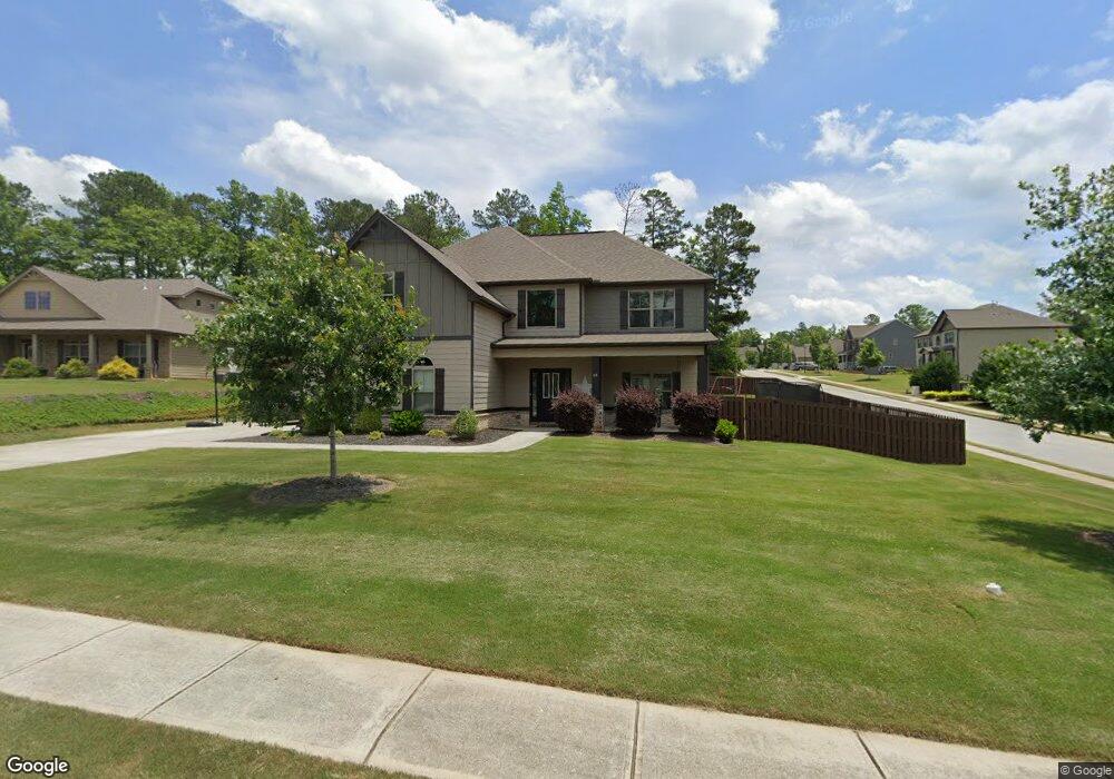
10 Windward Ct Unit LOT 26 Senoia, GA 30276
Estimated Value: $465,674 - $564,000
5
Beds
4
Baths
2,922
Sq Ft
$174/Sq Ft
Est. Value
About This Home
This home is located at 10 Windward Ct Unit LOT 26, Senoia, GA 30276 and is currently estimated at $508,669, approximately $174 per square foot. 10 Windward Ct Unit LOT 26 is a home located in Coweta County with nearby schools including Willis Road Elementary School, East Coweta Middle School, and East Coweta High School.
Ownership History
Date
Name
Owned For
Owner Type
Purchase Details
Closed on
Jun 5, 2017
Sold by
Dr Horton Crown Llc
Bought by
Dillard Nathan T and Dillard Jeanine M
Current Estimated Value
Home Financials for this Owner
Home Financials are based on the most recent Mortgage that was taken out on this home.
Original Mortgage
$285,750
Outstanding Balance
$237,113
Interest Rate
4.02%
Mortgage Type
New Conventional
Estimated Equity
$271,556
Purchase Details
Closed on
Sep 29, 2016
Sold by
Lotco Llc
Bought by
Dr Horton Crown Llc
Create a Home Valuation Report for This Property
The Home Valuation Report is an in-depth analysis detailing your home's value as well as a comparison with similar homes in the area
Home Values in the Area
Average Home Value in this Area
Purchase History
| Date | Buyer | Sale Price | Title Company |
|---|---|---|---|
| Dillard Nathan T | $317,500 | -- | |
| Dr Horton Crown Llc | -- | -- |
Source: Public Records
Mortgage History
| Date | Status | Borrower | Loan Amount |
|---|---|---|---|
| Open | Dillard Nathan T | $285,750 |
Source: Public Records
Tax History Compared to Growth
Tax History
| Year | Tax Paid | Tax Assessment Tax Assessment Total Assessment is a certain percentage of the fair market value that is determined by local assessors to be the total taxable value of land and additions on the property. | Land | Improvement |
|---|---|---|---|---|
| 2025 | $4,842 | $180,499 | $30,000 | $150,499 |
| 2024 | $4,570 | $168,236 | $30,000 | $138,236 |
| 2023 | $4,570 | $150,579 | $30,000 | $120,579 |
| 2022 | $3,637 | $128,436 | $24,000 | $104,436 |
| 2021 | $4,015 | $130,742 | $24,000 | $106,742 |
| 2020 | $4,087 | $130,742 | $24,000 | $106,742 |
| 2019 | $4,172 | $120,961 | $26,000 | $94,961 |
| 2018 | $4,194 | $120,961 | $26,000 | $94,961 |
| 2017 | $938 | $26,000 | $26,000 | $0 |
| 2016 | $937 | $26,000 | $26,000 | $0 |
Source: Public Records
Map
Nearby Homes
- 200 Darien Dr
- 220 Calebee Ave
- 170 Savannah Dr
- 155 Filson Dr
- 310 Savannah Dr
- 345 Darien Dr
- 400 Mulberry Dr
- 185 Renwick Dr
- 290 Calebee Ave
- Hampshire Plan at Heritage Pointe
- 285 Staffin Dr
- Edison Plan at Heritage Pointe
- 270 Staffin Dr
- Jean Lee Plan at Heritage Pointe
- 300 Staffin Dr
- 305 Staffin Dr
- Marlene Plan at Heritage Pointe
- SAVANNAH Plan at Heritage Pointe
- 300 Calebee Ave
- 135 Mulberry Dr
- 20 Windward Ct Unit LOT 27
- 15 Windward Ct
- 30 Windward Ct Unit LOT 28
- 30 Windward Ct Unit 4-25
- 240 Savannah Dr Unit LOT 24
- 240 Savannah Dr
- 215 Savannah Dr Unit LOT 101
- 25 Windward Ct
- 220 Savannah Dr Unit LOT 25
- 220 Savannah Dr
- 20 Twelve Oaks Dr Unit LOT 100
- 250 Savannah Dr Unit LOT 23
- 250 Savannah Dr
- 40 Windward Ct Unit LOT 29
- 40 Windward Ct
- 35 Windward Ct
- 660 Twelve Oaks Dr Unit 99
- 265 Savannah Dr Unit LOT 44
- 210 Savannah Dr Unit 102
- 210 Savannah Dr