
Seller's Agent in 2026
Benjamin Snow
Coldwell Banker Realty - Boston
(617) 721-4182
4 in this area
100 Total Sales
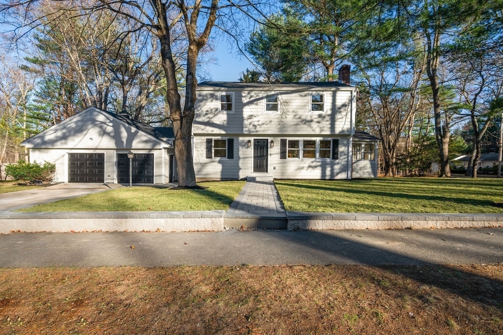
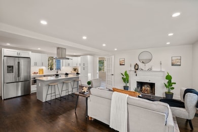
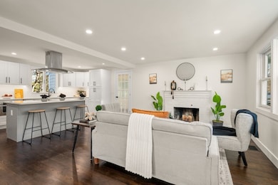
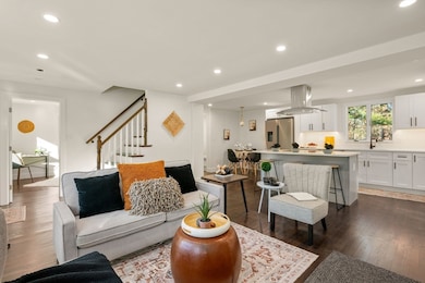
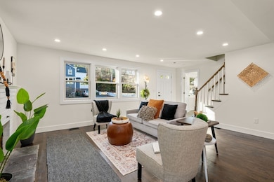
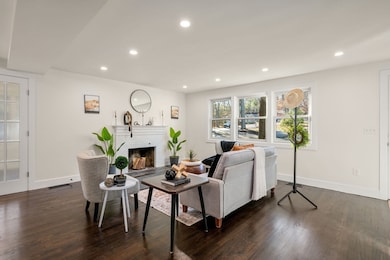
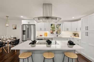
This is a beautifully renovated 4 bed, 2.5 bath colonial that has undergone a full interior renovation with all new systems, finishes, and modern features. Open concept first floor with living room & fireplace, kitchen with stainless steel appliances, induction cooktop, hood vent, quartz countertops, breakfast bar, and dining nook. Enclosed side porch can be formal dining room or flex space. Half bath and laundry room complete the first floor. Second floor features spacious primary bedroom with ensuite bathroom & walk in closet. Two additional bedrooms and bathroom serve the upper level. Lower level is finished, providing a flexible space for a playroom, workout area, or media room. Central AC, recessed lighting, and hardwood floors throughout. Detached two car garage with ample storage and workshop area. Half acre corner lot in a cul de sac neighborhood abutting conservation land. Easy access to walking trails, Thoreau School, Rideout Playground, Rt 2, and West Concord Train Station
| Date | Type | Sale Price | Title Company |
|---|---|---|---|
| Quit Claim Deed | $1,250,000 | -- | |
| Foreclosure Deed | $707,000 | None Available | |
| Foreclosure Deed | $707,000 | None Available | |
| Deed | -- | -- |
| Date | Status | Loan Amount | Loan Type |
|---|---|---|---|
| Open | $960,000 | New Conventional | |
| Previous Owner | $530,250 | Commercial | |
| Previous Owner | $802,500 | Reverse Mortgage Home Equity Conversion Mortgage | |
| Previous Owner | $175,000 | No Value Available | |
| Previous Owner | $120,000 | No Value Available |
| Date | Event | Price | List to Sale | Price per Sq Ft |
|---|---|---|---|---|
| 01/08/2026 01/08/26 | Sold | $1,250,000 | 0.0% | $553 / Sq Ft |
| 12/05/2025 12/05/25 | Pending | -- | -- | -- |
| 11/19/2025 11/19/25 | For Sale | $1,250,000 | -- | $553 / Sq Ft |
| Year | Tax Paid | Tax Assessment Tax Assessment Total Assessment is a certain percentage of the fair market value that is determined by local assessors to be the total taxable value of land and additions on the property. | Land | Improvement |
|---|---|---|---|---|
| 2025 | $11,434 | $862,300 | $491,400 | $370,900 |
| 2024 | $11,322 | $862,300 | $491,400 | $370,900 |
| 2023 | $10,365 | $799,800 | $446,800 | $353,000 |
| 2022 | $9,615 | $651,400 | $357,400 | $294,000 |
| 2021 | $9,443 | $641,500 | $357,400 | $284,100 |
| 2020 | $9,080 | $638,100 | $357,400 | $280,700 |
| 2019 | $8,899 | $627,100 | $369,200 | $257,900 |
| 2018 | $8,477 | $593,200 | $338,900 | $254,300 |
| 2017 | $8,238 | $585,500 | $314,700 | $270,800 |
| 2016 | $8,012 | $575,600 | $314,700 | $260,900 |
| 2015 | $7,574 | $530,000 | $291,400 | $238,600 |
Seller's Agent in 2026
Benjamin Snow
Coldwell Banker Realty - Boston
(617) 721-4182
4 in this area
100 Total Sales
Buyer's Agent in 2026
Carlisle Group
Compass
(973) 219-3337
1 in this area
544 Total Sales
Source: MLS Property Information Network (MLS PIN)
MLS Number: 73456476
APN: CONC-000009C-002082-000001
Disclaimer: Certain information contained herein is derived from information provided by parties other than Homes.com. All information provided is deemed reliable, but is not guaranteed to be accurate and should be independently verified.
![]() The property listing data and information, or the Images, set forth herein were provided to MLS Property Information Network, Inc. from third party sources, including sellers, lessors and public records, and were compiled by MLS Property Information Network, Inc. The property listing data and information, and the Images, are for the personal, non-commercial use of consumers having a good faith interest in purchasing or leasing listed properties of the type displayed to them and may not be used for any purpose other than to identify prospective properties which such consumers may have a good faith interest in purchasing or leasing. MLS Property Information Network, Inc. and its subscribers disclaim any and all representations and warranties as to the accuracy of the property listing data and information, or as to the accuracy of any of the Images, set forth herein.
The property listing data and information, or the Images, set forth herein were provided to MLS Property Information Network, Inc. from third party sources, including sellers, lessors and public records, and were compiled by MLS Property Information Network, Inc. The property listing data and information, and the Images, are for the personal, non-commercial use of consumers having a good faith interest in purchasing or leasing listed properties of the type displayed to them and may not be used for any purpose other than to identify prospective properties which such consumers may have a good faith interest in purchasing or leasing. MLS Property Information Network, Inc. and its subscribers disclaim any and all representations and warranties as to the accuracy of the property listing data and information, or as to the accuracy of any of the Images, set forth herein.
Ask me questions while you tour the home.