Estimated Value: $345,000 - $534,000
1
Bed
2
Baths
836
Sq Ft
$548/Sq Ft
Est. Value
About This Home
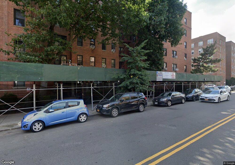
This home is located at 100-10 67th Rd Unit 1B, Forest Hills, NY 11375 and is currently estimated at $458,429, approximately $548 per square foot. 100-10 67th Rd Unit 1B is a home located in Queens County with nearby schools including Ps 144 Col Jeromus Remsen, J.H.S. 190 Russell Sage, and Valence College Preparatory Charter School.
Ownership History
Date
Name
Owned For
Owner Type
Purchase Details
Closed on
Jul 29, 2019
Sold by
Ho Deniss
Bought by
Ho Christopher Weiky and Ho Deniss
Current Estimated Value
Purchase Details
Closed on
Dec 22, 2015
Sold by
Cheung Linda Yuet Ngor and Cheung Michelle
Bought by
Ho Deniss
Purchase Details
Closed on
Aug 20, 2010
Sold by
Tong Samson
Bought by
Cheung Linda Yuet Ngor and Cheung Michelle
Purchase Details
Closed on
Dec 7, 1998
Sold by
Kuo Hwei Chuan
Bought by
Kwan Lai Yin and Rong James G
Home Financials for this Owner
Home Financials are based on the most recent Mortgage that was taken out on this home.
Original Mortgage
$70,000
Interest Rate
6.7%
Create a Home Valuation Report for This Property
The Home Valuation Report is an in-depth analysis detailing your home's value as well as a comparison with similar homes in the area
Home Values in the Area
Average Home Value in this Area
Purchase History
| Date | Buyer | Sale Price | Title Company |
|---|---|---|---|
| Ho Christopher Weiky | -- | -- | |
| Ho Christopher Weiky | -- | -- | |
| Ho Deniss | $385,000 | -- | |
| Ho Deniss | $385,000 | -- | |
| Cheung Linda Yuet Ngor | $311,000 | -- | |
| Cheung Linda Yuet Ngor | $311,000 | -- | |
| Kwan Lai Yin | $115,000 | -- | |
| Kwan Lai Yin | $115,000 | -- |
Source: Public Records
Mortgage History
| Date | Status | Borrower | Loan Amount |
|---|---|---|---|
| Previous Owner | Kwan Lai Yin | $70,000 |
Source: Public Records
Tax History Compared to Growth
Tax History
| Year | Tax Paid | Tax Assessment Tax Assessment Total Assessment is a certain percentage of the fair market value that is determined by local assessors to be the total taxable value of land and additions on the property. | Land | Improvement |
|---|---|---|---|---|
| 2025 | $6,023 | $47,789 | $3,969 | $43,820 |
| 2024 | $4,668 | $48,174 | $3,969 | $44,205 |
| 2023 | $4,072 | $46,173 | $3,969 | $42,204 |
| 2022 | $3,996 | $45,425 | $3,969 | $41,456 |
| 2021 | $3,988 | $45,214 | $3,969 | $41,245 |
| 2020 | $4,239 | $50,982 | $3,969 | $47,013 |
| 2019 | $4,081 | $48,627 | $3,969 | $44,658 |
| 2018 | $5,166 | $40,620 | $3,969 | $36,651 |
| 2017 | $4,783 | $37,606 | $3,969 | $33,637 |
| 2016 | $4,760 | $37,606 | $3,969 | $33,637 |
| 2014 | $2,143 | $28,000 | $3,969 | $24,031 |
Source: Public Records
About This Building
Map
Nearby Homes
- 100-11 67th Rd Unit 205
- 100-11 67th Rd Unit 416
- 100-11 67th Rd Unit 4
- 99-22 67th Ave
- 102-10 Queens Blvd Unit 404
- 102-10 Queens Blvd Unit 601
- 102-10 Queens Blvd Unit 403
- 102-10 Queens Blvd Unit 703
- 102-10 Queens Blvd Unit 704
- 102-10 Queens Blvd Unit 702
- 67-40 Booth St Unit 3A
- 67-40 Booth St Unit 6I
- 100-25 Queens Blvd Unit 7
- 100-25 Queens Blvd Unit 2
- 100-25 Queens Blvd Unit 4D
- 100-25 Queens Blvd Unit 6Aa
- 100-25 Queens Blvd Unit 6Ee
- 98-50 67th Ave Unit 1B
- 98-50 67th Ave Unit 6F
- 99-45 67th Rd Unit 620
- 100-10 67th Rd Unit 5
- 100-10 67th Rd Unit 2L
- 100-10 67th Rd Unit 3C
- 100-10 67th Rd Unit 3F
- 100-10 67th Rd Unit 4F
- 100-10 67th Rd Unit 1A
- 100-10 67th Rd Unit 6C
- 100-10 67th Rd Unit 4 E
- 100-10 67th Rd Unit 1H
- 100-10 67th Rd Unit 6L
- 100-10 67th Rd Unit 219
- 100-10 67th Rd Unit 2B
- 100-10 67th Rd Unit 5A
- 100-10 67th Rd
- 100-10 67th Rd Unit 2A
- 100-10 67th Rd Unit 3G
- 100-10 67th Rd Unit 2K
- 100-10 67th Rd Unit 6D
- 100-10 67th Rd Unit 6A
- 100-10 67th Rd Unit 6F