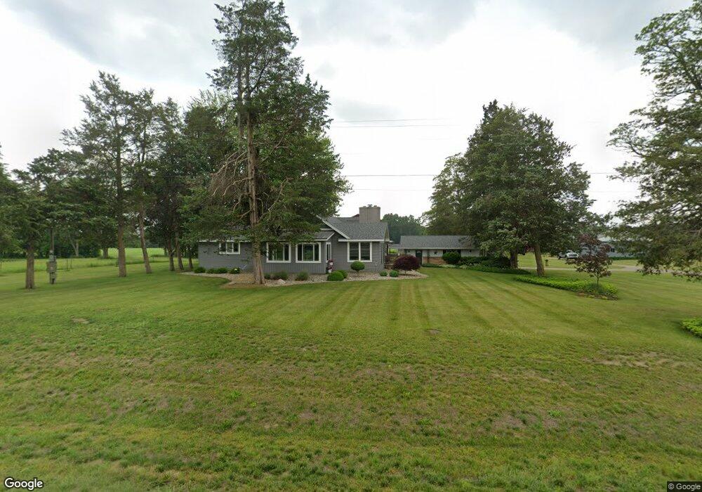
100 133rd Ave Wayland, MI 49348
Estimated Value: $346,063 - $565,000
--
Bed
2
Baths
2,328
Sq Ft
$186/Sq Ft
Est. Value
About This Home
This home is located at 100 133rd Ave, Wayland, MI 49348 and is currently estimated at $434,016, approximately $186 per square foot. 100 133rd Ave is a home located in Allegan County with nearby schools including Wayland High School.
Ownership History
Date
Name
Owned For
Owner Type
Purchase Details
Closed on
Mar 4, 2021
Sold by
Maxlow Joni G and Farratell Joni
Bought by
Maxlow Tracy L and Maxlow Joni G
Current Estimated Value
Home Financials for this Owner
Home Financials are based on the most recent Mortgage that was taken out on this home.
Original Mortgage
$122,615
Outstanding Balance
$71,506
Interest Rate
2.7%
Mortgage Type
New Conventional
Estimated Equity
$362,510
Purchase Details
Closed on
Nov 19, 2020
Sold by
Brinks Glenn A and Brinks Monica J
Bought by
Maxlow Tracy L and Maxlow Joni G
Purchase Details
Closed on
Mar 26, 2001
Sold by
Farratell Rafael Ruiz
Bought by
Farratell Joni and Farratell Joni Gale
Home Financials for this Owner
Home Financials are based on the most recent Mortgage that was taken out on this home.
Original Mortgage
$97,500
Interest Rate
7.13%
Mortgage Type
Purchase Money Mortgage
Create a Home Valuation Report for This Property
The Home Valuation Report is an in-depth analysis detailing your home's value as well as a comparison with similar homes in the area
Home Values in the Area
Average Home Value in this Area
Purchase History
| Date | Buyer | Sale Price | Title Company |
|---|---|---|---|
| Maxlow Tracy L | -- | Chicago Title Of Michigan In | |
| Maxlow Tracy L | $10,000 | None Available | |
| Farratell Joni | -- | -- |
Source: Public Records
Mortgage History
| Date | Status | Borrower | Loan Amount |
|---|---|---|---|
| Open | Maxlow Tracy L | $122,615 | |
| Previous Owner | Farratell Joni | $97,500 |
Source: Public Records
Tax History Compared to Growth
Tax History
| Year | Tax Paid | Tax Assessment Tax Assessment Total Assessment is a certain percentage of the fair market value that is determined by local assessors to be the total taxable value of land and additions on the property. | Land | Improvement |
|---|---|---|---|---|
| 2025 | $2,119 | $155,800 | $27,900 | $127,900 |
| 2024 | $1,839 | $156,400 | $26,300 | $130,100 |
| 2023 | $1,889 | $110,800 | $24,700 | $86,100 |
| 2022 | $1,839 | $91,400 | $13,500 | $77,900 |
| 2021 | $1,746 | $84,300 | $13,500 | $70,800 |
Source: Public Records
Map
Nearby Homes
- 12720 S Grey Ct
- 1164 E Bernie Ct
- 12857 Michael Dr Unit 49
- 1391 Shadowridge Dr
- 12031 Sandstone Dr
- 11753 Rosemary Ln
- 11751 Rosemary Ln
- 12169 Pine Meadows Dr
- 516 131st Ave
- 1736 Parker Dr
- 1875 Edwin Dr
- 2615 Harwood Lake Rd
- 1980 Parker Dr
- 2724 Pasture Ln
- 11401 Davis Rd
- 3214 7th St
- 12712 Sunrise Ct
- 590 129th Ave
- 35 Cannonball Ln
- Lot 7 Reflection Pond Dr
- 90 133rd Ave
- 3290 Lone Oak Dr
- 3274 Lone Oak Dr
- 0 Lone Oak Dr
- 32641 Lone Oak Dr
- 80 133rd Ave
- 140 133rd Ave
- 3251 Lone Oak Dr
- 3264 -1 Lone Oak Dr
- 3264 -1 Lone Oak Dr
- 3264 Lone Oak Dr
- 150 133rd Ave
- 3245 Lone Oak Dr
- 3248 Lone Oak Dr
- 3235 2nd St
- 195 133rd Ave
- 3281 2nd St
- 3238 Lone Oak Dr
- 55 133rd Ave
- 3231 2nd St