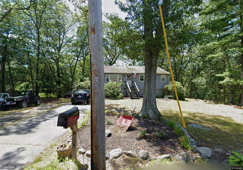
100 Adams Rd Tewksbury, MA 01876
Estimated Value: $536,000 - $620,000
3
Beds
1
Bath
954
Sq Ft
$614/Sq Ft
Est. Value
About This Home
This home is located at 100 Adams Rd, Tewksbury, MA 01876 and is currently estimated at $585,747, approximately $613 per square foot. 100 Adams Rd is a home located in Middlesex County with nearby schools including John F. Ryan Elementary School, John W. Wynn Middle School, and Tewksbury Memorial High School.
Ownership History
Date
Name
Owned For
Owner Type
Purchase Details
Closed on
Dec 5, 2016
Sold by
Doody Deborah A
Bought by
Campbell Patrick I
Current Estimated Value
Home Financials for this Owner
Home Financials are based on the most recent Mortgage that was taken out on this home.
Original Mortgage
$215,000
Outstanding Balance
$174,129
Interest Rate
3.25%
Mortgage Type
New Conventional
Estimated Equity
$411,618
Purchase Details
Closed on
Dec 21, 2009
Sold by
Doody John P and Doody Deborah A
Bought by
Doody Deborah A
Purchase Details
Closed on
Sep 30, 1991
Sold by
Beneficial Mtg Co
Bought by
Doody John P and Deborah Campbell
Home Financials for this Owner
Home Financials are based on the most recent Mortgage that was taken out on this home.
Original Mortgage
$102,600
Interest Rate
9.1%
Mortgage Type
Purchase Money Mortgage
Create a Home Valuation Report for This Property
The Home Valuation Report is an in-depth analysis detailing your home's value as well as a comparison with similar homes in the area
Home Values in the Area
Average Home Value in this Area
Purchase History
| Date | Buyer | Sale Price | Title Company |
|---|---|---|---|
| Campbell Patrick I | $240,000 | -- | |
| Doody Deborah A | -- | -- | |
| Doody John P | $114,000 | -- |
Source: Public Records
Mortgage History
| Date | Status | Borrower | Loan Amount |
|---|---|---|---|
| Open | Campbell Patrick I | $215,000 | |
| Previous Owner | Doody John P | $142,000 | |
| Previous Owner | Doody John P | $102,000 | |
| Previous Owner | Doody John P | $102,600 |
Source: Public Records
Tax History Compared to Growth
Tax History
| Year | Tax Paid | Tax Assessment Tax Assessment Total Assessment is a certain percentage of the fair market value that is determined by local assessors to be the total taxable value of land and additions on the property. | Land | Improvement |
|---|---|---|---|---|
| 2025 | $6,446 | $487,600 | $273,500 | $214,100 |
| 2024 | $6,221 | $464,600 | $260,300 | $204,300 |
| 2023 | $6,112 | $433,500 | $236,800 | $196,700 |
| 2022 | $5,814 | $382,500 | $205,700 | $176,800 |
| 2021 | $5,320 | $338,400 | $177,400 | $161,000 |
| 2020 | $5,123 | $320,800 | $169,000 | $151,800 |
| 2019 | $4,807 | $303,500 | $160,900 | $142,600 |
| 2018 | $4,341 | $269,100 | $160,900 | $108,200 |
| 2017 | $4,128 | $253,100 | $160,900 | $92,200 |
| 2016 | $4,002 | $244,800 | $160,900 | $83,900 |
| 2015 | $4,056 | $247,800 | $167,900 | $79,900 |
| 2014 | $3,784 | $234,900 | $167,900 | $67,000 |
Source: Public Records
Map
Nearby Homes
- 86 Van Buren Rd
- 1 Lincoln Rd
- 16 Crooked Spring Rd
- 160 Booth St
- 193 Shoreline Dr
- 189 Lakeview St
- 206 Shoreline Dr
- 221 Shoreline Dr
- 214 Shoreline Dr
- 44 Oak St
- 20 Upton St
- 24 Upton St
- 8 Corthell Rd
- 10 Babicz Rd
- 8 Billerica Ave Extension Unit 14
- 11 Mason Ave
- 8 Oxford Rd
- 71 Secor Way
- 1138 Whipple Rd
- 122 Marshall St