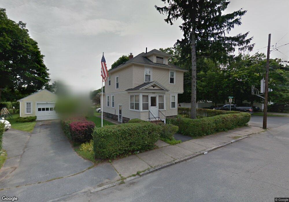
100 Ashland Ave Methuen, MA 01844
Downtown Methuen NeighborhoodEstimated Value: $540,033 - $580,000
3
Beds
2
Baths
1,716
Sq Ft
$329/Sq Ft
Est. Value
About This Home
This home is located at 100 Ashland Ave, Methuen, MA 01844 and is currently estimated at $564,008, approximately $328 per square foot. 100 Ashland Ave is a home located in Essex County with nearby schools including Marsh Grammar School, South Point Elementary School, and Methuen High School.
Ownership History
Date
Name
Owned For
Owner Type
Purchase Details
Closed on
Jan 6, 2023
Sold by
Kucukistepanoglu S Est and Kucukistepanough
Bought by
Kucukistepanoglu Katya M and Kucukistepanoglu Karin
Current Estimated Value
Purchase Details
Closed on
Jun 1, 1985
Bought by
Kucukistpanoglu Sahak and Kucukistpanoglu Arusyak
Create a Home Valuation Report for This Property
The Home Valuation Report is an in-depth analysis detailing your home's value as well as a comparison with similar homes in the area
Home Values in the Area
Average Home Value in this Area
Purchase History
| Date | Buyer | Sale Price | Title Company |
|---|---|---|---|
| Kucukistepanoglu Katya M | -- | None Available | |
| Kucukistepanoglu Katya M | -- | None Available | |
| Kucukistepanoglu Katya M | -- | None Available | |
| Kucukistpanoglu Sahak | -- | -- |
Source: Public Records
Tax History Compared to Growth
Tax History
| Year | Tax Paid | Tax Assessment Tax Assessment Total Assessment is a certain percentage of the fair market value that is determined by local assessors to be the total taxable value of land and additions on the property. | Land | Improvement |
|---|---|---|---|---|
| 2025 | $4,925 | $465,500 | $192,400 | $273,100 |
| 2024 | $4,797 | $441,700 | $175,500 | $266,200 |
| 2023 | $4,619 | $394,800 | $156,000 | $238,800 |
| 2022 | $4,275 | $327,600 | $123,500 | $204,100 |
| 2021 | $4,015 | $304,400 | $117,000 | $187,400 |
| 2020 | $3,980 | $296,100 | $117,000 | $179,100 |
| 2019 | $3,853 | $271,500 | $110,500 | $161,000 |
| 2018 | $3,665 | $256,800 | $104,000 | $152,800 |
| 2017 | $3,558 | $242,900 | $104,000 | $138,900 |
| 2016 | $3,363 | $227,100 | $91,000 | $136,100 |
| 2015 | $3,235 | $221,600 | $91,000 | $130,600 |
Source: Public Records
Map
Nearby Homes
- 83 Arnold St
- 17-19 Maplewood Ave
- 20-22 Ashland Ave
- 190-192 Oakland Ave
- 197 Oakland Ave
- 37 Maplewood Ave
- 24 Railroad St
- 47 Lowell St
- 23 Chase St
- 8 Francella Rd
- 2 Horne St
- 69 Broadway
- 35 Hardy St
- 32 Morrison Ct
- 35 Memorial Dr
- 65 Clayton Ave
- 100-102 Phillips St
- 52 High St Unit 5
- 47 Hallenan Ave
- 134 Haverhill St
- 98 Ashland Ave
- 106 Ashland Ave
- 4 Emsley Terrace
- 96 Ashland Ave
- 97 Ashland Ave
- 108 Ashland Ave
- 95 Ashland Ave
- 3 Emsley Terrace
- 103 Ashland Ave
- 2 Rachel Rd
- 94 Ashland Ave
- 89 Ashland Ave Unit 91
- 89-91 Ashland Ave
- 105 Ashland Ave
- 110 Ashland Ave
- 2 Emsley Terrace
- 107 Ashland Ave
- 1 Emsley Terrace
- 8 Emsley Terrace
- 6 Rachel Rd