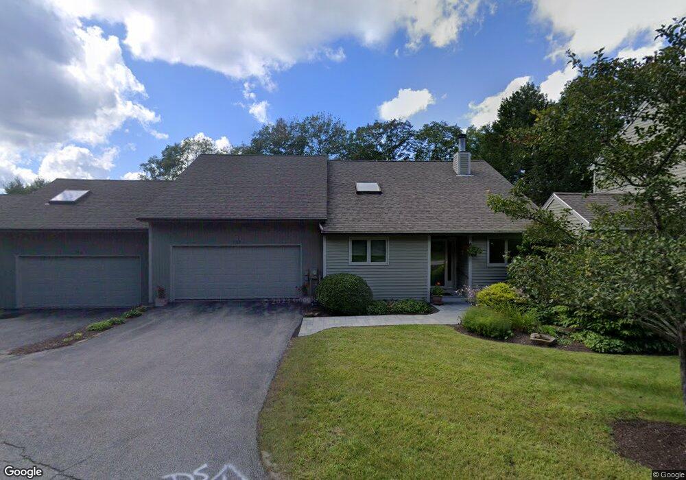
100 Bluff Rd Yarmouth, ME 04096
Estimated Value: $548,000 - $630,993
3
Beds
2
Baths
2,458
Sq Ft
$242/Sq Ft
Est. Value
About This Home
This home is located at 100 Bluff Rd, Yarmouth, ME 04096 and is currently estimated at $595,748, approximately $242 per square foot. 100 Bluff Rd is a home located in Cumberland County with nearby schools including William H. Rowe School, Yarmouth Elementary School, and Frank H. Harrison Middle School.
Ownership History
Date
Name
Owned For
Owner Type
Purchase Details
Closed on
Feb 14, 2023
Sold by
Ross Joan M
Bought by
Campbell Christopher S and Campbell Margaret K
Current Estimated Value
Purchase Details
Closed on
Apr 12, 2010
Sold by
Engle Susan
Bought by
Ross Joan M
Home Financials for this Owner
Home Financials are based on the most recent Mortgage that was taken out on this home.
Original Mortgage
$248,600
Interest Rate
5.12%
Mortgage Type
Purchase Money Mortgage
Create a Home Valuation Report for This Property
The Home Valuation Report is an in-depth analysis detailing your home's value as well as a comparison with similar homes in the area
Home Values in the Area
Average Home Value in this Area
Purchase History
| Date | Buyer | Sale Price | Title Company |
|---|---|---|---|
| Campbell Christopher S | $537,000 | None Available | |
| Ross Joan M | -- | -- |
Source: Public Records
Mortgage History
| Date | Status | Borrower | Loan Amount |
|---|---|---|---|
| Previous Owner | Ross Joan M | $248,600 | |
| Previous Owner | Ross Joan M | $215,000 |
Source: Public Records
Tax History Compared to Growth
Tax History
| Year | Tax Paid | Tax Assessment Tax Assessment Total Assessment is a certain percentage of the fair market value that is determined by local assessors to be the total taxable value of land and additions on the property. | Land | Improvement |
|---|---|---|---|---|
| 2024 | $7,167 | $279,200 | $100,000 | $179,200 |
| 2023 | $6,572 | $279,200 | $100,000 | $179,200 |
| 2022 | $6,036 | $279,200 | $100,000 | $179,200 |
| 2021 | $5,528 | $279,200 | $100,000 | $179,200 |
| 2020 | $5,472 | $279,200 | $100,000 | $179,200 |
| 2019 | $5,266 | $279,200 | $100,000 | $179,200 |
| 2018 | $4,970 | $279,200 | $100,000 | $179,200 |
| 2017 | $4,791 | $279,200 | $100,000 | $179,200 |
| 2016 | $4,763 | $279,200 | $100,000 | $179,200 |
| 2015 | $4,558 | $211,400 | $56,000 | $155,400 |
| 2014 | $4,566 | $211,400 | $56,000 | $155,400 |
| 2013 | $4,651 | $211,400 | $0 | $0 |
Source: Public Records
Map
Nearby Homes
- 241 Bluff Rd Unit 4
- 203 Bluff Rd Unit 13
- 393 E Main St
- 149 E Main St Unit 7
- 44 Ellen Cir
- 20 Blueberry Cove Rd Unit 20
- 62 Blueberry Cove Rd Unit 62
- 52 Blueberry Cove Rd Unit 52
- 70 Main St
- 309 Main St Unit A
- 15 Sequoia Dr
- 247 Ledge Rd
- 1 Railroad Square Unit Townhome C
- 1 Railroad Square Unit 103
- 1 Railroad Square Unit 205
- 1 Railroad Square Unit 305
- 1 Railroad Square Unit 403
- 1 Railroad Square Unit 101
- 25 Meadowbrook Ln
- 37 South St
- 100 Bluff Rd Unit 32
- 102 Bluff Rd
- 102 Bluff Rd Unit 1
- 98 Bluff Rd
- 98 Bluff Rd Unit 31
- 104 Bluff Rd
- 54 Bluff Rd
- 264 Bluff Rd
- 138 Bluff Rd
- 138 Bluff Rd Unit 30
- 268 Bluff Rd
- 268 Bluff Rd Unit 268
- 268 Bluff Rd Unit 43
- 266 Bluff Rd
- 262 Bluff Rd
- 262 Bluff Rd Unit 262
- 262 Bluff Rd Unit 46
- 256 Bluff Rd
- 56 Bluff Rd
- 56 Bluff Rd Unit 36