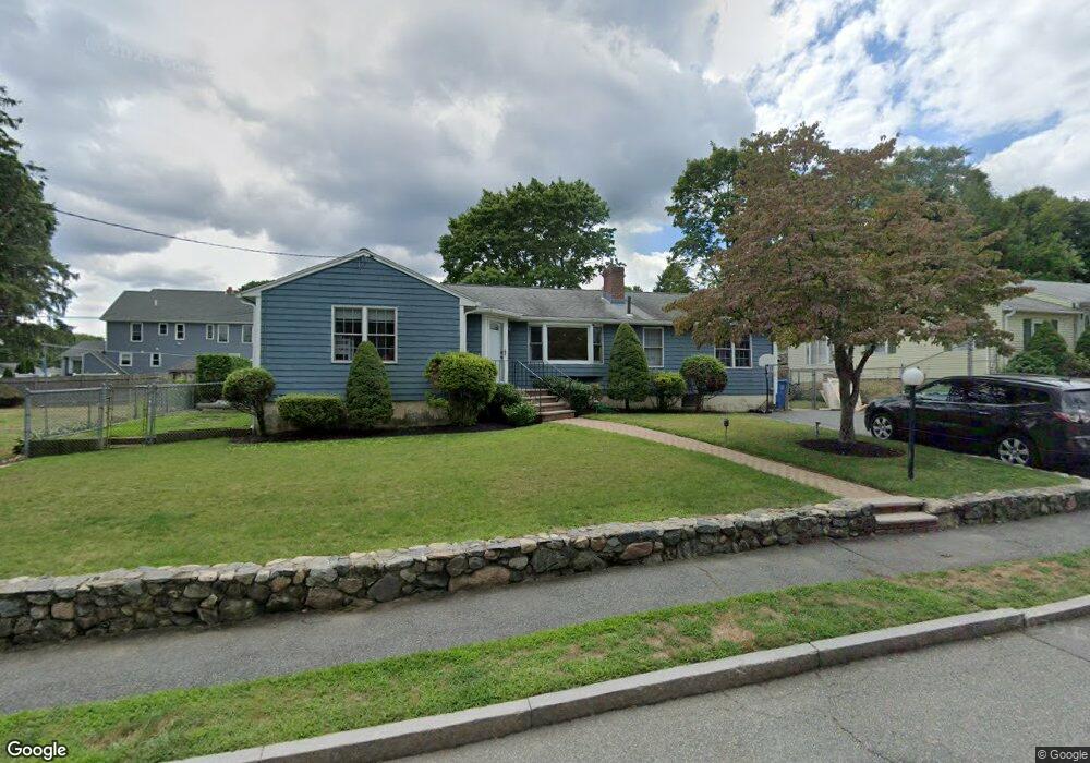
100 Brewster Rd Waltham, MA 02451
North Waltham NeighborhoodEstimated Value: $957,377 - $1,001,000
3
Beds
2
Baths
2,297
Sq Ft
$425/Sq Ft
Est. Value
About This Home
This home is located at 100 Brewster Rd, Waltham, MA 02451 and is currently estimated at $977,094, approximately $425 per square foot. 100 Brewster Rd is a home located in Middlesex County with nearby schools including Douglas Macarthur Elementary School, John F Kennedy Middle School, and Waltham Sr High School.
Ownership History
Date
Name
Owned For
Owner Type
Purchase Details
Closed on
Nov 16, 2021
Sold by
Ehwa Carol A
Bought by
Barbosa Michael and Barbosa Alison
Current Estimated Value
Home Financials for this Owner
Home Financials are based on the most recent Mortgage that was taken out on this home.
Original Mortgage
$664,000
Outstanding Balance
$608,610
Interest Rate
3.01%
Mortgage Type
Purchase Money Mortgage
Estimated Equity
$368,484
Purchase Details
Closed on
Sep 1, 1985
Bought by
Ehwa John M and Ehwa Carol A
Create a Home Valuation Report for This Property
The Home Valuation Report is an in-depth analysis detailing your home's value as well as a comparison with similar homes in the area
Home Values in the Area
Average Home Value in this Area
Purchase History
| Date | Buyer | Sale Price | Title Company |
|---|---|---|---|
| Barbosa Michael | $830,000 | None Available | |
| Ehwa John M | $180,000 | -- |
Source: Public Records
Mortgage History
| Date | Status | Borrower | Loan Amount |
|---|---|---|---|
| Open | Barbosa Michael | $664,000 | |
| Previous Owner | Ehwa John M | $161,000 | |
| Previous Owner | Ehwa John M | $100,000 | |
| Previous Owner | Ehwa John M | $30,000 | |
| Previous Owner | Ehwa John M | $50,000 |
Source: Public Records
Tax History Compared to Growth
Tax History
| Year | Tax Paid | Tax Assessment Tax Assessment Total Assessment is a certain percentage of the fair market value that is determined by local assessors to be the total taxable value of land and additions on the property. | Land | Improvement |
|---|---|---|---|---|
| 2025 | $8,404 | $855,800 | $443,400 | $412,400 |
| 2024 | $8,007 | $830,600 | $423,800 | $406,800 |
| 2023 | $7,971 | $772,400 | $384,600 | $387,800 |
| 2022 | $6,671 | $598,800 | $345,300 | $253,500 |
| 2021 | $6,629 | $585,600 | $345,300 | $240,300 |
| 2020 | $6,472 | $541,600 | $321,800 | $219,800 |
| 2019 | $6,431 | $508,000 | $317,800 | $190,200 |
| 2018 | $5,830 | $462,300 | $294,300 | $168,000 |
| 2017 | $5,461 | $434,800 | $266,800 | $168,000 |
| 2016 | $5,130 | $419,100 | $251,100 | $168,000 |
| 2015 | $4,953 | $377,200 | $219,700 | $157,500 |
Source: Public Records
Map
Nearby Homes
- 15 Kings Way Unit 25
- 14 Benjamin Rd
- 98 Seminole Ave
- 249 Lake St
- 234 Lake St
- 30 Wampum Ave
- 463 Lincoln St
- 1105 Lexington St Unit 102
- 129 Lake St
- 30 Jacqueline Rd Unit C
- 102 Milner St
- 92 Milner St
- 28 Hillcrest St
- 11 Autumn Ln
- 65 Montclair Ave
- 14 Piedmont Ave
- 28 Goldencrest Ave
- 5 April Ln Unit 12
- 311 Concord Ave
- 44 Sachem St