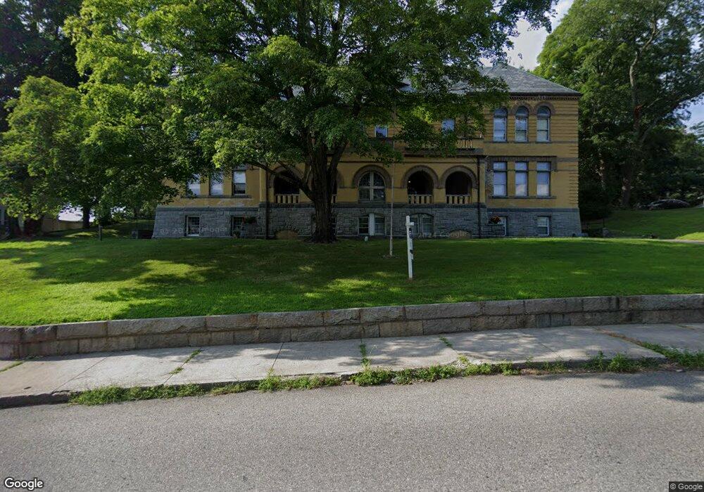
100 Broad St Unit 203 Norwich, CT 06360
Central Norwich NeighborhoodEstimated Value: $129,000 - $149,000
1
Bed
1
Bath
698
Sq Ft
$197/Sq Ft
Est. Value
About This Home
This home is located at 100 Broad St Unit 203, Norwich, CT 06360 and is currently estimated at $137,541, approximately $197 per square foot. 100 Broad St Unit 203 is a home located in New London County with nearby schools including Moriarty Magnet Elementary School, Kelly STEAM Magnet Middle School, and Integrated Day Charter School.
Ownership History
Date
Name
Owned For
Owner Type
Purchase Details
Closed on
Aug 27, 2004
Sold by
Wong William
Bought by
Lahan P Michael
Current Estimated Value
Purchase Details
Closed on
Dec 21, 2001
Sold by
Ignac Dev Co
Bought by
Wong William W
Home Financials for this Owner
Home Financials are based on the most recent Mortgage that was taken out on this home.
Original Mortgage
$34,400
Interest Rate
6.54%
Create a Home Valuation Report for This Property
The Home Valuation Report is an in-depth analysis detailing your home's value as well as a comparison with similar homes in the area
Home Values in the Area
Average Home Value in this Area
Purchase History
| Date | Buyer | Sale Price | Title Company |
|---|---|---|---|
| Lahan P Michael | $74,000 | -- | |
| Lahan P Michael | $74,000 | -- | |
| Wong William W | $43,000 | -- | |
| Wong William W | $43,000 | -- |
Source: Public Records
Mortgage History
| Date | Status | Borrower | Loan Amount |
|---|---|---|---|
| Previous Owner | Wong William W | $34,400 |
Source: Public Records
Tax History Compared to Growth
Tax History
| Year | Tax Paid | Tax Assessment Tax Assessment Total Assessment is a certain percentage of the fair market value that is determined by local assessors to be the total taxable value of land and additions on the property. | Land | Improvement |
|---|---|---|---|---|
| 2025 | $2,339 | $57,800 | $0 | $57,800 |
| 2024 | $2,208 | $57,800 | $0 | $57,800 |
| 2023 | $1,581 | $32,500 | $0 | $32,500 |
| 2022 | $1,576 | $32,500 | $0 | $32,500 |
| 2021 | $1,581 | $32,500 | $0 | $32,500 |
| 2020 | $1,575 | $32,500 | $0 | $32,500 |
| 2019 | $1,560 | $32,500 | $0 | $32,500 |
| 2018 | $3,266 | $67,500 | $0 | $67,500 |
| 2017 | $3,290 | $67,500 | $0 | $67,500 |
| 2016 | $3,312 | $67,500 | $0 | $67,500 |
| 2015 | $3,244 | $67,500 | $0 | $67,500 |
| 2014 | $3,100 | $67,500 | $0 | $67,500 |
Source: Public Records
Map
Nearby Homes
- 87 Broad St Unit 89
- 89 Rockwell St
- 28 Perkins Ave
- 48 Otis St
- 149 Broadway
- 223 Rockwell St
- 15 Platt Ave
- 214 Broadway
- 48 Lake St
- 28 Baltic St
- 93 Boswell Ave
- 220 Franklin St
- 136 Washington St
- 51 Division St
- 21 Buckingham Ave
- 164 Boswell Ave
- 49 Union St
- 76 Beech Dr
- 150 Yantic St Unit 125
- 150 Yantic St Unit 224
- 100 Broad St Unit 201
- 100 Broad St Unit L2
- 100 Broad St Unit 202
- 100 Broad St Unit L1
- 100 Broad St Unit 101
- 100 Broad St Unit 102
- 100 Broad St Unit 103
- 100 Broad St Unit 204
- 100 Broad St Unit L1
- 90 Broad St
- 97 Broad St
- 93 Broad St Unit 1
- 93 Broad St Unit 2
- 101 Broad St
- 111 Broad St
- 106 Broad St Unit 2
- 106 Broad St Unit 2
- 106 Broad St Unit B
- 106 Broad St Unit A
- 106 Broad St