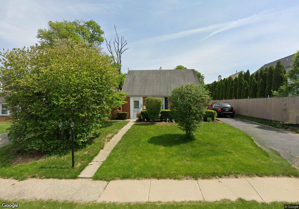
100 Burnside Ave Norristown, PA 19403
West Norriton Township NeighborhoodEstimated Value: $281,000 - $347,695
3
Beds
1
Bath
905
Sq Ft
$355/Sq Ft
Est. Value
About This Home
This home is located at 100 Burnside Ave, Norristown, PA 19403 and is currently estimated at $321,674, approximately $355 per square foot. 100 Burnside Ave is a home located in Montgomery County with nearby schools including Charles Blockson Middle School, Paul V Fly Elementary School, and East Norriton Middle School.
Ownership History
Date
Name
Owned For
Owner Type
Purchase Details
Closed on
Apr 28, 2011
Sold by
Day Hasibe and Abrams Barry C
Bought by
Abrams Barry C and Day Hasibe
Current Estimated Value
Purchase Details
Closed on
Feb 18, 2011
Sold by
Mccafferty Goldbeck and Mccafferty Mckeever
Bought by
Day Hasibe and Abrams Barry
Home Financials for this Owner
Home Financials are based on the most recent Mortgage that was taken out on this home.
Original Mortgage
$108,000
Outstanding Balance
$74,077
Interest Rate
4.83%
Estimated Equity
$247,597
Purchase Details
Closed on
Oct 29, 2010
Sold by
Saylor Donald and Saylor Jon
Bought by
Federal National Mortgage Association
Purchase Details
Closed on
Feb 12, 2008
Sold by
Kershner Ruth Esther and Saylor Charles J
Bought by
Saylor Donald and Saylor Jon
Home Financials for this Owner
Home Financials are based on the most recent Mortgage that was taken out on this home.
Original Mortgage
$148,000
Interest Rate
5.8%
Create a Home Valuation Report for This Property
The Home Valuation Report is an in-depth analysis detailing your home's value as well as a comparison with similar homes in the area
Home Values in the Area
Average Home Value in this Area
Purchase History
| Date | Buyer | Sale Price | Title Company |
|---|---|---|---|
| Abrams Barry C | -- | None Available | |
| Day Hasibe | $135,000 | None Available | |
| Federal National Mortgage Association | $1,763 | None Available | |
| Saylor Donald | $185,000 | None Available |
Source: Public Records
Mortgage History
| Date | Status | Borrower | Loan Amount |
|---|---|---|---|
| Open | Day Hasibe | $108,000 | |
| Previous Owner | Saylor Donald | $148,000 |
Source: Public Records
Tax History Compared to Growth
Tax History
| Year | Tax Paid | Tax Assessment Tax Assessment Total Assessment is a certain percentage of the fair market value that is determined by local assessors to be the total taxable value of land and additions on the property. | Land | Improvement |
|---|---|---|---|---|
| 2025 | $5,034 | $103,040 | -- | -- |
| 2024 | $5,034 | $103,040 | -- | -- |
| 2023 | $4,978 | $103,040 | $0 | $0 |
| 2022 | $4,978 | $103,040 | $0 | $0 |
| 2021 | $4,915 | $103,040 | $0 | $0 |
| 2020 | $4,768 | $103,040 | $0 | $0 |
| 2019 | $4,662 | $103,040 | $0 | $0 |
| 2018 | $3,557 | $103,040 | $0 | $0 |
| 2017 | $4,401 | $103,040 | $0 | $0 |
| 2016 | $4,360 | $103,040 | $0 | $0 |
| 2015 | $4,040 | $103,040 | $0 | $0 |
| 2014 | $4,040 | $103,040 | $0 | $0 |
Source: Public Records
Map
Nearby Homes
- 2020 Davis Dr
- 2055 W Marshall St
- 136 Markley Farm Cir
- 37 Burnside Ave
- 32 Miami Rd
- 2020 Sterigere St
- 68 Jefferson Ave
- 709 Middleton Place
- 00 Arden Dr Unit METHACTON SCHOOL
- 1104 Arden Dr Unit METHACTON SCHOOL
- 1107 Middleton Place
- 1749 W Marshall St
- 166 Hoover Ave
- 137 Avondale Rd
- 1613 Countryside Ln
- 155 Avondale Rd
- 108 N Prospect Ave
- 2158 Alexander Dr
- 2008 Hemlock Rd
- 1635 W Marshall W Marshall St
- 104 Burnside Ave
- 1101 E Chestnut Ave
- 108 Burnside Ave
- 1103 E Chestnut Ave
- 225 Liberty Ave
- 221 Liberty Ave
- 112 Burnside Ave
- 1105 E Chestnut Ave
- 229 Liberty Ave
- 103 Burnside Ave
- 101 Burnside Ave
- 105 Burnside Ave
- 1102 E Chestnut Ave
- 1107 E Chestnut Ave
- 217 Liberty Ave
- 1104 E Chestnut Ave
- 109 Burnside Ave
- 220 Liberty Ave
- 213 Liberty Ave
- 73 Burnside Ave