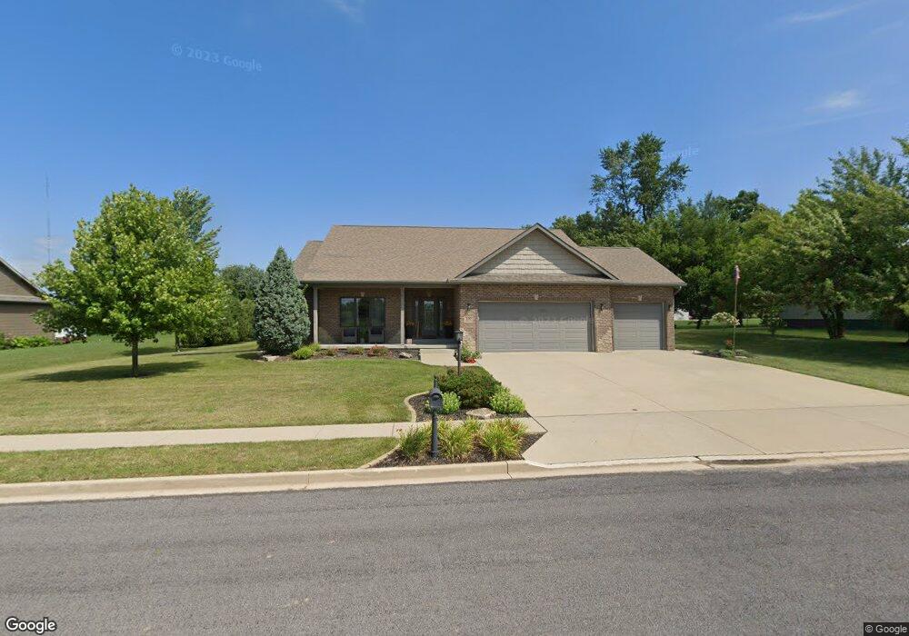
100 Cherokee Dr Groveland, IL 61535
Estimated Value: $381,000 - $605,000
3
Beds
2
Baths
2,558
Sq Ft
$189/Sq Ft
Est. Value
About This Home
This home is located at 100 Cherokee Dr, Groveland, IL 61535 and is currently estimated at $482,600, approximately $188 per square foot. 100 Cherokee Dr is a home located in Tazewell County with nearby schools including Morton High School, Blessed Sacrament School, and Bethel Lutheran School.
Ownership History
Date
Name
Owned For
Owner Type
Purchase Details
Closed on
Mar 5, 2020
Sold by
Aten Leslw J
Bought by
Aten Leslie J and Aten Trust 8080
Current Estimated Value
Purchase Details
Closed on
Nov 12, 2010
Sold by
Donnelly Mike
Bought by
Aten Patrick L and Aten Leslie J
Home Financials for this Owner
Home Financials are based on the most recent Mortgage that was taken out on this home.
Original Mortgage
$210,000
Outstanding Balance
$3,034
Interest Rate
3.72%
Mortgage Type
New Conventional
Estimated Equity
$479,566
Create a Home Valuation Report for This Property
The Home Valuation Report is an in-depth analysis detailing your home's value as well as a comparison with similar homes in the area
Home Values in the Area
Average Home Value in this Area
Purchase History
| Date | Buyer | Sale Price | Title Company |
|---|---|---|---|
| Aten Leslie J | -- | Attorney | |
| Aten Patrick L | $320,000 | Pekin Title Llc | |
| Donnelly Mike | -- | Pekin Title Llc |
Source: Public Records
Mortgage History
| Date | Status | Borrower | Loan Amount |
|---|---|---|---|
| Open | Aten Patrick L | $210,000 |
Source: Public Records
Tax History Compared to Growth
Tax History
| Year | Tax Paid | Tax Assessment Tax Assessment Total Assessment is a certain percentage of the fair market value that is determined by local assessors to be the total taxable value of land and additions on the property. | Land | Improvement |
|---|---|---|---|---|
| 2024 | $8,316 | $139,760 | $19,990 | $119,770 |
| 2023 | $8,316 | $128,310 | $18,350 | $109,960 |
| 2022 | $8,019 | $118,680 | $16,970 | $101,710 |
| 2021 | $7,672 | $114,120 | $16,320 | $97,800 |
| 2020 | $7,826 | $114,120 | $16,320 | $97,800 |
| 2019 | $7,810 | $114,120 | $16,320 | $97,800 |
| 2018 | $7,666 | $114,120 | $16,320 | $97,800 |
| 2017 | $7,467 | $114,120 | $16,320 | $97,800 |
| 2016 | $7,233 | $108,370 | $15,810 | $92,560 |
| 2015 | $6,980 | $0 | $0 | $0 |
| 2013 | $6,914 | $108,370 | $15,810 | $92,560 |
Source: Public Records
Map
Nearby Homes
- 19314 Springfield Rd
- 101 Apache Way
- 105 Apache Way
- 109 Apache Way
- 417 Apache Way
- 19478 Springfield Rd
- 123 Apache Way
- 105 Sheffield Rd
- 305 Apache Way
- 210 Apache Way
- 4851 Sheridan Rd
- 305 Conaghan Dr
- 015 Harris Rd
- Lot 4 Harris Rd
- 5559 Broadway Rd
- 0 Pinecrest Dr
- 301 Briarbrook Dr
- 5859 Broadway Rd
- Lot 1 Briarbrook Dr
- Lot 2 Briarbrook Dr
- 104 Cherokee Dr
- 36 Cherokee Dr
- 19357 Springfield Rd
- 139 Sheffield Rd
- 19369 Springfield Rd
- Lot 39 Cherokee Hills Way
- 39 Cherokee Hills Way
- 108 Cherokee Dr
- 58 Apache Way
- 19 Apache Way
- 51 Apache Way
- 19383 Springfield Rd
- 19343 Springfield Rd
- 143 Sheffield Rd
- 131 Sheffield Rd
- 147 Sheffield Rd
- 123 Sheffield Rd Unit 125
- 112 Cherokee Dr
- 19313 Springfield Rd