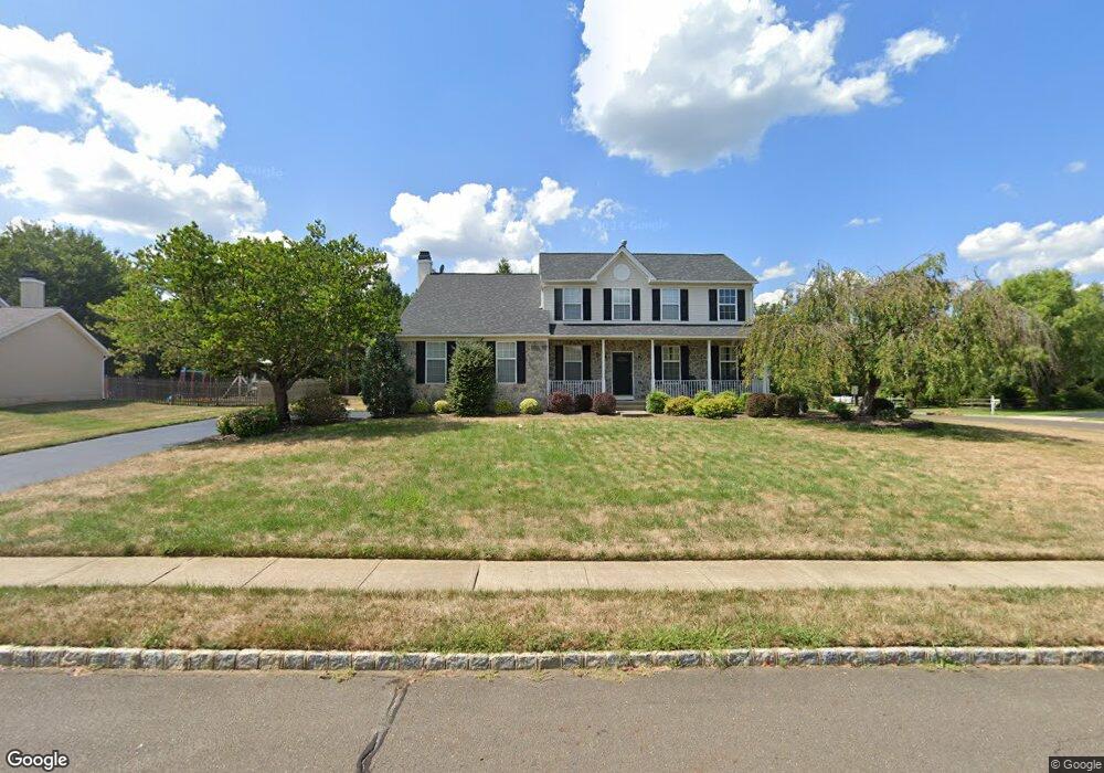
100 Compton Cir Trenton, NJ 08691
Estimated Value: $920,184 - $1,012,000
--
Bed
--
Bath
2,380
Sq Ft
$407/Sq Ft
Est. Value
About This Home
This home is located at 100 Compton Cir, Trenton, NJ 08691 and is currently estimated at $969,296, approximately $407 per square foot. 100 Compton Cir is a home located in Mercer County with nearby schools including Sharon Elementary School, Pond Road Middle School, and Robbinsville High School.
Ownership History
Date
Name
Owned For
Owner Type
Purchase Details
Closed on
Mar 22, 2013
Sold by
Pokallus Jeffrey S and Pokallus Carrie A
Bought by
Pokallus Jeffrey S
Current Estimated Value
Home Financials for this Owner
Home Financials are based on the most recent Mortgage that was taken out on this home.
Original Mortgage
$235,000
Outstanding Balance
$165,983
Interest Rate
3.56%
Mortgage Type
New Conventional
Estimated Equity
$803,313
Purchase Details
Closed on
Sep 11, 1997
Sold by
Trafalgar House Property
Bought by
Pokallus Jeffrey and Pokallus Carrie
Create a Home Valuation Report for This Property
The Home Valuation Report is an in-depth analysis detailing your home's value as well as a comparison with similar homes in the area
Home Values in the Area
Average Home Value in this Area
Purchase History
| Date | Buyer | Sale Price | Title Company |
|---|---|---|---|
| Pokallus Jeffrey S | -- | None Available | |
| Pokallus Jeffrey S | -- | None Available | |
| Pokallus Jeffrey | $249,421 | -- |
Source: Public Records
Mortgage History
| Date | Status | Borrower | Loan Amount |
|---|---|---|---|
| Open | Pokallus Jeffrey S | $235,000 | |
| Closed | Pokallus Jeffrey S | $235,000 |
Source: Public Records
Tax History Compared to Growth
Tax History
| Year | Tax Paid | Tax Assessment Tax Assessment Total Assessment is a certain percentage of the fair market value that is determined by local assessors to be the total taxable value of land and additions on the property. | Land | Improvement |
|---|---|---|---|---|
| 2025 | $16,045 | $480,100 | $182,000 | $298,100 |
| 2024 | $14,974 | $480,100 | $182,000 | $298,100 |
| 2023 | $14,974 | $480,100 | $182,000 | $298,100 |
| 2022 | $14,393 | $480,100 | $182,000 | $298,100 |
| 2021 | $14,187 | $480,100 | $182,000 | $298,100 |
| 2020 | $14,192 | $480,100 | $182,000 | $298,100 |
| 2019 | $14,197 | $480,100 | $182,000 | $298,100 |
| 2018 | $14,105 | $480,100 | $182,000 | $298,100 |
| 2017 | $14,077 | $480,100 | $182,000 | $298,100 |
| 2016 | $13,947 | $480,100 | $182,000 | $298,100 |
| 2015 | $13,736 | $480,100 | $182,000 | $298,100 |
| 2014 | $13,784 | $480,100 | $182,000 | $298,100 |
Source: Public Records
Map
Nearby Homes
- 7 Anderson Ln
- 26 Arnold Ln
- 21 Eldridge Dr
- 5 Dunston Ln
- 16 Tasley Ct
- 83 Malsbury St
- 968 Robbinsville Edinburg Rd Unit 306
- 109 Endsleigh Ct
- 15 Newtown Blvd
- 968 Robbins-Edinburg Unit 305
- 968 Robbins-Edin Burg Rd Unit 306
- 117 George St
- 29 Faxon Dr
- 13 Stanwyck Ct
- 2346 Route 33 Unit 202
- 2346 Route 33 Unit 308
- 10 North St
- 2330 Route 33 Unit 315
- 84 Wyndham Place
- 62 Wyndham Place
- 101 Compton Cir
- 1 Branford Dr
- 104 Compton Cir
- 66 Robbinsville Edinburg Rd
- 3 Branford Dr
- 103 Compton Cir
- 6 Branford Dr
- 5 Branford Dr
- 65 Robbinsville Edinburg Rd
- 8 Branford Dr
- 67 Robbinsville Edinburg Rd
- 71 Robbinsville Edinburg Rd
- 108 Compton Cir
- 63 Robbinsville Edinburg Rd
- 7 Branford Dr
- 10 Branford Dr
- 73 Robbinsville Edinburg Rd
- 1 Anderson Ln
- 9 Branford Dr
- 3 Anderson Ln