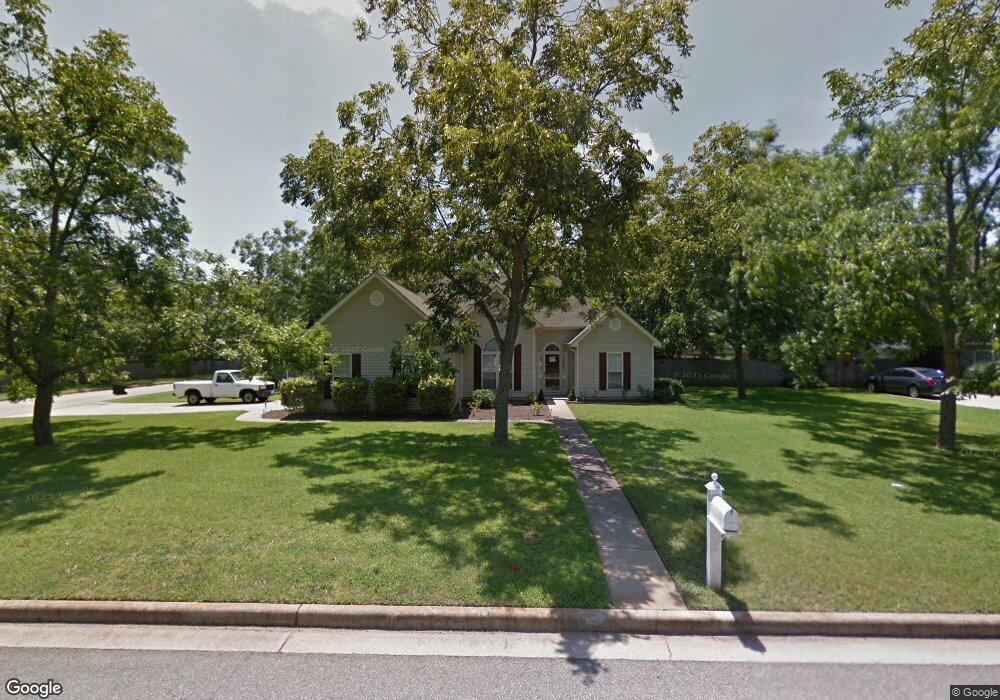
100 Crocket Way Kathleen, GA 31047
Estimated Value: $255,000 - $278,000
3
Beds
2
Baths
1,506
Sq Ft
$177/Sq Ft
Est. Value
About This Home
This home is located at 100 Crocket Way, Kathleen, GA 31047 and is currently estimated at $266,720, approximately $177 per square foot. 100 Crocket Way is a home located in Houston County with nearby schools including Matthew Arthur Elementary School, Bonaire Middle School, and Veterans High School.
Ownership History
Date
Name
Owned For
Owner Type
Purchase Details
Closed on
Apr 28, 2021
Sold by
Whatley John Leland and Whatley Anita M
Bought by
Sewell Aaron Richard Thomas and Perdomo Emma Marie
Current Estimated Value
Home Financials for this Owner
Home Financials are based on the most recent Mortgage that was taken out on this home.
Original Mortgage
$156,500
Outstanding Balance
$141,301
Interest Rate
3%
Mortgage Type
New Conventional
Estimated Equity
$125,419
Purchase Details
Closed on
May 22, 2003
Sold by
Whatley Leland W
Bought by
Whatley Leland W and Whatley Anita M
Purchase Details
Closed on
Apr 23, 1998
Bought by
Whatley Leland W
Create a Home Valuation Report for This Property
The Home Valuation Report is an in-depth analysis detailing your home's value as well as a comparison with similar homes in the area
Home Values in the Area
Average Home Value in this Area
Purchase History
| Date | Buyer | Sale Price | Title Company |
|---|---|---|---|
| Sewell Aaron Richard Thomas | $175,000 | None Available | |
| Whatley Leland W | -- | -- | |
| Whatley Leland W | $112,400 | -- |
Source: Public Records
Mortgage History
| Date | Status | Borrower | Loan Amount |
|---|---|---|---|
| Open | Sewell Aaron Richard Thomas | $156,500 |
Source: Public Records
Tax History Compared to Growth
Tax History
| Year | Tax Paid | Tax Assessment Tax Assessment Total Assessment is a certain percentage of the fair market value that is determined by local assessors to be the total taxable value of land and additions on the property. | Land | Improvement |
|---|---|---|---|---|
| 2024 | $2,168 | $90,640 | $11,200 | $79,440 |
| 2023 | $1,844 | $76,280 | $11,200 | $65,080 |
| 2022 | $1,684 | $69,680 | $11,200 | $58,480 |
| 2021 | $1,102 | $54,440 | $11,200 | $43,240 |
| 2020 | $1,305 | $53,320 | $11,200 | $42,120 |
| 2019 | $1,080 | $53,320 | $11,200 | $42,120 |
| 2018 | $1,080 | $53,320 | $11,200 | $42,120 |
| 2017 | $1,081 | $53,320 | $11,200 | $42,120 |
| 2016 | $1,082 | $53,320 | $11,200 | $42,120 |
| 2015 | $1,082 | $53,320 | $11,200 | $42,120 |
| 2014 | -- | $53,320 | $11,200 | $42,120 |
| 2013 | -- | $51,720 | $11,200 | $40,520 |
Source: Public Records
Map
Nearby Homes
- 101 Pond Dr
- 231 Grove Ln
- 135 Pond Dr
- 119 Richfield Cir
- 204 Weeping Moss Way
- 105 Cabin Cove Dr
- 2006 Melrose Place
- 527 Bristleleaf Path
- 117 Black Birch Ln
- 115 Black Birch Ln
- 102 Emberwood Dr
- 200 Emberwood Way
- 102 Emberwood Way
- 206 Emberwood Way
- 410 Woodlands Blvd
- 105 Spring Chase Cir
- 104 Cloverdale Dr
- 108 Cloverdale Dr
- 510 Mt Zion Rd
- 510 Mount Zion Rd
- 124 Grove Ln
- 0 Grove Ln Unit 7479850
- 0 Grove Ln Unit 7438956
- 0 Grove Ln Unit 7432499
- 0 Grove Ln Unit 3283777
- 0 Grove Ln Unit 3172062
- 0 Grove Ln Unit 8841886
- 0 Grove Ln Unit 8588663
- 0 Grove Ln Unit 8572034
- 0 Grove Ln Unit 8568795
- 0 Grove Ln Unit 8540360
- 0 Grove Ln Unit 8233430
- 0 Grove Ln Unit 8164173
- 0 Grove Ln Unit 8149926
- 0 Grove Ln Unit 8152423
- 0 Grove Ln Unit 8126492
- 0 Grove Ln Unit 8040229
- 0 Grove Ln Unit 3284723
- 0 Grove Ln Unit 3230650
- 0 Grove Ln Unit 7011662