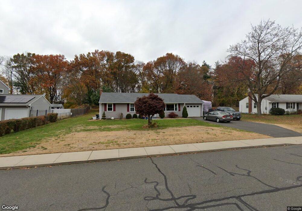
100 Croft Dr Manchester, CT 06042
Robertson NeighborhoodEstimated Value: $307,352 - $384,000
2
Beds
2
Baths
1,188
Sq Ft
$288/Sq Ft
Est. Value
About This Home
This home is located at 100 Croft Dr, Manchester, CT 06042 and is currently estimated at $342,451, approximately $288 per square foot. 100 Croft Dr is a home located in Hartford County with nearby schools including Robertson School, Illing Middle School, and Elisabeth M. Bennet Academy.
Ownership History
Date
Name
Owned For
Owner Type
Purchase Details
Closed on
May 2, 2016
Sold by
Eliasson Scott R
Bought by
Eliasson Scott R and Eliasson Donna M
Current Estimated Value
Purchase Details
Closed on
Apr 28, 1995
Sold by
Landolphi Michele F
Bought by
Grates William C
Home Financials for this Owner
Home Financials are based on the most recent Mortgage that was taken out on this home.
Original Mortgage
$95,700
Interest Rate
8.33%
Mortgage Type
Unknown
Purchase Details
Closed on
Apr 24, 1989
Sold by
Wallace Ray E
Bought by
Peltier Michele F
Home Financials for this Owner
Home Financials are based on the most recent Mortgage that was taken out on this home.
Original Mortgage
$120,000
Interest Rate
10.79%
Mortgage Type
Purchase Money Mortgage
Create a Home Valuation Report for This Property
The Home Valuation Report is an in-depth analysis detailing your home's value as well as a comparison with similar homes in the area
Home Values in the Area
Average Home Value in this Area
Purchase History
| Date | Buyer | Sale Price | Title Company |
|---|---|---|---|
| Eliasson Scott R | -- | -- | |
| Eliasson Scott R | -- | -- | |
| Quinn Scott M | $79,002 | -- | |
| Quinn Scott M | $79,002 | -- | |
| Grates William C | $104,000 | -- | |
| Grates William C | $104,000 | -- | |
| Peltier Michele F | $153,000 | -- |
Source: Public Records
Mortgage History
| Date | Status | Borrower | Loan Amount |
|---|---|---|---|
| Previous Owner | Peltier Michele F | $95,700 | |
| Previous Owner | Peltier Michele F | $120,000 |
Source: Public Records
Tax History
| Year | Tax Paid | Tax Assessment Tax Assessment Total Assessment is a certain percentage of the fair market value that is determined by local assessors to be the total taxable value of land and additions on the property. | Land | Improvement |
|---|---|---|---|---|
| 2025 | $6,809 | $171,000 | $47,200 | $123,800 |
| 2024 | $6,614 | $171,000 | $47,200 | $123,800 |
| 2023 | $6,361 | $171,000 | $47,200 | $123,800 |
| 2022 | $6,236 | $171,000 | $47,200 | $123,800 |
| 2021 | $5,062 | $138,600 | $40,500 | $98,100 |
| 2020 | $5,062 | $138,600 | $40,500 | $98,100 |
| 2019 | $5,062 | $138,600 | $40,500 | $98,100 |
| 2018 | $4,963 | $138,600 | $40,500 | $98,100 |
| 2017 | $4,694 | $134,700 | $40,500 | $94,200 |
| 2016 | $4,252 | $122,000 | $53,300 | $68,700 |
| 2015 | $4,231 | $122,000 | $53,300 | $68,700 |
| 2014 | $4,148 | $122,000 | $53,300 | $68,700 |
Source: Public Records
Map
Nearby Homes
- 101 Croft Dr
- 21 Ivy Ln
- 260 Smith St
- 949 Pleasant Valley Rd Unit 8-1
- 949 Pleasant Valley Rd Unit 4 12
- 949 Pleasant Valley Rd Unit 5-1
- 102 Lavender Ln
- 779 Ellington Rd
- 1202 Twin Circle Dr
- 145 Candlewood Dr Unit 145
- 1408 Mill Pond Dr
- 112 Gilbert Ln
- 703 Twin Circle Dr Unit 703
- 136 Gilbert Ln
- 908 Mill Pond Dr
- 512 Twin Circle Dr Unit 512
- 41 Murielle Dr
- 65 Andover Rd
- 880 Tolland Turnpike
- 1220 Burnside Ave Unit A