Estimated Value: $113,000 - $157,000
2
Beds
1
Bath
1,036
Sq Ft
$133/Sq Ft
Est. Value
About This Home
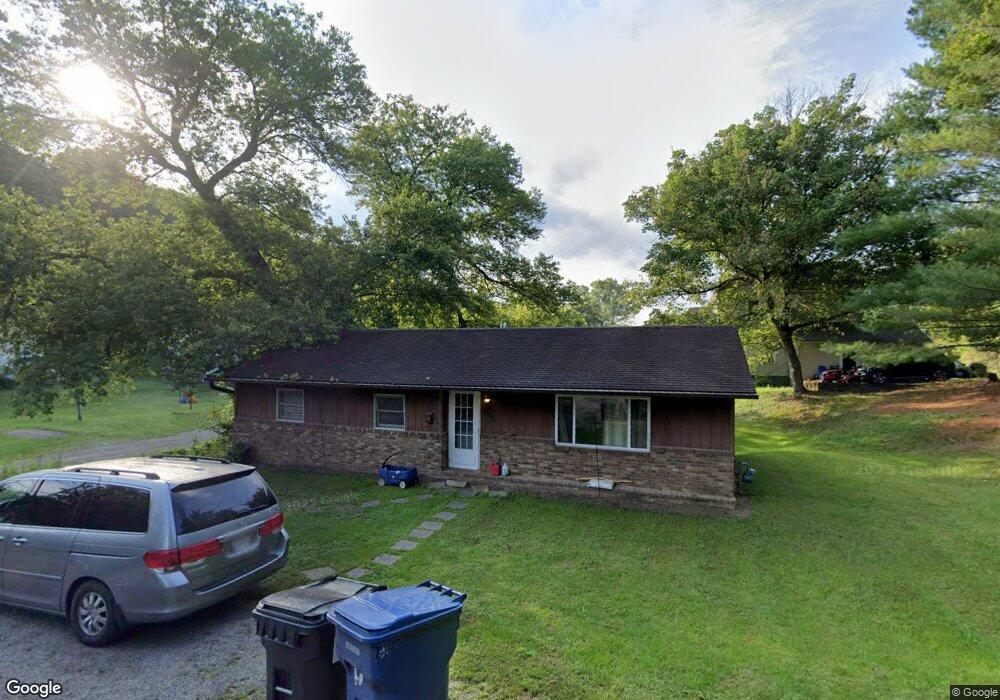
This home is located at 100 Cushing Ave, Logan, OH 43138 and is currently estimated at $137,534, approximately $132 per square foot. 100 Cushing Ave is a home located in Hocking County with nearby schools including Central Elementary School, St. John the Evangelist School, and Logan Christian School.
Ownership History
Date
Name
Owned For
Owner Type
Purchase Details
Closed on
Nov 24, 2010
Sold by
Us Bank Na
Bought by
Wall Sidney A and Wall Diana M
Current Estimated Value
Home Financials for this Owner
Home Financials are based on the most recent Mortgage that was taken out on this home.
Original Mortgage
$28,000
Outstanding Balance
$18,705
Interest Rate
4.44%
Mortgage Type
Future Advance Clause Open End Mortgage
Estimated Equity
$118,829
Purchase Details
Closed on
Oct 15, 2009
Sold by
Shriner Terry M
Bought by
Us Bank Na
Purchase Details
Closed on
Mar 11, 2001
Bought by
Wall Sidney A and 152 Timmon Diana M
Create a Home Valuation Report for This Property
The Home Valuation Report is an in-depth analysis detailing your home's value as well as a comparison with similar homes in the area
Home Values in the Area
Average Home Value in this Area
Purchase History
| Date | Buyer | Sale Price | Title Company |
|---|---|---|---|
| Wall Sidney A | $25,000 | -- | |
| Us Bank Na | $28,000 | None Available | |
| Wall Sidney A | $25,000 | -- |
Source: Public Records
Mortgage History
| Date | Status | Borrower | Loan Amount |
|---|---|---|---|
| Open | Wall Sidney A | $28,000 |
Source: Public Records
Tax History
| Year | Tax Paid | Tax Assessment Tax Assessment Total Assessment is a certain percentage of the fair market value that is determined by local assessors to be the total taxable value of land and additions on the property. | Land | Improvement |
|---|---|---|---|---|
| 2024 | $1,260 | $26,270 | $10,680 | $15,590 |
| 2023 | $1,060 | $26,270 | $10,680 | $15,590 |
| 2022 | $1,062 | $26,270 | $10,680 | $15,590 |
| 2021 | $909 | $20,850 | $8,400 | $12,450 |
| 2020 | $792 | $18,160 | $5,710 | $12,450 |
| 2019 | $793 | $18,160 | $5,710 | $12,450 |
| 2018 | $694 | $16,170 | $4,850 | $11,320 |
| 2017 | $654 | $16,170 | $4,850 | $11,320 |
| 2016 | $650 | $16,170 | $4,850 | $11,320 |
| 2015 | $559 | $13,400 | $4,340 | $9,060 |
| 2014 | $559 | $13,400 | $4,340 | $9,060 |
| 2013 | $561 | $13,400 | $4,340 | $9,060 |
Source: Public Records
Map
Nearby Homes
- 648 N Mulberry St
- 685 N Walnut St
- 695 N Walnut St
- 700 Mingo Terrace
- 697 N Walnut St
- 665 N Walnut St
- 641 N Walnut St
- 620 N Mulberry St
- 699 N Walnut St
- 639 N Walnut St
- 692 N Walnut St
- 707 Mingo Terrace
- 707 Mingo Terrace
- 54 E Grogan Ave
- 633 Walnut Dr
- 782 N Mulberry St
- 635 N Walnut St
- 530 N Mulberry St
- 520 N Mulberry St
- 698 N Walnut St
Your Personal Tour Guide
Ask me questions while you tour the home.