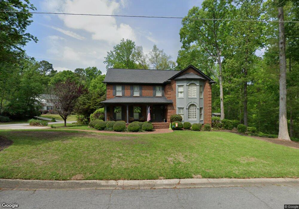
100 Eagle Nest Trail West Columbia, SC 29169
Estimated Value: $457,419 - $597,000
4
Beds
4
Baths
3,424
Sq Ft
$152/Sq Ft
Est. Value
About This Home
This home is located at 100 Eagle Nest Trail, West Columbia, SC 29169 and is currently estimated at $518,855, approximately $151 per square foot. 100 Eagle Nest Trail is a home located in Lexington County with nearby schools including Riverbank Elementary, Northside Middle, and Brookland-Cayce High School.
Ownership History
Date
Name
Owned For
Owner Type
Purchase Details
Closed on
Jun 17, 2019
Sold by
Fitzhugh James C and Fitzhugh Kathy Seabolt
Bought by
Hazel Jason L and Hazel Jessica S
Current Estimated Value
Home Financials for this Owner
Home Financials are based on the most recent Mortgage that was taken out on this home.
Original Mortgage
$266,250
Outstanding Balance
$234,099
Interest Rate
4.1%
Mortgage Type
New Conventional
Estimated Equity
$284,756
Purchase Details
Closed on
Aug 23, 2010
Sold by
Ragsdale Glenn E and Ragsdale Cathy W
Bought by
Fitzhugh James C and Fitzhugh Kathy Seabolt
Home Financials for this Owner
Home Financials are based on the most recent Mortgage that was taken out on this home.
Original Mortgage
$255,200
Interest Rate
4.6%
Mortgage Type
Future Advance Clause Open End Mortgage
Create a Home Valuation Report for This Property
The Home Valuation Report is an in-depth analysis detailing your home's value as well as a comparison with similar homes in the area
Home Values in the Area
Average Home Value in this Area
Purchase History
| Date | Buyer | Sale Price | Title Company |
|---|---|---|---|
| Hazel Jason L | $337,500 | None Available | |
| Fitzhugh James C | $319,000 | -- |
Source: Public Records
Mortgage History
| Date | Status | Borrower | Loan Amount |
|---|---|---|---|
| Open | Hazel Jason L | $266,250 | |
| Previous Owner | Fitzhugh James C | $255,200 |
Source: Public Records
Tax History Compared to Growth
Tax History
| Year | Tax Paid | Tax Assessment Tax Assessment Total Assessment is a certain percentage of the fair market value that is determined by local assessors to be the total taxable value of land and additions on the property. | Land | Improvement |
|---|---|---|---|---|
| 2024 | $1,912 | $13,500 | $2,400 | $11,100 |
| 2023 | $1,912 | $13,500 | $2,400 | $11,100 |
| 2022 | $1,914 | $13,500 | $2,400 | $11,100 |
| 2020 | $1,904 | $13,500 | $2,400 | $11,100 |
| 2019 | $1,561 | $10,835 | $1,600 | $9,235 |
| 2018 | $1,583 | $10,835 | $1,600 | $9,235 |
| 2017 | $1,523 | $10,835 | $1,600 | $9,235 |
| 2016 | $1,565 | $10,832 | $1,600 | $9,232 |
| 2014 | $1,258 | $12,758 | $1,600 | $11,158 |
| 2013 | -- | $12,760 | $1,600 | $11,160 |
Source: Public Records
Map
Nearby Homes
- 0 Quail Hollow Ln
- 2420 Feather Run Trail
- 2225 Quail Hollow Ct
- 106 Meadowview Ct
- 203 Holly Ridge Ln
- 119 Meadowview Ct
- 2637 Pine Lake Dr
- 227 Holly Ridge Ln
- 1711 Holly Hill Dr
- 2641 Pine Lake Dr
- 1605 Quail Lake Dr
- 1208 Bush River Rd Unit G6
- 1208 Bush River Rd Unit r12
- 1208 Bush River Rd Unit H5
- 1208 Bush River Rd Unit J7
- 1208 Bush River Rd Unit H11
- 1208 Bush River Rd Unit P2
- 1208 Bush River Rd Unit H9
- 1208 Bush River Rd Unit C12
- 1208 Bush River Rd Unit P1
- 108 Eagle Nest Trail
- 101 Boulder Top Ct
- 2612 Quail Hollow Ln
- 112 Eagle Nest Trail
- 105 Eagle Nest Trail
- 114 Holly Ridge Ln
- 2600 Quail Hollow Ln
- 103 Boulder Top Ct
- 104 Holly Ridge Ln
- 107 Eagle Nest Trail
- 118 Holly Ridge Ln
- 111 Eagle Nest Trail
- 100 Holly Ridge Ln
- 14 Gray Heron Ct
- 100 Boulder Top Ct
- 113 Eagle Nest Trail
- 107 Boulder Top Ct
- 122 Holly Ridge Ln
- 22 Gray Heron Ct
- 109 Holly Ridge Ln