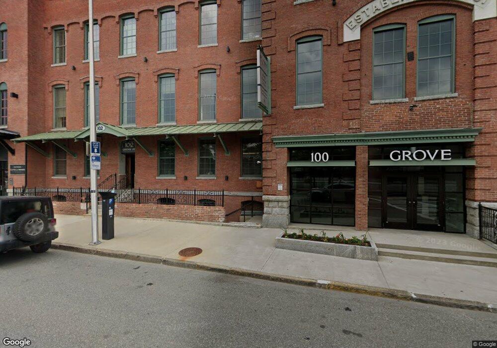
100 Grove St Worcester, MA 01605
Indian Lake East Neighborhood
--
Bed
--
Bath
101,439
Sq Ft
0.92
Acres
About This Home
This home is located at 100 Grove St, Worcester, MA 01605. 100 Grove St is a home located in Worcester County with nearby schools including Francis J. McGrath Elementary School, Jacob Hiatt Magnet School, and Chandler Magnet.
Ownership History
Date
Name
Owned For
Owner Type
Purchase Details
Closed on
Oct 19, 2012
Sold by
Ajp Realty Llc
Bought by
Grove Street Family Pr
Home Financials for this Owner
Home Financials are based on the most recent Mortgage that was taken out on this home.
Original Mortgage
$3,600,000
Outstanding Balance
$2,499,920
Interest Rate
3.57%
Mortgage Type
Commercial
Purchase Details
Closed on
Oct 27, 2004
Sold by
Virginia L Palley Ft
Bought by
Palley Arthur
Create a Home Valuation Report for This Property
The Home Valuation Report is an in-depth analysis detailing your home's value as well as a comparison with similar homes in the area
Home Values in the Area
Average Home Value in this Area
Purchase History
| Date | Buyer | Sale Price | Title Company |
|---|---|---|---|
| Grove Street Family Pr | $4,450,000 | -- | |
| Palley Arthur | -- | -- | |
| Pallley Artthur | -- | -- | |
| Mass Comm Of Mgmt Llc | -- | -- | |
| Pallley Arthur | -- | -- |
Source: Public Records
Mortgage History
| Date | Status | Borrower | Loan Amount |
|---|---|---|---|
| Open | Grove Street Family Pr | $3,600,000 |
Source: Public Records
Tax History Compared to Growth
Tax History
| Year | Tax Paid | Tax Assessment Tax Assessment Total Assessment is a certain percentage of the fair market value that is determined by local assessors to be the total taxable value of land and additions on the property. | Land | Improvement |
|---|---|---|---|---|
| 2025 | $146,054 | $5,105,000 | $588,500 | $4,516,500 |
| 2024 | $157,217 | $5,233,600 | $588,500 | $4,645,100 |
| 2023 | $158,929 | $5,084,100 | $511,800 | $4,572,300 |
| 2022 | $163,804 | $4,914,600 | $511,800 | $4,402,800 |
| 2021 | $152,634 | $4,216,400 | $375,700 | $3,840,700 |
| 2020 | $148,249 | $4,216,400 | $375,700 | $3,840,700 |
| 2019 | $142,933 | $4,095,500 | $375,700 | $3,719,800 |
| 2018 | $137,314 | $4,035,100 | $375,700 | $3,659,400 |
| 2017 | $132,876 | $4,035,100 | $375,700 | $3,659,400 |
| 2016 | $124,425 | $3,661,700 | $363,700 | $3,298,000 |
| 2015 | $116,186 | $3,661,700 | $363,700 | $3,298,000 |
| 2014 | $112,890 | $3,661,700 | $363,700 | $3,298,000 |
Source: Public Records
Map
Nearby Homes
- 80 Salisbury St Unit 206
- 126 Lincoln St
- 139 Lincoln St
- 24 Catharine St
- 41 Westminster St
- 6 Milton St
- 63 North St Unit A
- 63 North St Unit B
- 44 Westminster St
- 12 Windsor St
- 10 Windsor St Unit C
- 71 Edgeworth St Unit 21
- 26 Orne St
- 74 Green Hill Pkwy
- 73 Paine St
- 78 Green Hill Pkwy
- 10 Dryden St Unit 7
- 82 Green Hill Pkwy
- 55 Channing St
- 10 Hemans St Unit 9
- 100 Grove St Unit 207
- 100 Grove St Unit 216
- 100 Grove St Unit 309
- 100 Grove St Unit 215
- 100 Grove St Unit 407
- 100 Grove St Unit B-4
- 100 Grove St Unit 110-Ecoo
- 100 Grove St Unit 320
- 100 Grove St Unit 113 B
- 100 Grove St Unit 217
- 100 Grove St Unit 303
- 100 Grove St Unit 102
- 100 Grove St Unit 115
- 95 Prescott St Unit Blg A
- 95 Prescott St
- 85 Prescott St
- 85 Prescott St Unit 404
- 90 Grove St
- 75 Grove St
- 99 Prescott St Unit B-1-a