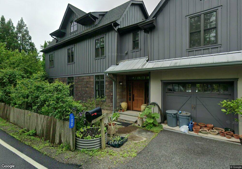
100 Halsey Rd Newton, NJ 07860
Estimated Value: $465,000 - $600,000
--
Bed
--
Bath
2,608
Sq Ft
$200/Sq Ft
Est. Value
About This Home
This home is located at 100 Halsey Rd, Newton, NJ 07860 and is currently estimated at $520,348, approximately $199 per square foot. 100 Halsey Rd is a home located in Sussex County with nearby schools including Marian E. McKeown School, Kittatinny Regional High School, and Northwest Christian School.
Ownership History
Date
Name
Owned For
Owner Type
Purchase Details
Closed on
May 14, 2020
Sold by
Druse Ken
Bought by
Druse Kenneth B and Bauer Louis C
Current Estimated Value
Purchase Details
Closed on
Apr 25, 1995
Sold by
Mccarthy Edward and Mccarthy Monica A
Bought by
Druse Ken
Create a Home Valuation Report for This Property
The Home Valuation Report is an in-depth analysis detailing your home's value as well as a comparison with similar homes in the area
Home Values in the Area
Average Home Value in this Area
Purchase History
| Date | Buyer | Sale Price | Title Company |
|---|---|---|---|
| Druse Kenneth B | -- | None Available | |
| Druse Ken | $106,750 | -- |
Source: Public Records
Tax History Compared to Growth
Tax History
| Year | Tax Paid | Tax Assessment Tax Assessment Total Assessment is a certain percentage of the fair market value that is determined by local assessors to be the total taxable value of land and additions on the property. | Land | Improvement |
|---|---|---|---|---|
| 2025 | $9,520 | $285,200 | $68,500 | $216,700 |
| 2024 | $9,015 | $285,200 | $68,500 | $216,700 |
| 2023 | $9,015 | $285,200 | $68,500 | $216,700 |
| 2022 | $8,796 | $285,200 | $68,500 | $216,700 |
| 2021 | $8,547 | $285,200 | $68,500 | $216,700 |
| 2020 | $8,516 | $285,200 | $68,500 | $216,700 |
| 2019 | $8,439 | $285,200 | $68,500 | $216,700 |
| 2018 | $8,189 | $282,200 | $68,500 | $213,700 |
| 2017 | $8,023 | $282,200 | $68,500 | $213,700 |
| 2016 | $7,789 | $282,200 | $68,500 | $213,700 |
| 2015 | $7,306 | $180,600 | $68,500 | $112,100 |
| 2014 | $4,622 | $180,600 | $68,500 | $112,100 |
Source: Public Records
Map
Nearby Homes
- 137 Hampton House Rd
- 52 Church Rd
- 37 Cypress Dr
- 59 Fieldstone Dr
- 33 Acadia Dr
- 2 - 4 Garrett Dr
- 301 Lakewood Terrace
- 2 Sparrow CI
- 4 Eagle Dr Unit 2
- 13 Cardinal Ln
- 43 Rhea Run Unit 6
- 1007 Hillside Ave
- 22 Peregrine Point Unit 1
- 53-57 Snover Rd
- 208 Highland Ave
- 59 Newton Ave
- 41 Swartswood Rd
- 86 County Road 521
- 77 Swartswood Rd
- 19 Mudcut Rd
- 106 County Road 519
- 147 Halsey Rd
- 115 County Road 519
- 111 County Road 519
- 111 Route 519
- 104 County Road 519
- 117 County Road 519
- 117 Route 519
- 110 County Road 519
- 109-1 County Road 519
- 102 County Road 519
- 109 County Road 519
- 42 Glencrest Dr
- 119 County Road 519
- 119 Route 519
- 40 Glencrest Dr
- 44 Glencrest Dr
- 148 Halsey Rd
- 38 Glencrest Dr
- 149 Halsey Rd