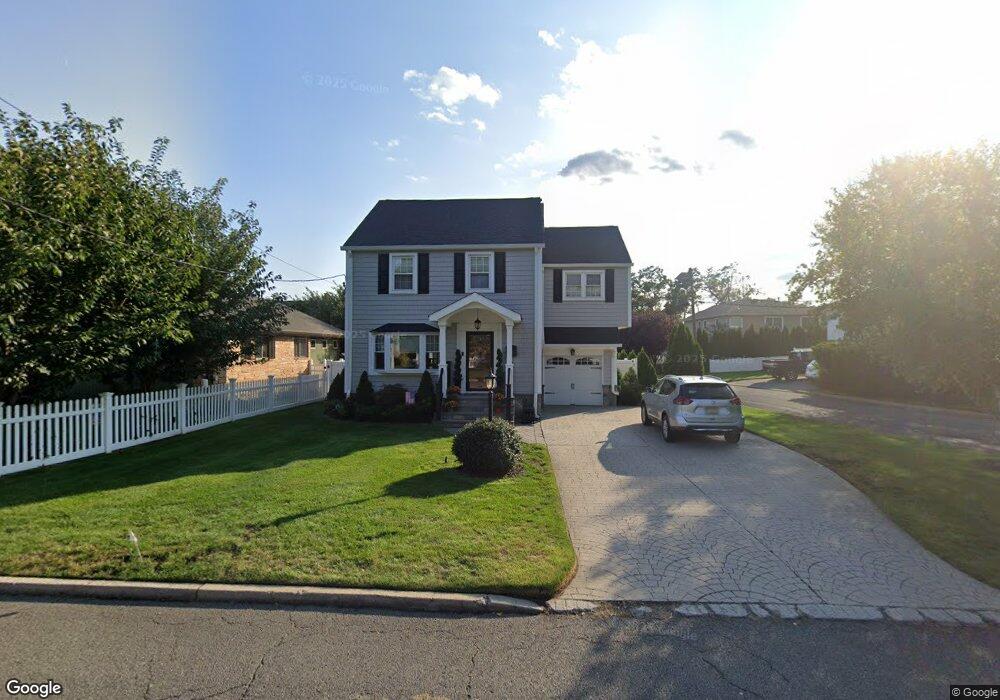
100 Harrison Ave Hasbrouck Heights, NJ 07604
Estimated Value: $663,000 - $819,000
3
Beds
2
Baths
1,444
Sq Ft
$511/Sq Ft
Est. Value
About This Home
This home is located at 100 Harrison Ave, Hasbrouck Heights, NJ 07604 and is currently estimated at $737,946, approximately $511 per square foot. 100 Harrison Ave is a home located in Bergen County with nearby schools including Hasbrouck Heights High School and Corpus Christi School.
Ownership History
Date
Name
Owned For
Owner Type
Purchase Details
Closed on
Dec 28, 2017
Sold by
Mucci Adam
Bought by
Crnin Paul
Current Estimated Value
Home Financials for this Owner
Home Financials are based on the most recent Mortgage that was taken out on this home.
Original Mortgage
$384,000
Outstanding Balance
$323,719
Interest Rate
3.9%
Mortgage Type
Purchase Money Mortgage
Estimated Equity
$414,227
Purchase Details
Closed on
Aug 7, 2015
Sold by
Mucci Adam and Mucci Renee
Bought by
Mucci Adam
Home Financials for this Owner
Home Financials are based on the most recent Mortgage that was taken out on this home.
Original Mortgage
$385,000
Interest Rate
4.07%
Mortgage Type
New Conventional
Purchase Details
Closed on
May 30, 2014
Sold by
Capo Cynthia and Whiting Richard
Bought by
Mucci Adam and Mucci Renee
Home Financials for this Owner
Home Financials are based on the most recent Mortgage that was taken out on this home.
Original Mortgage
$389,500
Interest Rate
4.27%
Mortgage Type
New Conventional
Create a Home Valuation Report for This Property
The Home Valuation Report is an in-depth analysis detailing your home's value as well as a comparison with similar homes in the area
Home Values in the Area
Average Home Value in this Area
Purchase History
| Date | Buyer | Sale Price | Title Company |
|---|---|---|---|
| Crnin Paul | $480,000 | -- | |
| Mucci Adam | -- | Break Water Title Agency Llc | |
| Mucci Adam | $410,000 | -- |
Source: Public Records
Mortgage History
| Date | Status | Borrower | Loan Amount |
|---|---|---|---|
| Open | Crnin Paul | $384,000 | |
| Previous Owner | Mucci Adam | $385,000 | |
| Previous Owner | Mucci Adam | $389,500 |
Source: Public Records
Tax History Compared to Growth
Tax History
| Year | Tax Paid | Tax Assessment Tax Assessment Total Assessment is a certain percentage of the fair market value that is determined by local assessors to be the total taxable value of land and additions on the property. | Land | Improvement |
|---|---|---|---|---|
| 2025 | $14,318 | $560,400 | $238,300 | $322,100 |
| 2024 | $13,859 | $560,400 | $238,300 | $322,100 |
| 2023 | $13,570 | $537,800 | $228,300 | $309,500 |
| 2022 | $13,570 | $504,100 | $210,800 | $293,300 |
| 2021 | $13,171 | $466,400 | $198,300 | $268,100 |
| 2020 | $12,666 | $440,400 | $188,300 | $252,100 |
| 2019 | $12,313 | $432,800 | $185,800 | $247,000 |
| 2018 | $10,176 | $356,800 | $183,300 | $173,500 |
| 2017 | $10,013 | $350,600 | $180,800 | $169,800 |
| 2016 | $10,525 | $346,800 | $170,800 | $176,000 |
| 2015 | $10,355 | $346,800 | $170,800 | $176,000 |
| 2014 | $10,071 | $346,800 | $170,800 | $176,000 |
Source: Public Records
Map
Nearby Homes
- 110 Harrison Ave
- 288 Sussex Rd
- 38 Springfield Ave
- 243 Cleveland Ave
- 289 Valley Blvd Unit 1D
- 289 Valley Blvd Unit 1A
- 420 Innes Rd
- 27 Roosevelt Dr
- 25 Roosevelt Dr
- 2 Passaic Ave
- 311 Harrison Ave
- 432 Innes Rd
- 225 Marlboro Rd
- 68 Wesmont Dr
- 73 Wesmont Dr Unit 1811
- 109 Wesmont Dr Unit 1913
- 43 Wesmont Dr Unit 1712
- 102 Wesmont Dr
- 120 Wesmont Dr
- 30 Woodside Ave
- 104 Harrison Ave
- 103 Roosevelt Ave
- 114 Harrison Ave
- 109 Roosevelt Ave
- 116 Harrison Ave
- 103 Harrison Ave
- 113 Roosevelt Ave
- 107 Harrison Ave
- 29 Wood St
- 81 Roosevelt Ave
- 80 Harrison Ave
- 115 Harrison Ave
- 21 Wood St
- 117 Harrison Ave
- 117 Roosevelt Ave
- 77 Roosevelt Ave
- 48 Wood St
- 121 Harrison Ave
- 100 Roosevelt Aka 14 Ave
- 121 Roosevelt Ave