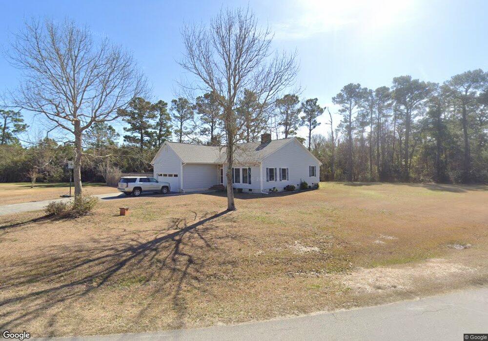
100 Howland Pkwy Beaufort, NC 28516
Estimated Value: $395,000 - $456,000
3
Beds
2
Baths
1,731
Sq Ft
$243/Sq Ft
Est. Value
About This Home
This home is located at 100 Howland Pkwy, Beaufort, NC 28516 and is currently estimated at $420,539, approximately $242 per square foot. 100 Howland Pkwy is a home located in Carteret County with nearby schools including Beaufort Elementary School, Beaufort Middle School, and East Carteret High School.
Ownership History
Date
Name
Owned For
Owner Type
Purchase Details
Closed on
Mar 13, 2013
Sold by
Lawrence Dannie B and Lawrence Earlene R
Bought by
Lawrence Dannie B
Current Estimated Value
Home Financials for this Owner
Home Financials are based on the most recent Mortgage that was taken out on this home.
Original Mortgage
$394,500
Interest Rate
3.57%
Mortgage Type
Reverse Mortgage Home Equity Conversion Mortgage
Create a Home Valuation Report for This Property
The Home Valuation Report is an in-depth analysis detailing your home's value as well as a comparison with similar homes in the area
Home Values in the Area
Average Home Value in this Area
Purchase History
| Date | Buyer | Sale Price | Title Company |
|---|---|---|---|
| Lawrence Dannie B | -- | None Available |
Source: Public Records
Mortgage History
| Date | Status | Borrower | Loan Amount |
|---|---|---|---|
| Closed | Lawrence Dannie B | $394,500 |
Source: Public Records
Tax History Compared to Growth
Tax History
| Year | Tax Paid | Tax Assessment Tax Assessment Total Assessment is a certain percentage of the fair market value that is determined by local assessors to be the total taxable value of land and additions on the property. | Land | Improvement |
|---|---|---|---|---|
| 2025 | $1,507 | $402,647 | $79,636 | $323,011 |
| 2024 | $1,402 | $260,897 | $126,099 | $134,798 |
| 2023 | $1,476 | $260,897 | $126,099 | $134,798 |
| 2022 | $1,450 | $260,897 | $126,099 | $134,798 |
| 2021 | $1,450 | $260,897 | $126,099 | $134,798 |
| 2020 | $1,380 | $260,897 | $126,099 | $134,798 |
| 2019 | $870 | $159,512 | $104,031 | $55,481 |
| 2017 | $1,273 | $251,212 | $104,031 | $147,181 |
| 2016 | $1,235 | $251,212 | $104,031 | $147,181 |
| 2015 | $1,210 | $251,212 | $104,031 | $147,181 |
| 2014 | $1,345 | $287,633 | $157,306 | $130,327 |
Source: Public Records
Map
Nearby Homes
- 000 Live Oak Pinners Point Rd
- 109 Sanctuary
- 500 Swan
- 0 Live Oak St Unit 100542378
- 556 Sheldrake Ct
- 235 Cline Way Unit 107, 1809 Live
- 231 Cline Way Unit 105, 1809 Live
- 228 Cline Way Unit 131, 1809 Live
- 237 Cline Way Unit 108, 1809 Live
- 230 Cline Way Unit 130, 1809 Live
- The Lookout Plan at 1809 Live Oak - Towns at Live Oak
- The Harbour Plan at 1809 Live Oak - Towns at Live Oak
- 535 Sheldrake
- 504 Swan
- 534 Sheldrake
- 509 Swan
- 508 Swan
- 503 Swan
- 530 Sheldrake Ct
- 526 Sheldrake
- 112 Howland Pkwy
- 293 Pinners Point Rd
- 101 Howland Pkwy
- 283 Pinners Point Rd
- 128 Howland Pkwy
- 129 Howland Pkwy
- 271 Pinners Point Rd
- 144 Howland Pkwy
- 257 Pinners Point Rd
- 151 Howland Pkwy
- 500 Steep Point Rd
- 350 Steep Point Rd
- Lot 7 Ash Ln
- 220 Ash Ln
- 156 Howland Pkwy
- 161 Howland Pkwy
- 215 Ash Ln
- 358 Steep Point Rd
- 241 Pinners Point Rd
- 202 Ash Ln